
Existed: 1920 – present Constructed 1920 | Length 299.3 km | |
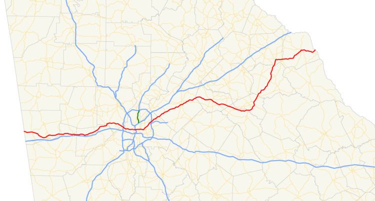 | ||
State Route 8 (SR 8) is a 183-mile-long (295 km) state highway that travels west-to-east through portions of Haralson, Carroll, Douglas, Cobb, Fulton, DeKalb, Gwinnett, Barrow, Clarke, Oconee, Madison, Franklin, and Hart counties, bisecting the northern part of the U.S. state of Georgia. The highway travels from its western terminus at US 78 and SR 4 at the Alabama state line west of Tallapoosa to its eastern terminus at US 29 at the South Carolina state line at the south end of Lake Hartwell. The highway is concurrent with either US 29 or US 78 for nearly its entire length.
Contents
- Map of GA 8 Georgia USA
- Route description
- 1920s
- 1930s
- 1940s and 1950s
- 1960s
- 1980s
- 1990s
- Alternate route
- Villa Rica connector route
- Athens business loop
- References
Map of GA-8, Georgia, USA
Route description
SR 8 starts at the Alabama state line west of Tallapoosa in Haralson County, and closely parallels I-20 from there into Atlanta. SR 8 heads through Bremen and crosses through Carroll County and Villa Rica and on through Douglasville in Douglas County. The highway continues through Austell in Cobb County before it reaches the City of Atlanta and Fulton County, crossing the Downtown Connector on its way into Decatur in DeKalb County.
In Decatur, SR 8 turns northeast, crossing I-285 in Tucker, and paralleling I-85 through Lilburn and Lawrenceville in Gwinnett County to Auburn in Barrow County, where the highway turns southeast and heads into Winder. Continuing southeast, SR 8 makes a southern half-circle around Athens in Clarke County, just briefly touching Oconee County, before turning sharply northeast and heading through Danielsville in Madison County to Franklin Springs in Franklin County. There, the highway turns east, travels through Royston, and heads to its eastern terminus after heading through Hartwell.
The following segments of SR 8 are included as part of the National Highway System, a system of roadways important to the nation's economy, defense, and mobility:
1920s
SR 8 was established at least as early as 1920, traveling on its current path. At the same time, SR 34 was established on a path from Carrollton to Villa Rica. In 1921, SR 16 was established on a path from the Alabama state line to Carrollton. By the end of 1926, SR 8 had a "sand clay or top soil" surface from the Alabama state line to just west of Atlanta, a completed hard surface from just west of Atlanta to the current east end of the western US 78 concurrency, under construction from the east end of the US 78 concurrency to just southwest of the DeKalb–Gwinnett county line and from the DeKalb–Gwinnett county line to just northeast of it, a completed hard surface from just northeast of the DeKalb–Gwinnett county line to Lawrenceville, a completed hard surface from about Statham to the northeast part of Athens, under construction in the northeast part of Athens, a sand clay or top soil surface from just northeast of Athens to a point northeast of Royston, a completed hard surface from a point northeast of Royston to Hartwell, and under construction from Hartwell to the South Carolina state line. At the same time, the entire length of SR 16 and SR 34 (which were now redesignated as a southern branch of SR 8) had a sand clay or top soil surface. Also, US 78 was designated along SR 8 from the Alabama state line to what is now the western terminus of the Stone Mountain Freeway, and US 29 was designated along SR 8 from that point to the South Carolina state line.
1930s
By the middle of 1930, SR 8 had a "completed semi-hard surface" from Lithia Springs to just west of Atlanta and a completed hard surface for the current east end of the western US 78 concurrency to Lawrenceville. Before the year ended, it had a sand clay or top soil surface from just east of the Alabama state line to Lithia Springs. Between Heflin, Alabama and Villa Rica, US 78 was split into two divided U.S. routes: US 78S was designated along the southern branch of SR 8, and US 78N was designated along the current path of the mainline route. Previously to 1932, the highway was under construction from just east of the Alabama state line to just west of Douglasville. It had a completed hard surface from just west of Douglasville to just northeast of Athens, "completed grading, no surface course" from just northeast of Athens to Danielsville, sand clay or top soil surface from Danielsville to a point about halfway between Danielsville and Royston, and a completed hard surface from a point about halfway between Danielsville and Royston to the South Carolina state line. At the same time, US 78S and the southern branch of SR 8 were under construction from the Alabama state line to Carrollton. It had a completed hard surface from Carrollton to just southwest of Villa Rica. About two months later, SR 8 had a sand clay or top soil surface from just northeast of Athens to Danielsville. At the same time, US 78S and the southern branch of SR 8 had a completed hard surface from just southwest of Villa Rica into that city. Approximately two months after that, SR 8 was under construction from just northeast of Athens to Danielsville. A few months later, SR 8 had a completed grading, no surface course from just east of the Alabama to Villa Rica and a completed hard surface from there to Douglasville. The next month, SR 8 was under construction from Bremen to Villa Rica and from Danielsville to a point about halfway between Danielsville and Royston. It also had a completed hard surface from Athens to Danielsville. By the middle of 1933, SR 8 had a completed hard surface from Bremen to Villa Rica and from Danielsville to Royston. US 78S and the southern branch of SR 8 had a completed grading, no surface course from the Alabama state line to Carrollton. The next month, the mainline route had a completed hard surface from just east of the Alabama state line to Bremen. Another month later, it had a completed hard surface from the Alabama state line to just east of it. The next month, SR 8 was moved off of US 29 to travel southeast from Winder to US 78/SR 10 at a point southeast of Bogart and then concurrent with those two highways to just west of Athens. Near the end of 1934, SR 8 was moved back onto US 29 between Winder and Athens. Also, US 78S and the southern branch of SR 8 had a completed hard surface from the Alabama state line to a point about halfway between there and Carrollton. By the middle of 1936, US 78S and the southern branch of SR 8 had a completed hard surface from the Alabama state line to Carrollton. By the third quarter of 1938, US 78S was redesignated as US 78 Alt.
1940s and 1950s
By 1948, the southern branch of SR 8 was decommissioned and redesignated as SR 8 Alt. In 1952, US 78 Alt. was decommissioned. The next year, SR 8 Alt. was decommissioned. It was redesignated as SR 166 from the Alabama state line to a point northeast of Carrollton and SR 61 from that point to Villa Rica.
1960s
By 1966, a freeway around the northern side of Athens (present-day SR 10 Loop) was under construction as SR 350. At this time, US 29, US 78, SR 8, and SR 10 traveled on what is now US 78 Bus. At Milledge Avenue, US 29 temporarily ended. at this intersection, US 29 Temp. turned off onto US 129/US 441 Temp./SR 15. US 78, SR 8, and SR 10 continued to the northeast. At Lumpkin Street, SR 15 Alt. joined the concurrency. At Thomas Street, SR 8 and SR 15 Alt. turned left and curved to the northeast onto Madison Avenue. At Hobson Avenue, SR 15 Alt. turned off, and SR 8 continued to the northeast to the interchange with US 29 and SR 350. There, SR 8 rejoined US 29. Later that year, SR 350 was completed. It was redesignated as part of US 29 and SR 8 and was extended to the east for one exit. At this time, SR 8's former path through downtown Athens was redesignated as SR 8 Bus. US 29 exited off the the north-northeast, concurrent with SR 106, while SR 8 continued to the eastern-most exit and headed to the northeast, along its current path. When US 29 split off SR 106, it traveled along SR 106 Spur for about 1 mile (1.6 km) and then rejoined SR 8. In 1967, US 29 had been extended eastward to the eastern-most exit of the Athens freeway (and thus moved off of SR 106) and traveled along SR 72, as well as SR 8.
1980s
By 1986, US 441 was re-routed to travel eastward along US 29 and SR 8, as it currently travels. Also, US 129 and SR 15 Alt. were moved to travel eastward along the freeway. At the eastern-most exit, US 29 and SR 8 split off to the northeast, while US 129, US 441, and SR 15 Alt. traveled to the south, as they currently do. By 1988, the entire route of what is now SR 10 Loop was completed. SR 10 was rerouted from downtown Athens to travel along the southern portion of the loop. Its former route became SR 10 Bus. The next year, US 78 was moved from downtown Athens to travel along the southern portion of the loop. Its former route became US 78 Bus. SR 10 was moved back into downtown Athens, as is current. The entire loop was designated as SR 10 Loop. In 1989, SR 817 was proposed from the intersection of US 29/SR 8 with SR 316 just west of Dacula to the southwestern part of SR 10 Loop.
1990s
By 1992, SR 316 was designated, and opened, along the path of SR 817 from just west of Dacula to SR 11 just north of Bethlehem. Less than two years later, SR 316 was extended east-southeastward, and opened, to US 78/US 78 Bus./SR 10 intersection southeast of Bogart. Also, US 29 had been moved off SR 8 between the Dacula and Athens areas; it had been designated along SR 316. By 1996, US 29 had been moved from the northern to the southern part of SR 10 Loop. By 1998, US 29 Bus. had been designated along SR 8 between the Dacula and Bogart areas.
Alternate route
State Route 8 Alternate (SR 8 Alt.) was an alternate route of SR 8. It existed along the former path of a southern branch of SR 8 between the Alabama state line, west of Bowdon through Carrollton and northeast to Villa Rica. When it was decommissioned, it was redesignated as SR 166 between the state line and a point northeast of Carrollton and SR 61 from there to Villa Rica. This path was also the route of U.S. Route 78S (US 78S) and later US 78 Alt.
The highway which would eventually become SR 8 Alt. was established at least as early as 1920, designated as SR 34, on a path from Carrollton to Villa Rica. In 1921, SR 16 was established on a path from the Alabama state line to Carrollton. By the end of 1926, the entire length of SR 16 and SR 34 (which were now redesignated as a southern branch of SR 8) had a sand clay or top soil surface.
Before 1930 ended, between Heflin, Alabama and Villa Rica, US 78 was split into two divided U.S. routes: US 78S was designated along the southern branch of SR 8, and US 78N was designated along the current path of the mainline route. Previously to 1932, US 78S and the southern branch of SR 8 were under construction from the Alabama state line to Carrollton. It had a completed hard surface from Carrollton to just southwest of Villa Rica. About two months later, US 78S and the southern branch of SR 8 had a completed hard surface from just southwest of Villa Rica into that city. By the middle of 1933, US 78S and the southern branch of SR 8 had a completed grading, no surface course from the Alabama state line to Carrollton. Near the end of 1934, US 78S and the southern branch of SR 8 had a completed hard surface from the Alabama state line to a point about halfway between there and Carrollton. By the middle of 1936, US 78S and the southern branch of SR 8 had a completed hard surface from the Alabama state line to Carrollton. By the third quarter of 1938, US 78S was redesignated as US 78 Alt.
The southern branch of SR 8 was decommissioned and redesignated as SR 8 Alt. In 1952, US 78 Alt. was decommissioned. The next year, SR 8 Alt. was decommissioned. It was redesignated as SR 166 from the Alabama state line to a point northeast of Carrollton and SR 61 from that point to Villa Rica.
Villa Rica connector route
State Route 8 Connector (SR 8 Conn.) is a 0.2-mile-long (0.32 km) connector route that exists entirely within Douglas County and the city limits of Villa Rica. It begins at an interchange with Interstate 20 (Exit 26) to a northern terminus at US 78/SR 8. It is known as Liberty Road for its entire length.
The entire route is in Villa Rica, Douglas County.
Athens business loop
State Route 8 Business (SR 8 Bus.) was a business route of SR 8 that existed entirely in Athens. It traveled along the route of what is now U.S. Route 78 Business (US 78 Bus.).
Between 1963 and 1966, a freeway around the northern side of Athens (present-day SR 10 Loop) was under construction as SR 350. At this time, US 29, US 78, SR 8, and SR 10 traveled on what is now US 78 Bus. At Milledge Avenue, US 29 temporarily ended. at this intersection, US 29 Temp. turned off onto US 129/US 441 Temp./SR 15. US 78, SR 8, and SR 10 continued to the northeast. At Lumpkin Street, SR 15 Alt. joined the concurrency. At Thomas Street, SR 8 and SR 15 Alt. turned left and curved to the northeast onto Madison Avenue. At Hobson Avenue, SR 15 Alt. turned off, and SR 8 continued to the northeast to the interchange with US 29 and SR 350. There, SR 8 rejoined US 29. Later that year, SR 350 was completed. It was redesignated as part of US 29 and SR 8 and was extended to the east for one exit. At this time, SR 8's former path through downtown Athens was redesignated as SR 8 Bus.By 1987, SR 8 Bus. had been decommissioned.