
Website www.hartcountyga.gov Founded 7 December 1853 | Largest city Hartwell Area 665.6 km² Population 25,446 (2013) | |
 | ||
Points of interest Lake Hartwell, Hart State Park, Sam's Path Petting Zoo, RUSH Trampoline Parks | ||
Hart County is a county located in the U.S. state of Georgia. As of the 2010 census, the population was 25,213. The county seat is Hartwell.
Contents
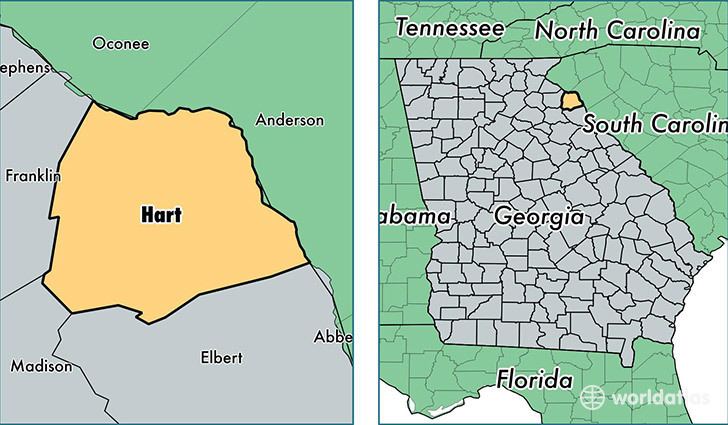
- Map of Hart County GA USA
- Geography
- Adjacent counties
- 2000 census
- 2010 census
- Attractions
- City
- Town
- Census designated places
- Other unincorporated communities
- References
Map of Hart County, GA, USA
Hart County was created December 7, 1853 and named for Nancy Hart. Of Georgia's 159 counties, Hart County is the only one named after a woman. Lake Hartwell is also named for her.
Letters to Miss Celie in the movie The Color Purple (film) by Steven Spielberg, based on the novel The Color Purple by Alice Walker, are addressed to "Hartwell County, Georgia" suggesting that the movie is set either in Hartwell or Hart County.
Geography
According to the U.S. Census Bureau, the county has a total area of 257 square miles (670 km2), of which 232 square miles (600 km2) is land and 25 square miles (65 km2) (9.6%) is water.
Most of the southern three-quarters of Hart County is located in the Upper Savannah River sub-basin of the larger Savannah River basin, with the exception of two slivers of the county, south of Royston and west of Bowersville, which are located in the Broad River sub-basin of the Savannah River basin. The northern quarter of the county is located in the Tugaloo River sub-basin of the same Savannah River basin.
Adjacent counties
2000 census
As of the census of 2000, there were 22,997 people, 9,106 households, and 6,610 families residing in the county. The population density was 99 people per square mile (38/km²). There were 11,111 housing units at an average density of 48 per square mile (18/km²). The racial makeup of the county was 79.09% White, 19.36% Black or African American, 0.15% Native American, 0.53% Asian, 0.24% from other races, and 0.63% from two or more races. 0.85% of the population were Hispanic or Latino of any race.
There were 9,106 households out of which 29.00% had children under the age of 18 living with them, 56.80% were married couples living together, 12.00% had a female householder with no husband present, and 27.40% were non-families. 24.40% of all households were made up of individuals and 10.60% had someone living alone who was 65 years of age or older. The average household size was 2.47 and the average family size was 2.92.
In the county, the population was spread out with 23.50% under the age of 18, 7.70% from 18 to 24, 27.30% from 25 to 44, 25.00% from 45 to 64, and 16.50% who were 65 years of age or older. The median age was 39 years. For every 100 females there were 97.00 males. For every 100 females age 18 and over, there were 92.70 males.
The median income for a household in the county was $32,833, and the median income for a family was $39,600. Males had a median income of $30,652 versus $21,233 for females. The per capita income for the county was $16,714. About 12.20% of families and 14.80% of the population were below the poverty line, including 19.10% of those under age 18 and 16.50% of those age 65 or over.
2010 census
As of the 2010 United States Census, there were 25,213 people, 10,121 households, and 6,998 families residing in the county. The population density was 108.5 inhabitants per square mile (41.9/km2). There were 13,007 housing units at an average density of 56.0 per square mile (21.6/km2). The racial makeup of the county was 77.4% white, 18.7% black or African American, 0.9% Asian, 0.1% American Indian, 1.7% from other races, and 1.3% from two or more races. Those of Hispanic or Latino origin made up 3.1% of the population. In terms of ancestry, 13.6% were American, 8.4% were English, 7.4% were Irish, and 6.6% were German.
Of the 10,121 households, 30.7% had children under the age of 18 living with them, 51.1% were married couples living together, 13.6% had a female householder with no husband present, 30.9% were non-families, and 27.4% of all households were made up of individuals. The average household size was 2.43 and the average family size was 2.94. The median age was 42.6 years.
The median income for a household in the county was $36,109 and the median income for a family was $44,451. Males had a median income of $35,172 versus $26,836 for females. The per capita income for the county was $19,124. About 17.4% of families and 22.4% of the population were below the poverty line, including 30.4% of those under age 18 and 13.4% of those age 65 or over.