
Length 355.8 km | ||
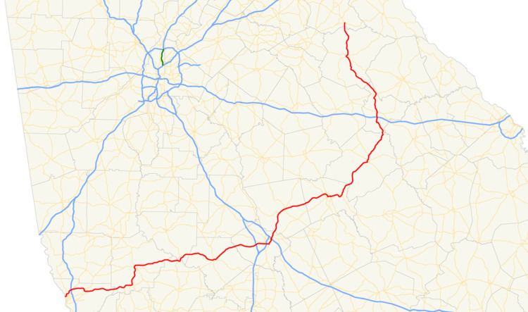 | ||
State Route 22 (SR 22) is a 221.1-mile-long (355.8 km) state highway that travels southwest-to-northeast in an eastern arc through portions of Muscogee, Talbot, Taylor, Upson, Crawford, Bibb, Jones, Baldwin, Hancock, Taliaferro, Oglethorpe, and Madison counties in the western and west-central parts of the U.S. state of Georgia. The highway connects the Alabama state line in Columbus, across the state line from Phenix City, Alabama, to Comer, via Macon and Milledgeville.
Contents
- Map of GA 22 Georgia USA
- Columbus to Macon
- Macon metropolitan area
- Jones County to Comer
- National Highway System
- Future
- Columbus connector route
- Columbus spur route
- References
Map of GA-22, Georgia, USA
Parts of the highway, specifically the segment from the Alabama state line east to Geneva, are planned to be included as part of the Fall Line Freeway, a long-distance highway that is planned to extend from the Alabama state line to Augusta. Also, this section could be included in the proposed Interstate highway Interstate 14 (I-14).
Columbus to Macon
SR 22 begins at the Alabama state line concurrent with US 80. West of the state line, US 80 continues over the Chattahoochee River into Phenix City as Phenix City Bypass (internally designated as Alabama State Route 8). Eastward, US 80/SR 22 travel on the J.R. Allen Parkway, a limited-access bypass of Columbus in Muscogee County. Almost immediately, they have an interchange with the northern terminus of SR 22 Conn. (2nd Avenue). Then they have an interchange with SR 219 (River Road). After that is Bradley Park Drive. Then, they have a full cloverleaf interchange with Interstate 185 (I-185). The same exit lanes for I-185 are also used for US 27/SR 1 (Veterans Parkway) and Moon Road. Then is a partial interchange with Schomburg Road and Blackmon Road. The highways curve to the southeast and have an interchange with US 27 Alt./SR 85 (Manchester Expressway). Here, the freeway ends and the two highways continue to the east and meet the eastern terminus of SR 22 Spur (Macon Road). US 80/SR 22 begin paralleling the northern border of Fort Benning and travel through the town of Upatoi. They travel south of Cox Lake and cross over the Tar River north of Montarella Lake, before crossing over Baker Creek into Talbot County. They travel to the north of Box Springs. The highways meet the northern terminus of SR 355. Just before entering Geneva, SR 41 joins the concurrency. In Geneva, they meet the western terminus of SR 96 and turn to the north. In Talbotton, they intersect SR 90/SR 208 (Clark Street). At this intersection, SR 90 meets its western terminus, and SR 208 joins the concurrency very briefly and departs at Monroe Street. A few blocks later, SR 41 also leaves the concurrency to the north on Washington Avenue, while US 80/SR 22 curve to the east. After traveling through rural areas of the county, they travel along the Talbot–Taylor county line before entering Taylor County proper. They intersect US 19/SR 3, which join the concurrency. The four highways cross over the Flint River into Upson County. Not long afterward, US 80/SR 22 split off to resume their eastern routing and enter Crawford County. In Roberta, they intersect US 341/SR 7/SR 42 (Dugger Avenue). At this intersection, SR 42 joins the concurrency. The three highways pass the Crawford County Public Library and Crawford County Middle School. In nearby Knoxville, SR 42 departs the concurrency, while US 80/SR 22 begin a curve to the northeast. They gradually curve to the east-northeast before crossing over Echoconnee Creek into Bibb County. Just before entering Lizella, they curve to the southeast and begin to curve back to the northeast and enter Macon.
Macon metropolitan area
They pass by Macon State College before an interchange with I-475. US 80/SR 22 curve to the east and travel between Macon Mall and Central Georgia Technical College. Next to Westgate Mall, they intersect US 41/SR 247 (Pio Nono Avenue). Just under 2,000 feet (610 m) later, they have an interchange with I-75. Then, they pass Saints Rest Cemetery and Memorial Park, before they intersect US 41 Bus./US 129/SR 11/SR 49 (Broadway). At this intersection, all six highways travel concurrently to the north and curve to the northeast. At Walnut Street, US 41 Bus./SR 22/SR 49 split off to the northwest. At 2nd Street, SR 22 departs to the northeast. There is an interchange with US 129/SR 11/SR 87 that is only accessible from the westbound lanes. Immediately, the road crosses over the Ocmulgee River and passes over I-16 (Jim Gillis Historic Savannah Parkway), which has a partial interchange with SR 22, but there is no access to I-16 from either direction of SR 22 or to SR 22 from I-16 east. Just west of Coliseum Medical Center is an intersection with US 23/US 129 Alt./SR 19 (Emery Highway). At this intersection, US 129 Alt. travels concurrent with SR 22 to the north for just over 500 feet (150 m). At the intersection with US 129/SR 11/SR 49, US 129 Alt. meets its northern terminus, and SR 22 joins that concurrency to the north-northeast. Less than 4,000 feet (1,200 m) later, SR 49 (Shurling Drive) splits off to the east.
Jones County to Comer
US 129/SR 11/SR 22 cross over Walnut Creek and then enter Jones County. Just before intersecting SR 18, the concurrency passes by Brasswells Lake, Newberry Lake, and Anderson Lake. On the southwestern edge of the city limits of Gray, SR 18 joins the concurrency. The four highways enter the main part of the town. At Bill Conn Parkway, SR 18 splits off to the southeast. At Atlanta Road, SR 11 departs the concurrency to the north. One block later, they intersect SR 44. Here, US 129 heads to the north, concurrent with SR 44, while SR 22 continues to the northeast. Just outside town, it passes Lake Jonesco Golf Course. After traveling through Haddock, the route enters Baldwin County. After entering Milledgeville, it passes the Walter B. Williams, Jr. Park. Immediately afterward, it meets the southern terminus of SR 212. Then, it intersects US 441/SR 29 (Robertson Mill Road). SR 22 passes by Youth Development Center Lake and Oconee Regional Medical Center. It curves to the south-southeast and then to the east-northeast and intersects US 441 Bus./SR 24 (North Columbia Street). The three highways travel concurrently to the east-northeast on West Montgomery Street. One block later, US 441 Bus. departs to the south-southeast on Clark Street, concurrent with SR 243, which has its northern terminus at this intersection. SR 22/SR 24 parallel the northern edge of Georgia College & State University. At North Elbert Street, the concurrency turns to the right and meets the northern terminus of SR 49 (East Hancock Street) and the northern terminus of SR 112 (South Elbert Street). At this intersection, SR 22/SR 24 turn to the left onto East Hancock Street and leave town by crossing over the Oconee River. The two highways diverge with SR 22 heading to the northeast and entering Hancock County. In Sparta, it intersects SR 15/SR 16 (Broad Street). The three highways travel north-northwest and leave town. Almost immediately, they curve to the north-northeast and split, with SR 15/SR 22 continuing straight ahead. After a curve back to the north-northwest, SR 22 splits to the northeast and travels through Powelton. Then, the highway enters Taliaferro County. After an interchange with I-20 (Carl Sanders Highway), it enters Crawfordville, where it intersects US 278/SR 12 (Broad Street). It parallels the southwestern edge of A. H. Stephens Historic Park and leaves town. It crosses over the South Fork Little River and North Fork Little River before intersecting SR 44. Then, it very gradually curves to the northwest and enters Oglethorpe County. It intersects US 78/SR 10 southeast of Lexington. The concurrency crosses the southeastern-most corner of the city limits on Main Street. Just over 1,000 feet (300 m) later, SR 77 (Elberton Road) joins the concurrency and leaves on Union Point Road. On the northwestern-most corner of the city limits, SR 22 splits off to the northeast on Comer Road. The highway crosses over the South Fork Broad River into Madison County. Almost immediately, SR 22 enters the southern city limits of Comer. At East Sunset Avenue, it meets its northern terminus, an intersection with SR 72.
National Highway System
There are three sections of SR 22 that are included as part of the National Highway System, a system of roadways important to the nation's economy, defense, and mobility:
Future
The section from the Alabama state line to Geneva is planned to be included as part of the Fall Line Freeway and could be included in the proposed I-14.
Columbus connector route
State Route 22 Connector (SR 22 Conn.) is a 0.3-mile-long (0.48 km) connector route that exists entirely within the city limits of Columbus in the west central part of Muscogee County. It is known as 2nd Avenue for its entire length.
It begins at an intersection with SR 85. It travels due north, curves to the north-northeast, and meets its northern terminus, an interchange with US 80/SR 22 (J.R. Allen Parkway).
All of SR 22 Connector is included as part of the National Highway System, a system of roadways important to the nation's economy, defense, and mobility.
The entire route is in Columbus, Muscogee County.
Columbus spur route
State Route 22 Spur (SR 22 Spur) is a 10.3-mile-long (16.6 km) spur route that exists entirely within the city limits of Columbus in the west-central and north-central parts of Muscogee County.
It begins at an intersection with US 27/SR 1 (Veterans Parkway). It travels due east on 13th Street. It turns right onto 13th Avenue and curves to the northeast onto Wynnton Road. Then, it takes on the name Macon Road and has an interchange with Interstate 185 (I-185; Lindsay Creek Bypass). Farther to the northeast, it skirts along the southern edge of Parkhill Cemetery. Just after passing northwest of Fort Benning, it meets its eastern terminus, an intersection with US 80/SR 22 (Beaver Run Road).
All of SR 22 Spur is included as part of the National Highway System, a system of roadways important to the nation's economy, defense, and mobility.
The entire route is in Columbus, Muscogee County.