
Existed: 1979 – present Length 79.3 km | Constructed 1979 | |
 | ||
South end: Lindsey Creek Parkway in Fort Benning Counties | ||
Interstate 185 (I-185) is a 49.30-mile-long (79.34 km) Auxiliary Interstate Highway in the west-central part of the U.S. state of Georgia. I-185 also carries the unsigned State Route 411 (SR 411), and is named the Chet Atkins Parkway for its entire length. It provides a freeway connection between the Columbus and Atlanta metropolitan areas.
Contents
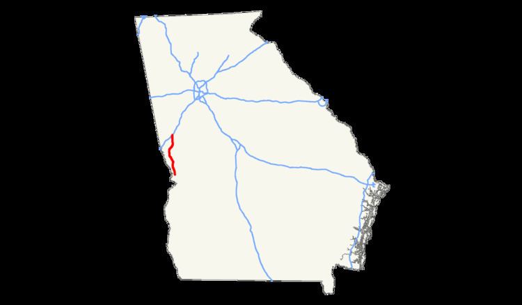
Map of I-185, Georgia, USA
Muscogee County
I-185 begins just north of Fort Benning in the southwestern part of Columbus, which is consolidated with Muscogee County. It starts off as a northern extension of Lyndsey Creek Parkway. That highway enters the base. It travels to the northeast. Almost immediately, it has an interchange with US 27/US 280/SR 1/SR 520 (Victory Drive). The interstate curves to the north-northwest. It passes Benning Hills Park and the Calhoun Tract before curving to the north-northeast. It crosses over Cusseta Road and some railroad tracks of Georgia Southwestern Railroad. It curves to the north-northwest and has an interchange with St. Marys Road. It curves to a due north direction and has an interchange with Buena Vista Road. The highway curves to the northwest and crosses over Bull Creek. It then has an interchange with SR 22 Spur (Macon Road). Here, it passes the Cross Country Plaza shopping center. I-185 crosses over Lindsey Creek and then begins to parallel the creek. Upon crossing over College Drive, Lindsey Creek veers away from the interstate. The highway then travels between Hardaway High School and Columbus State University. After crossing over the Fall Line Trace, it has an interchange with US 27 Alt./SR 85 (Manchester Expressway). It then has an interchange with the Airport Thruway, which leads to Columbus Metropolitan Airport. After the highway begins to curve to the north, it travels under a bridge that carries US 27/SR 1. It crosses over some railroad tracks of Norfolk Southern Railway. Almost immediately is an interchange with US 80/SR 22 (J.R. Allen Parkway), a limited-access bypass of Columbus to its north. Within this interchange, it crosses over Roaring Branch. It curves to the north and has an interchange with Williams Road. It curves to the north-northeast and has an interchange with Smith Road. Within this interchange, it crosses over Heiferhorn Creek. At the northern end of this interchange, the highway leaves the city limits of Columbus and enters Harris County.
Harris County
I-185 curves to the northwest and crosses over Standing Boy Creek. It curves to the north-northwest and has an interchange with SR 315. It crosses over Mulberry Creek and curves to the northwest. It winds its way to the north-northeast, traveling parallel to SR 219. It crosses over Little Creek just to the west of Peterson Lake and just south of an interchange with SR 116. The highway winds its way to the north and crosses over Mountain Oak Creek. At an interchange with Hopewell Church Road, SR 219 turns away from the Interstate. I-185 curves to the northeast and crosses over House Creek Tributary. It then has an interchange with SR 18. After it crosses over Ingram Creek, the highway parallels the creek briefly and then enters Troup County.
Troup County
I-185 curves to the north-northeast and crosses over Turkey Creek. It then crosses over Polecat Creek before curving to the north-northwest. It then crosses over Flat Shoals Creek. It curves to the north-northeast and has another interchange with US 27/SR 1 (Martha Berry Highway). The highway then crosses over Mud Creek. It curves to the north-northwest and crosses over Panther Creek. After curving back to the north-northeast, it has an interchange with Big Springs Road. It curves back to the north-northwest and crosses over some railroad tracks of CSX on the southeastern edge of LaGrange. The highway begins to skirt along the eastern edge of the city. It crosses over Long Cane Creek and then curves to the north-northeast again. It leaves the city limits of LaGrange and travels under a bridge that carries SR 109. It then meets its northern terminus, an interchange with I-85.
History
In 1966, the highway that would eventually become I-185 was under construction from its current southern terminus to Buena Vista Road, which at the time as signed as SR 357. However, the highway was signed as SR 1, since the current SR 1 had been redesignated as SR 1 Business. SR 1 was proposed from SR 357 to US 27/SR 1 Bus. in the northern part of Columbus. The next year, this segment was open. It was under construction from SR 357 to US 27/SR 1 in the northern part of Columbus. In 1969, the highway was open from its southern terminus to the northern part of Columbus. In 1975, it was redesignated as I-185, since SR 1 Business had been changed back to SR 1. The highway's northern extension was proposed from the northern part of Columbus to US 27/SR 1 southeast of LaGrange. It was under construction from that interchange to I-85. The next year, the entire northern extension was under construction. In 1978, it was opened from US 27/SR 1 to Smith Road in the northern part of Columbus. It was also open from US 27/SR 1 southeast of LaGrange to I-85. In 1979, I-185 was open for its entire length.
The portions of I-185 north of exit 8 were equipped with call boxes as part of a pilot program in May 1999. It is currently the only stretch of Interstate Highway in Georgia to be so equipped.
Future
In 2006, business and government officials in Southwest Georgia began a campaign to have the interstate extended to Monticello, Florida, and connect with I-10. The proposed route of the highway would travel parallel to SR 520 (known as "Corridor Z") to Albany, and then parallel to US 19. Local opposition to the plan soon emerged. Critics argued that the proposed interstate would siphon business from small towns that the new road bypassed. In 2009, Georgia's Department of Transportation concluded a two-year study of the proposal, which found that extending I-185 would "be inconsistent with existing comprehensive land use plans; would have a negative impact on prime agricultural land, forests and cultural assets; and could have a detrimental impact on poverty and minority populations". GDOT announced it would instead focus on upgrading and improving other key arterial highways in southwest Georgia, including SR 133 between Albany and Valdosta.