
 | ||
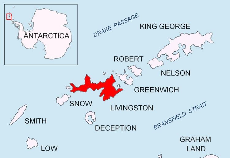
Etar Snowfield (Bulgarian: Ледник Етър \'led-nik 'e-t&r, Lednik Etar) is a roughly crescent-shaped snowfield on western Livingston Island in the South Shetland Islands, Antarctica situated west of Urdoviza, Medven and Berkovitsa Glaciers, and northwest of Verila Glacier. It drains the west slopes of Oryahovo Heights and the north slopes of Rotch Dome, and flows into Barclay Bay between Mercury Bluff and Rowe Point. The feature extends 5 km (3 mi) inland, and 15 km (9 mi) in south-southwest to north-northeast direction. Bulgarian mapping in 2005 and 2009.
Contents
The glacier was named after the settlement of Etar in the central Balkan Mountains, Bulgaria.
Maps
Location
The snowfield is located at 62°34′07″S 60°46′27″W. Bulgarian mapping in 2005 and 2009.
References
Etar Snowfield Wikipedia(Text) CC BY-SA