
 | ||
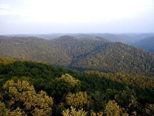
Cumberland falls state resort park south eastern kentucky hd beautiful
The Eastern Kentucky Coalfield is part of the Central Appalachian bituminous coalfield, including all or parts of 30 Kentucky counties and adjoining areas in Ohio, West Virginia, Virginia and Tennessee. It covers an area from the Allegheny Mountains in the east across the Cumberland Plateau to the Pottsville Escarpment in the west. The region is known for its coal mining; most family farms in the region have disappeared since the introduction of surface mining in the 1940s and 1950s.
Contents
- Cumberland falls state resort park south eastern kentucky hd beautiful
- Geography
- Major cities
- Historical parks
- State resort parks
- State recreational parks
- Other
- Economy
- Persistent poverty
- Appalachian Regional Commission
- Health
- Public universities
- Private colleges and universities
- Community and technical colleges
- Notable residents
- References
The Daniel Boone National Forest is located on rough but beautiful terrain along and east of the Pottsville Escarpment. There are many natural arches and sandstone cliffs that are excellent for rock climbing and rappeling. The Red River Gorge, part of the National Forest, is known worldwide in rock climbing circles.
The Sheltowee Trace Trail runs 420–430 km north and south through the region.
During the American Civil War most of this region leaned toward the Union due to its makeup at the time of mostly small farmers, but more than 2,000 men from this area formed the 5th. Kentucky Vol. Inf., known as the Army of Eastern Kentucky, under Gen. Humphrey Marshall, C.S.A. During the Great Depression, New Deal programs and the organizing of the United Mine Workers of America made many of the eastern counties Democratic.
Eastern Kentucky has a rich musical heritage. A large number of nationally acclaimed country music singers and musicians are from the area. These include: Loretta Lynn, Crystal Gayle, The Judds, Ricky Skaggs, Keith Whitley, Patty Loveless, Dwight Yoakam, Tom T. Hall, Billy Ray Cyrus, Jean Ritchie, Sturgill Simpson and George S. Davis.
As of the 1980s, the only counties in the United States where over half of the population cited "English" as their only ancestry group were in the hills of eastern Kentucky (and made up virtually every county in this region). In the 1980 census, 1,267,079 Kentuckians out of a total population of 2,554,359 cited that they were of English ancestry,making them 49 percent of the state at that time.
Geography
The Eastern Kentucky Coalfield covers 31 counties with a combined land area of 13,370 sq mi (34,628 km²), or about 33.1 percent of the state's land area. Its 2000 census population was 734,194 inhabitants, or about 18.2 percent of the state's population. The largest city, Ashland, has a population of 21,981. Other cities of significance in the region include Pikeville, Corbin, and Middlesboro. The state's highest point, Black Mountain, is located in the southeastern part of the region in Harlan County.
Major cities
The following list consists of Eastern Kentucky cities with populations over 4,000 according to the U.S. Census estimates released in 2014:
Historical parks
State resort parks
State recreational parks
Other
Economy
The region's economy is centered around the vast amount of natural resources available, which includes coal, timber, natural gas, and oil. Recently, tourism has become a leading industry in the region, due to the region's unique cultural history and the creation of state parks.
Calgon Carbon constructed the Big Sandy Plant near Ashland in 1961 and it has since became the world's largest producer of granular activated carbon. The facility produces in over 100 million pounds of granular activated carbon annually.
Persistent poverty
Most of the counties in the Eastern Kentucky Coalfield are classified as "persistent poverty counties". The definition of a persistent poverty county by the Economic Research Service of the United States Department of Agriculture is that 20 percent or more of the total county population has been living in poverty since the 1980 census.
A New York Times article in June 2014 identified six counties in the Kentucky Coal Field as among the "hardest places to live in the United States." The lowest-ranking counties were Breathitt, Clay, Jackson, Lee, Leslie, and Magoffin. They ranked among the bottom ten counties nationwide. The factors which accounted for the low ranking of those six counties were unemployment, prevalence of disabilities, obesity, income, and education. The Times declared Clay County the hardest place to live in the U.S.
Appalachian Regional Commission
The Appalachian Regional Commission was formed in 1965 to aid economic development in the Appalachian region, which was lagging far behind the rest of the nation on most economic indicators. The Appalachian region currently defined by the Commission includes 420 counties in 13 states, including all counties in Kentucky's Eastern Coalfield. The Commission gives each county one of five possible economic designations—distressed, at-risk, transitional, competitive, or attainment—with "distressed" counties being the most economically endangered and "attainment" counties being the most economically prosperous. These designations are based primarily on three indicators—three-year average unemployment rate, market income per capita, and poverty rate.
From 2008 to 2010, "Appalachian" Kentucky—which includes all of the Eastern Coalfield and several counties in South Central Kentucky and a few in the eastern part of the Bluegrass region—had a three-year average unemployment rate of 10.2%, compared with 9.3% statewide and 8.2% nationwide. In 2009, Appalachian Kentucky had a per capita market income of $16,923, compared with $24,290 statewide and $32,562 nationwide. From 2007 to 2011, Appalachian Kentucky had an average poverty rate of 24.8%—the highest of any of the ARC regions—, compared to 18.1% statewide and 14.3% nationwide. Twenty-three Eastern Mountain Coal Field counties—Bell, Breathitt, Clay, Elliott, Floyd, Harlan, Jackson, Knott, Knox, Lawrence, Lee, Leslie, Letcher, Magoffin, Martin, McCreary, Menifee, Morgan, Owsley, Powell, Rowan, Whitley, and Wolfe—were designated "distressed," while six—Carter, Johnson, Laurel, Montgomery, Perry, and Pike—were designated "at-risk." Two Eastern Coalfield counties were designated "transitional"—Boyd and Greenup. No counties in the Eastern Coalfields region were given the "attainment" designation or were designated "competitive."
The following table illustrates the economic status of each county.
Health
Most of the counties in the Eastern Kentucky Coalfield rank in the lowest ten percent of U.S. counties in average life expectancy. Both men and women have average life spans that are several years less than the average life span in the United States. Moreover, many counties have seen a decline in the life expectancy of men and/or women since 1985. Factors influencing the health of residents include a high prevalence of smoking and obesity and a low level of physical activity.