
Country United States Incorporated February 29, 1848 Elevation 160 m Local time Thursday 11:13 PM | State Kentucky Established February 4, 1818 Named for its county Zip code 41144 Population 1,171 (2013) | |
 | ||
Weather 13°C, Wind W at 5 km/h, 44% Humidity | ||
Greenup is a home rule-class city located at the confluence of the Little Sandy River with the Ohio River in Greenup County, Kentucky, in the United States. The population was 1,188 at the 2010 census. Greenup is one of three county seats in the Commonwealth of Kentucky to share its name with its county; the other two being Harlan and Henderson.
Contents
Map of Greenup, KY 41144, USA
Greenup is a part of the Huntington-Ashland, WV-KY-OH Metropolitan Statistical Area (MSA). As of the 2010 census, the MSA had a population of 287,702.
History
Greenup was laid out in 1803 and 1804 by Robert Johnson, a pioneer and legislator who owned the land. Upon the formation of Greenup County (named for the former congressman and future governor Christopher Greenup) out of land separated from Mason County, Johnson's settlement was chosen to be the seat of government and adopted the name "Greenupsburg". Its post office was erected on July 1, 1811. The state assembly formally established the town on February 4, 1818, and incorporated the city thirty years later on February 29, 1848. The name was shortened to "Greenup" on March 13, 1872, partially to avoid confusion with Greensburg.
The Ohio River flood of 1937 brought devastation to Greenup.
Geography
Greenup is located in eastern Greenup County at 38°34′25″N 82°50′1″W (38.573503, -82.833549), along the south bank of the Ohio River. The northeast boundary of the city follows the Ohio–Kentucky border within the river. The Little Sandy River forms most of the western boundary of the city, except for a small portion of the city that extends west across the river between Seaton Avenue and Main Street.
U.S. Route 23 (Seaton Avenue) runs through the southwest side of the city, leading northwest 19 miles (31 km) to Portsmouth, Ohio and southeast 13 miles (21 km) to Ashland, Kentucky. Kentucky Route 1 leads south 23 miles (37 km) to Grayson, and Kentucky Route 2 leads southwest 37 miles (60 km) to Olive Hill.
According to the United States Census Bureau, Greenup has a total area of 1.2 square miles (3.2 km2), of which 0.77 square miles (2.0 km2) is land and 0.42 square miles (1.1 km2), or 36.08%, is water.
Government
The city of Greenup has a mayor-council form of government. The city's current mayor is Lundie Meadows. Its representative body is the city council, which consists of a panel of six individuals.
Public safety
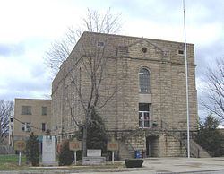
Greenup is protected by its own police and fire departments. In addition, surrounding fire and police departments are in a mutual aid agreement with the city of Greenup. Also, the Greenup County Sheriff's Department offices are located in the Greenup County Courthouse in Downtown Greenup. Emergency medical service is provided by Greenup County Emergency Medical Services.
Demographics
As of the census of 2000, there were 1,198 people, 478 households, and 321 families residing in the city. The population density was 1,523.0 people per square mile (585.5/km²). There were 526 housing units at an average density of 668.7 per square mile (257.1/km²). The racial makeup of the city was 90.07% White, 8.85% African American, 0.25% Native American, 0.17% Asian, 0.17% from other races, and 0.50% from two or more races. Hispanic or Latino of any race were 0.75% of the population.
There were 478 households out of which 24.3% had children under the age of 18 living with them, 54.0% were married couples living together, 11.7% had a female householder with no husband present, and 32.8% were non-families. 31.0% of all households were made up of individuals and 17.2% had someone living alone who was 65 years of age or older. The average household size was 2.27 and the average family size was 2.83.
In the city the population was spread out with 18.5% under the age of 18, 10.2% from 18 to 24, 30.1% from 25 to 44, 22.8% from 45 to 64, and 18.4% who were 65 years of age or older. The median age was 39 years. For every 100 females there were 96.4 males. For every 100 females age 18 and over, there were 94.0 males.
The median income for a household in the city was $33,158, and the median income for a family was $41,548. Males had a median income of $33,750 versus $23,036 for females. The per capita income for the city was $15,926. About 6.2% of families and 10.7% of the population were below the poverty line, including 10.7% of those under age 18 and 12.1% of those age 65 or over.