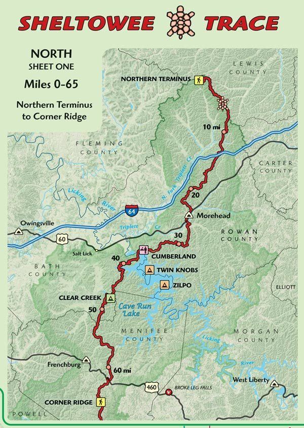
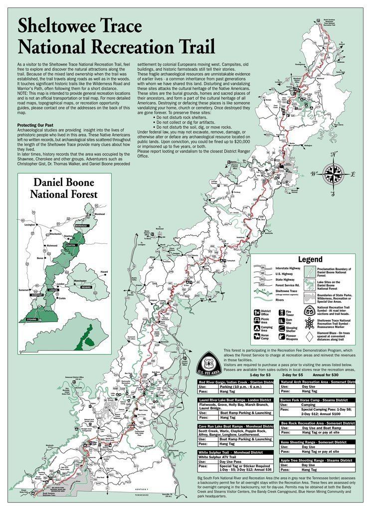
Trail difficulty Easy to strenuous Length 519,818 m | Use Hiking Season Year-round Designation National Recreation Trail | |
 | ||
Hazards Severe weatherAmerican black bearTick-borne diseasesMosquitosYellowjacketsBiting fliesChiggersSteep gradesLimited waterDiarrhea from waterPoison ivyVenomous snakes Trailheads | ||
Sheltowee trace thru hike gear list 2016
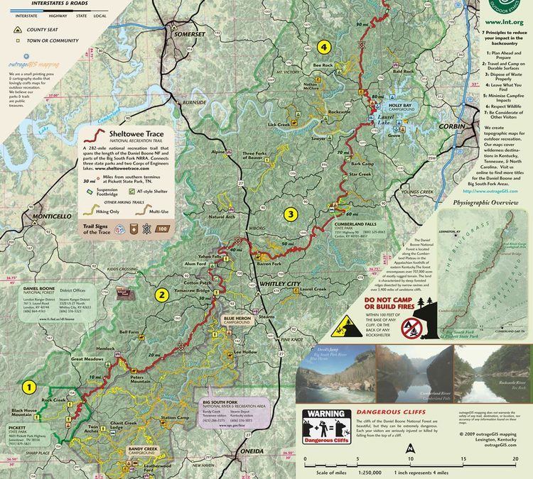
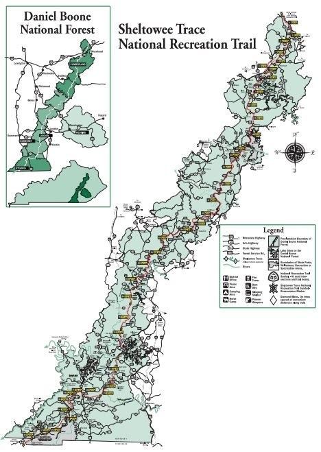
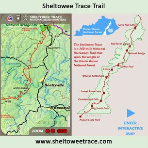
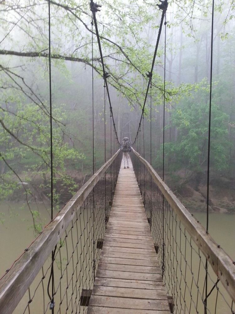
The Sheltowee Trace Trail is a 323-mile (519.82 km) National Recreation Trail that was created in 1979 and stretches from the Burnt Mill Bridge Trail Head in the Big South Fork National River and Recreation Area in Tennessee to northern Rowan County, Kentucky. The trail is named after Daniel Boone, who was given the name Sheltowee (meaning "Big Turtle") when he was adopted as the son of the great warrior Chief Blackfish of the Shawnee tribe.
Contents
- Sheltowee trace thru hike gear list 2016
- Hiking on sheltowee trace trail waterfalls and high jinks
- References
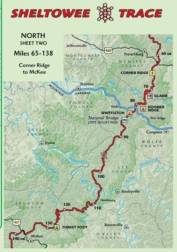
The trail is primarily in the Daniel Boone National Forest, but also takes visitors through the Big South Fork National River and Recreation Area, Cumberland Falls State Resort Park, Natural Bridge State Resort Park, two large recreation lakes (Cave Run Lake and Laurel Lake), and many wildlife management areas. All but the southernmost 45 miles (72.42 km) are in Kentucky.
The trail is multi-use with certain sections, allowing horses, mountain bikes and all-terrain vehicless in some designated sections. Using off-road motorcycles, SUVs, 4x4, ATVs and even mountain bikes in certain areas can result in equipment confiscation and fines. While the southern terminus was moved in 2014, the trail into Pickett State Park remains open for those that wish to exit on that trail or wish to walk further down the scenic Rock Creek.
Hiking on sheltowee trace trail waterfalls and high jinks