Administrative district Dorogobuzhsky District Local time Friday 7:51 PM | Urban settlement Dorogobuzhskoye | |
 | ||
Administrative center of Dorogobuzhsky District, Dorogobuzhskoye Urban Settlement Municipal district Dorogobuzhsky Municipal District Weather 6°C, Wind S at 14 km/h, 81% Humidity | ||
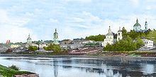
Dorogobuzh (Russian: Дорогобу́ж; Polish: Dorohobuż) is a historic town and the administrative center of Dorogobuzhsky District in Smolensk Oblast, Russia, straddling the Dnieper River and located 125 kilometers (78 mi) east of Smolensk, the administrative center of the oblast. Population: 10,720 (2010 Census); 12,250 (2002 Census); 12,254 (1989 Census).
Contents
Map of Dorogobuzh, Smolensky, Russia
History
First mentioned in 1150, it was established as a fortress defending eastern approaches to Smolensk. In 1508, Vasily III sent Italian masters to build a wooden fort there. Dorogobuzh was ravaged during the Time of Troubles, with its population reduced to ten people in 1614. Between 1611 and 1668, it belonged to Polish–Lithuanian Commonwealth as a part of Smolensk Voivodeship. Subsequently, it survived other foreign invasions and numerous fires.
Dorogobuzh was occupied by the German Army during World War II first from October 5, 1941 to February 15, 1942 (when it was liberated by three partisan detachments and some Soviet troops), then again from June 7, 1942 to September 1, 1943.
Administrative and municipal status
Within the framework of administrative divisions, Dorogobuzh serves as the administrative center of Dorogobuzhsky District. As an administrative division, it is incorporated within Dorogobuzhsky District as Dorogobuzhskoye Urban Settlement. As a municipal division, this administrative unit also has urban settlement status and is a part of Dorogobuzhsky Municipal District.
