
Population 11,383 (2012) Abolished 2016 Area 2,329 km² Council seat Corowa | Established 1955 Founded 1955 | |
 | ||
Points of interest Tunzafun, Corowa Federation Museum, River of Islands | ||
Corowa shire the holiday choice
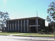
Corowa Shire was a local government area in the Riverina region in southern New South Wales, Australia. The area was located adjacent to the Murray River and the Riverina Highway.
Contents
- Corowa shire the holiday choice
- Map of Corowa NSW Australia
- Corowa shire
- Amalgamation
- Composition and election method
- References
Map of Corowa, NSW, Australia
The Shire included the towns of Corowa, Howlong, Balldale, Coreen and Daysdale, Rennie and Mulwala.
It was established in 1955 through a merger of the Corowa Municipality and Coreen Shire.
Corowa shire
Amalgamation
A 2015 review of local government boundaries by the NSW Government Independent Pricing and Regulatory Tribunal recommended that the Corowa Shire merge with the Lockhart and Urana shires to form a new council with an area of 8,581 square kilometres (3,313 sq mi) and support a population of approximately 16,000. The Council was dissolved on 12 May 2016 and along with Urana Shire the area became part of the new Federation Council
Composition and election method
At the time of dissolution, Corowa Shire Council was composed of nine councillors elected proportionally as a single ward. All councillors were elected for a fixed four-year term of office. The last election was due to be held on 8 September 2012. However, only nine candidates, being the below, nominated for election. There being no additional candidates, the election was uncontested.