
Population 1,180 (2012) Abolished 2016 Website Urana Shire Area 3,356 km² Council seat Urana | Established 1906 Founded 1906 | |
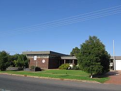 | ||
Urana Shire was a local government area in the Riverina region of New South Wales, Australia. The Newell Highway crosses its north-west corner. The Shire included the town of Urana and the small towns of Boree Creek, Morundah, Oaklands and Rand.
Contents
Map of Urana, NSW, Australia
The last mayor of Urana Shire was Cr. Patrick Bourke an unaligned politician.
Amalgamation
A 2015 review of local government boundaries by the NSW Government Independent Pricing and Regulatory Tribunal recommended that the Urana Shire merge with the Lockhart and Corowa shires to form a new council with an area of 8,581 square kilometres (3,313 sq mi) and support a population of approximately 16,000. Following an independent review, on 12 May 2016 the Minister for Local Government announced that the merger with the Corowa Shire would proceed with immediate effect to form the Federation Council.
Composition and election method
At the time of dissolution, Urana Shire Council wascomposed of nine councillors elected proportionally as three separate wards, each electing three councillors. All councillors were elected for a fixed four-year term of office. The mayor was elected by the councillors at the first meeting of the Council. The last election was held on 8 September 2012. In the B and C Wards, only three candidates, being those below, nominated for election. There being no additional candidates, the election for these Wards was uncontested. In the A Ward, an election was held.