
Population 135,971 (2015 est) Mayor Cr James Dooley Founded 1994 | Established 1994 Area 131 km² | |
 | ||
State electorate(s) FrankstonCarrumCranbourneHastings University Monash University, Peninsula campus Points of interest McClelland Gallery and Sculpture, Port Phillip, Lower Sweetwater Creek Na, The Pines Flora and Fauna Re, Foreshore Reserve | ||
Frankston City is a local government area in Victoria, Australia in the southern suburbs of Melbourne. It has an area of 131 square kilometres and has an estimated population of 128,576 people.
Contents
- Map of Frankston VIC Australia
- Geography
- History
- Council
- Mayors
- Suburbs and localities
- Wards
- Sister Cities
- References
Map of Frankston, VIC, Australia
Despite its similar area and name, Frankston City is a different entity to the former City of Frankston which existed from 1966 until 1994, which was a continuation of the former Shire of Frankston and was abolished under the Kennett local government reforms. This is similar to the situation for the Shire of South Gippsland and Shire of Glenelg, but is unlike the City of Melbourne, City of Knox, City of Whittlesea and City of Melton, whose administrations stayed intact through the amalgamations of the early 1990s.
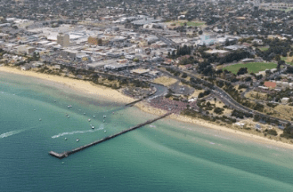
Geography
The City is located on the eastern shores of Port Phillip, and is bounded on the north by the City of Kingston and the City of Greater Dandenong, on the east by the City of Casey, and on the south by the Shire of Mornington Peninsula. The boundaries of the City are defined largely on the north by Eel Race Road and Thompsons Road, on the east by the Dandenong-Hastings Road, and on the south by a complex boundary featuring Baxter-Tooradin Road, Golf Links Road and Humphries Road.
History
The City of Frankston was created in 1994 out of the remains of three abolished councils — all but the suburb of Mount Eliza from the former City of Frankston; the suburbs of Carrum Downs, Langwarrin and Skye from the City of Cranbourne; and part of Carrum Downs from the City of Springvale.
The major part of the City was first incorporated in 1860 as the Mornington Roads District, which became a shire in 1871 and was renamed Shire of Frankston and Hastings in 1893, losing its western riding to form the Shire of Mornington, which has since been amalgamated into the Shire of Mornington Peninsula. On 19 October 1960, the Shire of Frankston and Hastings split in two, with the western part remaining as the Shire of Frankston, and the eastern part being incorporated as the Shire of Hastings.
Frankston was officially proclaimed as a City on 24 August 1966.
In 1993, Jeff Kennett and his Local Government Minister, Roger Hallam, announced a major statewide program of local government amalgamations, most of which took effect on 15 December 1994. Most councils and their LGA's were abolished with new ones being created to replace them.
Some changes occurred between the release of the Local Government Board report in July and the actual amalgamation — the original plan was to merge with the City of Chelsea and take Braeside and Carrum Downs from the City of Springvale. However, Frankston City Council submitted that it should expand eastwards instead, as well as taking Mount Eliza and Baxter. By October, the present boundaries had been agreed upon, but the new entity was to be known as the City of Nepean. This appeared in the Board's final report in November 1994. However, the State Government ultimately decided to use the old name for the new entity, departing from the Board's recommendation.
Council
The current council, as of June 2016, is:
Mayors
The following Frankston councillors have served as mayor since the inaugural elections in 1997:
Suburbs and localities
Wards
Ratepayers within the municipality are represented by elected city councillors. In the 2005 elections, held on 26 November 2005, where the previous single-councillor ward system was replaced with three, multi-councillor wards. These wards are known as North-West Ward (covering mostly Seaford, Frankston North and parts of Frankston), South-West Ward (covering the southern parts of Frankston and Frankston South) and East Ward (covering Langwarrin and Carrum Downs). Voting is compulsory and conducted by postal ballot, and is based on a preferential voting system.
Elections were last held in October 2012, and councillors were elected for a four-year term. Current councillors are:
Councillors in the 2008-2012 term were: