
Area 1,606 km² Population 95,897 (2013) Unemployment rate 13.5% (Apr 2015) | Website capemaycountynj.gov Founded 1685 | |
 | ||
Points of interest Cape May County Park & Zoo, Jersey Shore, Emlen Physick Estate, Naval Air Station Wildwood, Morey's Piers Destinations | ||
Cape May County is the southernmost county in the U.S. state of New Jersey. The county's Census-estimated population was 94,727 in 2015, a 2.6% decrease from the 97,265 enumerated at the 2010 United States Census, in turn decreasing by 5,061 (-4.9%) from the 102,326 counted in the 2000 Census, retaining its position as the state's second-least populous county. Cape May was one of only two counties to lose population in the decade since 2000; the decline was the largest percentage decrease of any county statewide and the second-largest in absolute terms. A consistently popular summer destination with 30 miles (48 km) of beaches, Cape May attracts vacationers from New Jersey and surrounding states, with the summer population exceeding 800,000. Tourism generates annual revenues of $5.3 billion, making it the county's single largest industry, with leisure and hospitality being Cape May's largest employment category.
Contents
- Map of Cape May County NJ USA
- GeographyEdit
- Adjacent countiesEdit
- National protected areaEdit
- ClimateEdit
- Census 2010Edit
- Census 2000Edit
- EconomyEdit
- GovernmentEdit
- PoliticsEdit
- MunicipalitiesEdit
- EducationEdit
- TransportationEdit
- WineriesEdit
- Notable peopleEdit
- References
Map of Cape May County, NJ, USA
The county is part of the Ocean City, NJ Metropolitan Statistical Area as well as the Philadelphia-Reading-Camden, PA-NJ-DE-MD Combined Statistical Area. Its county seat is the Cape May Court House section of Middle Township.
The county was named for Cornelius Jacobsen Mey, a Dutch captain who explored and charted the area from 1611 to 1614, and established a claim for the province of New Netherland.
GeographyEdit
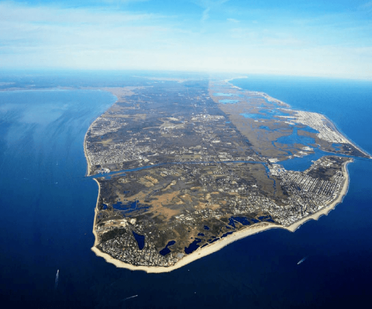
Most of the county lies on a peninsula that juts into Delaware Bay. It is flat and coastal. Sea level is the lowest point; the highest elevation is found at three areas in Belleplain State Forest in the county's northern corner which are approximately 60 feet (18 m) above sea level.
According to the 2010 Census, the county had a total area of 620.42 square miles (1,606.9 km2), including 251.42 square miles (651.2 km2) of land (40.5%) and 368.99 square miles (955.7 km2) of water (59.5%).
Adjacent countiesEdit
Cape May County borders the following counties:
¹ across Delaware Bay; no land border
National protected areaEdit
ClimateEdit
Given its maritime influence and southernmost location within New Jersey, Cape May County has relatively mild wintertime temperatures, with very windy conditions more than half of the year, mostly in June and July. Conversely, the county witnesses lower summertime temperatures than most places in the state, making it a popular place to escape the heat as well. It is in USDA plant hardiness zone 7a/7b, Humid/Temperate. Its climate is suited to growing traditional Northeastern plants, including English Yew, Boxwoods and Sugar Maples. Because of the warmer wintertime temperatures, Hardy Palms, including Trachycarpus fortunei (Chinese Windmill Palm) and Needle Palms, would work quite well in the landscape, these plants having survived for many years also in other parts of coastal New Jersey, from Sandy Hook to Cape May. Wine grapes also do particularly well, given the long growing season. The wine industry is growing – four vineyards and wineries operate in the county now – three more are planted and on the way. The county had a once-vibrant lima bean industry that covered as much as 5,000 acres (2,000 ha) of land and West Cape May still calls itself the "lima bean capital of the world" and hosts an annual lima bean festival, though wine grapes are quickly becoming more common and many wineries dot the landscape.
According to the Köppen climate classification system, Cape May has a humid subtropical climate (Cfa) typical of New Jersey with warm, windy summers and cold winters.
The average temperatures in the county seat of Cape May Court House range from a low of 22 °F (−6 °C) in January to a high of 85 °F (29 °C) in July, although a record low of −22 °F (−30 °C) was recorded in January 1942 and a record high of 103 °F (39 °C) was recorded in July 1993. Average monthly precipitation ranged from 2.91 inches (74 mm) in June to 4.68 inches (119 mm) in August.
Census 2010Edit
The 2010 United States Census counted 97,265 people, 40,812 households, and 25,956 families residing in the county. The population density was 386.9 per square mile (149.4/km2). The county contained 98,309 housing units at an average density of 391 per square mile (151/km2). The racial makeup of the county was 89.83% (87,369) White, 4.69% (4,565) Black or African American, 0.21% (205) Native American, 0.86% (834) Asian, 0.04% (36) Pacific Islander, 2.47% (2,399) from other races, and 1.91% (1,857) from two or more races. Hispanics or Latinos of any race were 6.22% (6,054) of the population.
Out of a total of 40,812 households, 21.6% had children under the age of 18 living with them, 48.3% were married couples living together, 11% had a female householder with no husband present, and 36.4% were non-families. 31.2% of all households were made up of individuals, and 15.5% had someone living alone who was 65 years of age or older. The average household size was 2.32 and the average family size was 2.89.
In the county, 18.9% of the population were under the age of 18, 8% from 18 to 24, 20.1% from 25 to 44, 31.6% from 45 to 64, and 21.6% who were 65 years of age or older. The median age was 47.1 years. For every 100 females the census counted 94.6 males, but for 100 females at least 18 years old, it was 92.4 males.
Census 2000Edit
As of the 2000 United States Census there were 102,326 people in 27,354 families and 42,148 households residing in the county. The population density was 401 people per square mile (155/km²). There were 91,047 housing units at an average density of 357 per square mile (138/km²). The racial makeup of the county was 91.57% White, 5.06% Black or African American, 0.18% Native American, 0.65% Asian, 0.04% Pacific Islander, 1.35% from other races, and 1.16% from two or more races. 3.30% of the population were Hispanic or Latino of any race. Among those residents listing their ancestry, 28.2% were Irish, 21.7% German, 17.1% Italian, 13.2% English, 5.2% Polish and 4.9% American ancestry.
There were 42,148 households out of which 26.10% had children under the age of 18 living with them, 50.50% were married couples living together, 10.90% had a female householder with no husband present, and 35.10% were non-families. 30.20% of all households were made up of individuals and 14.70% had someone living alone who was 65 years of age or older. The average household size was 2.36 and the average family size was 2.94.
In the county, the population age structure was spread out, with 22.3% under the age of 18, 6.4% from 18 to 24, 25.5% from 25 to 44, 25.6% from 45 to 64, and 20.2% who were 65 years of age or older. The median age was 42 years. For every 100 females there were 92.6 males. For every 100 females age 18 and over, there were 88.8 males.
The median income for a household in the county was $41,591, and the median income for a family was $51,402. Males had a median income of $39,340 versus $27,621 for females. The per capita income for the county was $24,172. About 6.4% of families and 8.6% of the population were below the poverty line, including 11.7% of those under age 18 and 7.3% of those age 65 or over.
EconomyEdit
The majority of Cape May County's industry is tourism, due to its beaches and location between the Delaware Bay and the Atlantic Ocean. During the summer season (which traditionally ranges from Memorial Day to Labor Day), tourists often outnumber "locals" 9 to 1. As of 2010, the tourism industry in the county is worth $5 billion. As of that year, the four largest markets for tourism in Cape May County were Greater Philadelphia, North Jersey, New York, and the Canadian province of Quebec.
Canadian tourists typically visit Cape May County over the summer. In 1991 Canadian tourism into Cape May County remained strong despite an economic recession occurring in Canada. As of 1993, most Canadian tourists to the county were Francophones, who typically began their visits during the final two weeks of the month of July, when many Canadians working in the construction and garment sectors received two-week paid time off around that period. Cape May County established a tourism office in Montreal, along St. Catherine's Street. It was the sole international branch of the county tourism authority. Around 1995, it closed due to budget cuts. By 2010 the tourism office of Cape May County established a French language coupon booklet. In 2009, the tourism director of Cape May County, Diane Wieland, said that the Canadian market remained strong despite the Great Recession. In 2010 Wieland said that 13% of visitors to the New Jersey cape originate from Quebec. Mark Di Ionno of The Star-Ledger concluded that out of the $5 billion the county tourism industry is worth, "basic math says French Canadians spend about $650 million."
The commercial fishing industry is also important in Cape May County. In 2005, Cape May County ranked fifth nationally in commercial fishing landings, generating $68.1 million. By 2009, the total value of the catch landed at Cape May was $73.7 million paid to fishermen, with a market value over $440 million, good enough to be the fourth-most-valuable fishing port in the United States. The 2007 harvest was the largest in over 30 years, with more than three quarters of the value coming from scallops, which have increased in value based on federal fishing restrictions intended to allow stocks to recover.
GovernmentEdit
Cape May County is governed by a Board of Chosen Freeholders consisting of five members elected at-large in partisan elections to serve three-year terms of office on a staggered basis, with either one or two seats up for vote as part of the November general election. At an annual reorganization meeting held in January, the board selects a Director and Deputy Director from among its members. As of 2015, Cape May County's freeholders (all Republicans) are:
Cape May County is also served by three Constitutional Officers: County Clerk Rita Marie Fulginiti (R, 2015, Ocean City), Sheriff Gary G. Schafer (R, 2017, Cape May Court House / Middle Township), and Surrogate M. Susan Sheppard (R, 2017, Ocean City).
Cape May County, along with Atlantic County, is part of Vicinage 1 of New Jersey Superior Court. Atlantic County has a civil courthouse in Atlantic City, while criminal cases are heard in May's Landing; the Assignment Judge for Vicinage 1 is the Honorable Julio L. Mendez.
The 2nd Congressional District covers all of Cape May County. New Jersey's Second Congressional District is represented by Frank LoBiondo (R, Ventnor City).
The county lies entirely within the 1st Legislative District. For the 2016–2017 session (Senate, General Assembly), the 1st Legislative District of the New Jersey Legislature is represented in the State Senate by Jeff Van Drew (D, Dennis Township) and in the General Assembly by Bob Andrzejczak (D, Middle Township) and R. Bruce Land (D, Vineland).
PoliticsEdit
Though New Jersey is generally a blue state in most elections, Cape May County is a red county.
As of October 31, 2014, there were a total of 67,972 registered voters in Cape May County, of whom 26,525 (39.%) were registered as Republicans, 13,534 (19.9%) were registered as Democrats and 27,850 (41.%) were registered as Unaffiliated. There were 63 voters registered to other parties. Among the county's 2010 Census population, 69.9% were registered to vote, including 81.1% of those ages 18 and over.
In the 2008 U.S. Presidential election, John McCain carried the county by an 8.6% margin over Barack Obama, with Obama winning statewide by 15.5% over McCain.
MunicipalitiesEdit
Municipalities in Cape May County (with 2010 Census data for population, housing units and area; along with communities within each municipalities for which census designated places are noted with their population) are:
EducationEdit
Atlantic Cape Community College, founded in 1964 with campuses in Mays Landing and Cape May Court House, serves students from both Atlantic County and Cape May County. Rutgers University has a partnership with Atlantic Cape Community College which offers bachelor's degree completion programs at Atlantic Cape's Mays Landing campus.
TransportationEdit
The county had a total of 1,023.85 miles (1,647.73 km) of roadways, of which 717.91 miles (1,155.36 km) are maintained by the local municipality, 199.91 miles (321.72 km) by Cape May County, 74.94 miles (120.60 km) by the New Jersey Department of Transportation and 31.09 miles (50.03 km) by the New Jersey Turnpike Authority.
The southern terminus of the Garden State Parkway, known as Exit Zero, is in the county. The parkway passes through the length of the county, heading north to Egg Harbor Township in the north in Atlantic County.