
Founded 1837 Website www.aclink.org Population 275,862 (2013) | Area 1,738 km² Unemployment rate 10.6% (Apr 2015) | |
 | ||
Largest city Colleges and Universities Stockton University, Atlantic Cape Communi, Star Career Academy‑Egg Harbor, Prism Career Institute Destinations | ||
Atlantic city new jersey
Atlantic County is a county located in the U.S. state of New Jersey. As of the 2010 United States Census, the county had a population of 274,549, having increased by 21,997 from the 252,552 counted at the 2000 Census (+8.7%, tied for third-fastest in the state), retaining its position as the 15th-most populous county in the state. As of the 2015 Census estimate, the county's population was 274,219, a decline of 0.2% from the 2010 enumeration. Its county seat is Mays Landing. The most populous place was Egg Harbor Township, with 43,323 residents at the time of the 2010 Census, while Galloway Township, covered 115.21 square miles (298.4 km2), the largest total area of any municipality, though Hamilton Township has the largest land area, covering 111.13 square miles (287.8 km2).
Contents
- Atlantic city new jersey
- Map of Atlantic County NJ USA
- History
- Geography
- Adjacent counties
- National protected areas
- Census 2010
- Census 2000
- Government and politics
- Politics
- Municipalities
- Education
- Roads and highways
- Public transportation
- Climate and weather
- Wineries
- References
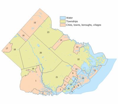
Map of Atlantic County, NJ, USA
This county forms the Atlantic City–Hammonton Metropolitan Statistical Area, which is also part of the Delaware Valley Combined Statistical Area.
History
All of what is known today as Atlantic County was once called Egg Harbor Township, the eastern half of the original County of Gloucester. Named as an official district as early as 1693, it was bounded on the north by the Little Egg Harbor River (now known as the Mullica River), and on the south by the Great Egg Harbor River and its southern branch the Tuckahoe River. Its eastern boundary was the Atlantic Ocean, but the western boundary in the South Jersey interior was not fixed until 1761. The county was formally created from portions of Gloucester County as of February 7, 1837, and consisted of the townships of Egg Harbor, Galloway, Hamilton and Weymouth.
Geography
According to the 2010 Census, the county had a total area of 671.83 square miles (1,740.0 km2), including 555.70 square miles (1,439.3 km2) of land (82.7%) and 116.12 square miles (300.7 km2) of water (17.3%).
Atlantic County is located in the Atlantic Coastal Plain in the southeastern part of New Jersey.
Topographically, much of Atlantic County is low-lying and flat. The highest elevation, approximately 150 feet (46 m) above sea level, is found at two areas next to the New Jersey Transit passenger rail line just west of Hammonton. Sea level is the lowest point.
Adjacent counties
Atlantic County borders the following counties:
National protected areas
Census 2010
The 2010 United States Census counted 274,549 people, 102,847 households, and 68,702 families residing in the county. The population density was 494.1 per square mile (190.8/km2). The county contained 126,647 housing units at an average density of 227.9 per square mile (88.0/km2). The racial makeup of the county was 65.40% (179,566) White, 16.08% (44,138) Black or African American, 0.38% (1,050) Native American, 7.50% (20,595) Asian, 0.03% (92) Pacific Islander, 7.36% (20,218) from other races, and 3.24% (8,890) from two or more races. Hispanics or Latinos of any race were 16.84% (46,241) of the population.
Out of a total of 102,847 households, 29.8% had children under the age of 18 living with them, 45.6% were married couples living together, 15.5% had a female householder with no husband present, and 33.2% were non-families. 26.9% of all households were made up of individuals, and 10.8% had someone living alone who was 65 years of age or older. The average household size was 2.61 and the average family size was 3.17.
In the county, 23.3% of the population were under the age of 18, 9.3% from 18 to 24, 24.6% from 25 to 44, 28.7% from 45 to 64, and 14.2% who were 65 years of age or older. The median age was 39.9 years. For every 100 females the census counted 94.2 males, but for 100 females at least 18 years old, it was 91 males.
Census 2000
As of the 2000 United States Census there were 252,552 people, 95,024 households, and 63,190 families residing in the county. The population density was 450 people per square mile (174/km²). There were 114,090 housing units at an average density of 203 per square mile (79/km²). The racial makeup of the county was 68.36% White, 17.63% Black or African American, 0.26% Native American, 5.06% Asian, 0.05% Pacific Islander, 6.06% from other races, and 2.58% from two or more races. 12.17% of the population were Hispanic or Latino of any race. Among those residents listing their ancestry, 18.3% were of Italian, 17.3% Irish, 13.8% German and 7.7% English ancestry according to Census 2000.
There were 95,024 households out of which 31.70% had children under the age of 18 living with them, 46.50% were married couples living together, 14.80% had a female householder with no husband present, and 33.50% were non-families. 27.00% of all households were made up of individuals and 10.70% had someone living alone who was 65 years of age or older. The average household size was 2.59 and the average family size was 3.16.
In the county, the population was spread out with 25.30% under the age of 18, 8.10% from 18 to 24, 30.60% from 25 to 44, 22.40% from 45 to 64, and 13.60% who were 65 years of age or older. The median age was 37 years. For every 100 females there were 93.60 males. For every 100 females age 18 and over, there were 90.20 males.
The median income for a household in the county was $43,933, and the median income for a family was $51,710. Males had a median income of $36,397 versus $28,059 for females. The per capita income for the county was $21,034. About 7.6% of families and 10.50% of the population were below the poverty line, including 12.8% of those under age 18 and 10.50% of those age 65 or over.
Government and politics
In 1974, Atlantic County voters changed the county governmental form under the Optional County Charter Law to the County executive form. The charter provides for a directly elected executive and a nine-member Board of Chosen Freeholders, responsible for legislation. The executive is elected to a four-year term and the freeholders are elected to staggered three-year terms, of which four are elected from the county on an at-large basis and five of the freeholders represent equally populated districts.
As of 2016, Atlantic County's Executive is Republican Dennis Levinson, whose term of office ends December 31, 2019. Members of the Board of Chosen Freeholders are:
Constitutional officers are County Clerk Edward P. McGettigan (2016), Sheriff Frank X. Balles (2017) and Surrogate James Curcio (2018).
Atlantic County, along with Cape May County, is part of Vicinage 1 of New Jersey Superior Court. Atlantic County has a civil courthouse in Atlantic City, while criminal cases are heard in May's Landing; the Assignment Judge for Vicinage 1 is the Honorable Julio L. Mendez.
The 2nd Congressional District covers all of Atlantic County. New Jersey's Second Congressional District is represented by Frank LoBiondo (R, Ventnor City).
The county is part of the 1st, 2nd, 8th and 9th Districts in the New Jersey Legislature. For the 2016–2017 session (Senate, General Assembly), the 1st Legislative District of the New Jersey Legislature is represented in the State Senate by Jeff Van Drew (D, Dennis Township) and in the General Assembly by Bob Andrzejczak (D, Middle Township) and R. Bruce Land (D, Vineland). For the 2016–2017 session (Senate, General Assembly), the 2nd Legislative District of the New Jersey Legislature is represented in the State Senate by Jim Whelan (D, Atlantic City) and in the General Assembly by Chris A. Brown (R, Ventnor City) and Vince Mazzeo (D, Northfield). For the 2016–2017 session (Senate, General Assembly), the 8th Legislative District of the New Jersey Legislature is represented in the State Senate by Dawn Marie Addiego (R, Evesham Township) and in the General Assembly by Maria Rodriguez-Gregg (R, Evesham Township) and Joe Howarth (R, Evesham Township). For the 2016–2017 session (Senate, General Assembly), the 9th Legislative District of the New Jersey Legislature is represented in the State Senate by Christopher J. Connors (R, Lacey Township) and in the General Assembly by DiAnne Gove (R, Long Beach Township) and Brian E. Rumpf (R, Little Egg Harbor Township).
Politics
In state and national elections, Atlantic County is a reliably Democratic county, in contrast to the other three counties on the Jersey Shore, Monmouth, Ocean, and Cape May Counties, which tend to lean heavily Republican.
As of October 31, 2014, there were a total of 171,490 registered voters in Atlantic County, of whom 50,536 (29.5%) were registered as Democrats, 41,695 (24.3%) were registered as Republicans and 79,135 (46.1%) were registered as Unaffiliated. There were 124 voters registered to other parties. Among the county's 2010 Census population, 62.5% were registered to vote, including 76.7% of those ages 18 and over.
In the 2012 presidential election, Democrat Barack Obama received 65,600 votes in the county (57.9%), ahead of Republican Mitt Romney with 46,522 votes (41.1%) and other candidates with 1,057 votes (0.9%), among the 113,231 ballots cast by the county's 172,204 registered voters, for a turnout of 65.8%. In the 2008 presidential election, Democrat Barack Obama received 67,830 votes in Atlantic County (56.5%), ahead of Republican John McCain with 49,902 votes (41.6%) and other candidates with 1,310 votes (1.1%), among the 120,074 ballots cast by the county's 176,316 registered voters, for a turnout of 68.1%. In the 2004 presidential election, Democrat John Kerry received 55,746 votes (52.0%), ahead of Republican George W. Bush with 49,487 votes (46.2%%) and other candidates with 864 votes (0.8%), among the 107,187 ballots cast by the county's 153,496 registered voters, for a turnout of 69.8%.
In the 2013 gubernatorial election, Republican Chris Christie received 43,975 votes in the county (60.0%), ahead of Democrat Barbara Buono with 25,557 votes (34.9%) and other candidates with 947 votes (1.3%), among the 73,258 ballots cast by the county's 176,696 registered voters, yielding a 41.5% turnout. In the 2009 gubernatorial election, Republican Chris Christie received 35,724 votes (47.7%), ahead of Democrat Jon Corzine with 33,361 votes (44.5%), Independent Chris Daggett with 3,611 votes (4.8%) and other candidates with 913 votes (1.2%), among the 74,915 ballots cast by the county's 166,958 registered voters, yielding a 44.9% turnout.
Municipalities
Municipalities in Atlantic County (with 2010 Census data for population, housing units and area) are:
Education
Institutions of higher education in Atlantic County include:
Roads and highways
As of 2010, the county had a total of 1,930.77 miles (3,107.27 km) of roadways, of which 1,357.05 miles (2,183.96 km) were maintained by the local municipality, 372.63 miles (599.69 km) by Atlantic County and 143.50 miles (230.94 km) by the New Jersey Department of Transportation and 57.59 miles (92.68 km) by either the New Jersey Turnpike Authority or South Jersey Transportation Authority.
Major roadways include the Garden State Parkway (with 21.5 miles (34.6 km) of roadway in the county), the Atlantic City Expressway (29.6 miles (47.6 km)), U.S. Route 9, U.S. Route 30, U.S. Route 40, U.S. Route 206 and U.S. Route 322, as well as Route 49, Route 50, Route 52, Route 54, Route 87 and Route 152.
Public transportation
New Jersey Transit's Atlantic City Line connects the Atlantic City Rail Terminal in Atlantic City with the 30th Street Station in Philadelphia, with service at intermediate stations at Hammonton, Egg Harbor City and Absecon in the county.
Climate and weather
In recent years, average temperatures in the county seat of Mays Landing have ranged from a low of 24 °F (−4 °C) in January to a high of 86 °F (30 °C) in July, although a record low of −11 °F (−24 °C) was recorded in February 1979 and a record high of 106 °F (41 °C) was recorded in June 1969. Average monthly precipitation ranged from 2.99 inches (76 mm) in February to 4.21 inches (107 mm) in March.