 | ||
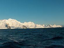
Burgas Peninsula (Poluostrov Burgas po-lu-'os-trov bur-'gas) is a predominantly ice-covered peninsula forming the east extremity of Livingston Island in the South Shetland Islands, Antarctica extending 10 km in the east-northeast direction towards Renier Point and 4.7 km wide. It is bounded by Bruix Cove, Moon Bay and Mugla Passage to the north, and Bransfield Strait to the south-southeast. The peninsula's interior is occupied by the Delchev Ridge of Tangra Mountains.
Contents
The Burgas Peninsula is named after the Bulgarian city of Burgas.
Location
The peninsula is centred at 62°37′40″S 59°54′00″W. British mapping in 1822 and 1968, Chilean in 1971, Argentine in 1980, Spanish mapping in 1991, and Bulgarian topographic survey Tangra 2004/05 and mapping in 2005 and 2009.
