
Population 181,860 (2013) Area 147.5 sq mi | ||
 | ||
Points of interest Gladys Porter Zoo, Palo Alto Battlefield National Historical Park, Boca Chica State Park, Fort Brown, Resaca de la Palma Battlefield Colleges and Universities University of Texas at Brownsville, Texas Southmost College, South Texas Vocational Technical Institute-Brownsville, Savannah State University College of Business Administration, Salon & Spa Institute | ||
Unemployment rate 7.0% (Feb 2015) | ||
Map of Brownsville, Texas
Brownsville is the county seat of Cameron County, Texas. It is the sixteenth most populous city in the state of Texas, with a population at the 2010 census of 175,023 and an estimated population in 2014 of 183,046. It is located at the southernmost tip of Texas, on the northern bank of the Rio Grande, directly north and across the border from Matamoros, Tamaulipas, Mexico.
Contents
- Map of Brownsville Texas
- Dentist in brownsville tx best dentist in brownsville
- Visit gladys porter zoo brownsville tx
- History
- Geography
- Flora
- Climate
- Demographics
- Economy
- Top employers
- Technology growth in the 2010s
- City government
- County Commission representation
- State representation
- Federal representation
- Social Security Administration
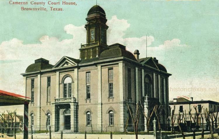
- Federal Courthouse
- Military installations
- National parks
- Universities and colleges
- Vocational schools
- Public schools
- Private and parochial schools
- Public libraries
- University libraries
- Railroad
- Mass transit
- Highways
- International bridges
- Airport
- Cycling and hiking
- Cyclobia
- Festivals and parades
- Museums
- Theatre
- Arts
- Films made or inspired by Brownsville
- Sports
- Newspapers
- Television
- Radio
- Points of interest
- Sanctuary
- Notable nativesresidents
- Sister cities
- References
The 2014 U.S. Census Bureau estimate placed the Brownsville-Harlingen metropolitan area population at 420,392, making it the ninth most populous metropolitan area in the state of Texas. In addition, the international Matamoros–Brownsville Metropolitan Area was estimated to have a population of 1,136,995.

Brownsville has one of the highest poverty rates in the nation, and is frequently cited as having the highest percentage of residents below the federal poverty level out of all cities in the nation.
Nonetheless, the Brownsville urban area is one of the fastest growing in the United States. The city's population dramatically increased after it experienced a boom in the steel industry during the first decade of the 1900s, when steel output tripled. In recent times, the Port of Brownsville has become a major economic hub for South Texas, where shipments arrive from other parts of the United States, from Mexico, and from around the world.
Brownsville's economy is mainly based on its international trade with Mexico through the North American Free Trade Agreement (NAFTA), and is home to one of the fastest growing manufacturing sectors in the nation. Brownsville has been recognized as having one of the best pro-business climates in the United States, and the city has been ranked among the least expensive places to live in the U.S.
Brownsville served as a site for several battles and events in the Texas Revolution, the Mexican–American War, and the American Civil War. Right across the U.S–Mexico border lies Matamoros, Tamaulipas, a city with a population of 500,000 people and a major site of the Mexican War of Independence, the Mexican Revolution, and the French Intervention.
Dentist in brownsville tx best dentist in brownsville
Visit gladys porter zoo brownsville tx
History
In April 1846, construction of a fort on the Mexican border was begun by American forces due to increased instability in the region on the eve of the Mexican–American War of 1846–1848. Before the completion of the construction, the Mexican Army began the Siege of Fort Texas, during the first active campaign in the Mexican–American War, from May 3–9, 1846. The first battle of the war occurred on May 8, when General Zachary Taylor received word of the siege of the fort. Taylor's forces rushed to help, but Mexican troops intercepted them, resulting in the Battle of Palo Alto, approximately 5 miles (8.0 km) north of present-day Brownsville.
The next morning the Mexican forces had retreated, and Taylor's troops caught up with them, resulting in the Battle of Resaca de la Palma, which took place within the present city limits. When Taylor finally arrived at the besieged Fort Texas, it was found that two soldiers had died, one of them the fort's commander, Major Jacob Brown. In his honor, General Taylor renamed the fort Fort Brown. An old cannon at the University of Texas at Brownsville and Texas Southmost College marks the spot where Major Brown received his fatal wound.
The city of Brownsville was originally established late in 1848 by Charles Stillman, and was made the county seat of the new Cameron County on January 13, 1849. The state originally incorporated the city on January 24, 1850. This was repealed on April 1, 1852, due to a land-ownership dispute between Stillman and the former owners. The state reincorporated the city on February 7, 1853, which remains in effect. The issue of ownership was not decided until 1879, when the U.S. Supreme Court ruled in favor of Stillman.
On July 13, 1859, the First Cortina War started. Juan Nepomuceno Cortina became one of the most important historical figures of the area, and continued to exert a decisive influence in the local events until his arrest in 1875. The First Cortina War ended on December 27, 1859. In May 1861, the brief Second Cortina War took place.
During the American Civil War, Brownsville served as a smuggling point for Confederate goods into Mexico, most importantly cotton smuggled to European ships waiting at the Mexican port of Bagdad. Initially the Confederates controlled Fort Brown. In November 1863, Union troops landed at Port Isabel and marched for Brownsville to stop the smuggling. In the ensuing battle of Brownsville, Confederate forces abandoned the fort, blowing it up with 8,000 pounds (3,600 kg) of explosives. In 1864, Confederate forces commanded by John Salmon 'Rip' Ford reoccupied the town.
On May 15, 1865, a month after the surrender had been signed at Appomattox Court House, the Battle of Palmito Ranch (generally accepted as the war's last battle) was fought and won by the Confederates. Ulysses S. Grant sent Union General Frederick Steele to Brownsville to patrol the Mexican–American border after Civil War to aid the Juaristas with military supplies.
On August 13 and 14, 1906, Brownsville was the site of the Brownsville Affair. Racial tensions were high between white townsfolk and black infantrymen stationed at Fort Brown. On the night of August 13, one white bartender was killed and a white police officer was wounded by rifle shots in the street. Townsfolk, including the mayor, accused the infantrymen of the murders. Without affording them a chance to defend themselves in a hearing, President Theodore Roosevelt dishonorably discharged the entire 167-member regiment due to their alleged "conspiracy of silence". Further investigations in the 1970s found that the soldiers were not at fault, and the Nixon Administration reversed all dishonorable discharges. Only two men of the unit were still alive.
On September 8, 1926, The Junior College of the Lower Rio Grande Valley (later known as Texas Southmost College) admitted its first class. In 1945, Fort Brown was decommissioned after the end of World War II. In 1948 the City and College acquired the land. Between 1945 and 1970, Brownsville's population continued to grow, more than doubling from 25,000 to 52,000 people. In 1991, Brownsville received a university via the partnership with the University of Texas at Brownsville.
Geography
Brownsville is located on the U.S.–Mexico border (marked here by the Rio Grande) opposite Matamoros, Tamaulipas. According to the U.S. Census Bureau, the city has a total area of 146.3 square miles (378.9 km2), making it the largest American city by land area in the lower Rio Grande Valley and the third largest American city by land area along the U.S.-Mexico border, after San Diego, California and El Paso, Texas. A total of 132.3 square miles (342.7 km2) of Brownsville's area is land, and 13.9 square miles (36.1 km2) is water.
Brownsville is among the southernmost of all contiguous U.S. cities. Within the contiguous United States, only a handful of municipalities in Florida's Miami-Dade and Monroe counties (plus Everglades City in Collier County) are further south than Brownsville, which lies at exactly the same latitude as North Miami Beach in northern Miami-Dade County.
In its efforts to become a cleaner, greener city, Brownsville became one of the first cities in the U.S. and Texas to require stores to charge a fee for single-use plastic shopping bags. In its first five years, approximately $3.8 million was collected. Funds have been used for city beautification and maintenance projects. This has led other cities in the area to also consider such a fee. Forbes has identified Brownsville as one of 12 metropolitan areas in the U.S. with the cleanest air; Laredo was the only other Texas metropolitan area to be among the 12.
Flora
Broadleaf evergreen plants, including palms, dominate Brownsville neighborhoods to a greater degree than is seen elsewhere in Texas—even in nearby cities such as Harlingen and McAllen. Soils are mostly of clay to silty clay loam texture, moderately alkaline (pH 8.2) to strongly alkaline (pH8.5) and with a significant degree of salinity in many places.
Climate
Brownsville has a humid subtropical climate (Köppen Cfa), just outside a hot semi-arid climate with winter temperatures just slightly cooler than would qualify for a tropical savanna climate (Aw). Years with above-average temperatures are not rare and occasionally land the city in a tropical climate. Yet the nearby ocean waters and winds of the Gulf of Mexico help keep Brownsville cooler during the summer relative to cities further inland such as Laredo and McAllen. Thus temperatures above 100 °F (37.8 °C) are uncommon, with an average of only 1.1 days reaching that level of heat. At the other extreme, there is an average of one to two nights per year with freezing temperatures. Average monthly rainfall demonstrates a strong September maximum; the next-wettest month is October, with a slight May–June peak across the rest of the year. Generally, November through April represents a marked drier season, and Brownsville can go for weeks with minimal, even negligible, rainfall, especially over the cooler season. Despite this, Brownsville's rain totals fluctuate and can experience several years of above average precipitation. Extreme temperatures range from 12 °F (−11 °C) on February 13, 1899 to 106 °F (41 °C) on March 27, 1984. The greatest snowfall in a day and a season was 1.5 inches (3.8 cm), which fell on December 25, 2004. The coolest month is January and the warmest month is August.
Brownsville's proximity to the Gulf Coast has made it a target for hurricanes. Throughout its history, the area has been impacted by several major hurricanes, most notably the 1933 Cuba-Brownsville hurricane, Beulah, Allen, Bret and Dolly. While the area has been struck by major hurricanes, it is more prone to impacts by weak cyclones, tropical storms and depressions. In addition, the city has seen an increase in tropical storm impacts in the 2010s, most likely due to the El Niño phenomenon.
On December 25, 2004, Brownsville had its first instance of measurable snow in 109 years, with 1.5 inches (3.8 cm), and the first recorded White Christmas. This was part of the 2004 Christmas Eve Snowstorm.
Brownsville's location at the intersection of different climate regimes (subtropical, Chihuahuan desert, Gulf Coast plain, and Great Plains) causes it to be a birding location. Its unique network of resacas (distributaries of the Rio Grande and oxbow lakes) provide habitat for nesting/breeding birds of various types – most notably during the spring and fall migrations.
Demographics
As of the census of 2010, there were 175,023 people, 49,871 households, and 41,047 families residing in the city. The population density was 1,207.1 people per square mile (466.0/km2). There were 53,936 housing units at an average density of 372.0 per square mile (143.6/km2). The racial makeup of the city was:
Hispanic or Latino (of any race) – 91.28%Not Hispanic or Latino – 8.72%There were 38,174 households out of which 50.1% had children under the age of 18 living with them, 59.3% were married couples living together, 20.9% had a female householder with no husband present, and 15.7% were non-families. 13.7% of all households were made up of individuals and 6.7% had someone living alone who was 65 years of age or older. The average household size was 3.62 and the average family size was 3.99.
In the city, the population was spread out with 34.6% under the age of 18, 11.2% from 18 to 24, 27.5% from 25 to 44, 17.2% from 45 to 64, and 9.5% who were 65 years of age or older. The median age was 28 years. For every 100 females there were 89.0 males. For every 100 females age 18 and over, there were 82.5 males.
The median income for a household in the city was $24,468, and the median income for a family was $26,186. Males had a median income of $21,739 versus $17,116 for females. The per capita income for the city is $9,762. About 31.6% of families and 35.7% of the population were below the federal poverty line, including 48.4% of those under the age of 18 and 31.5% of those 65 or over.
As of the estimated census of 2015, the city's population stands at 183,887 with 50,207 households. The current metropolitan area estimates count 422,156 residents, an increase from 406,220 and its combined statistical area stood at 444,059 residents, an increase from 428,354, according to the census of 2010. It is the 131st largest city in the United States along with the 126th largest metropolitan area and the 93rd largest combined statistical area.
Economy
An important pillar of the economy is the Port of Brownsville. The port, located 2 miles (3.2 km) from the city, provides an important link between the road networks of nearby Mexico, and the Gulf Intracoastal Waterway of Texas.
Top employers
According to the Brownsville Economic Development Council (BEDC), the top employers in the city as of May 2015 were:
Technology growth in the 2010s
SpaceX is building the SpaceX South Texas Launch Site, a private space launch facility east of Brownsville on the Gulf Coast.
The new launch facility is expected to draw US$85 million to the city of Brownsville and eventually generate approximately US$51 million in annual salaries from some 500 jobs created by 2024.
The facility itself is projected to employ 75–100 full-time workers in the early years with up to 150 full-time employees/contractors by 2019.
As of October 2014, the University of Texas at Brownsville and the Brownsville Economic Development Council (BEDC), in collaboration with SpaceX, are building radio-frequency (RF) technology facilities for STARGATE (Spacecraft Tracking and Astronomical Research into Gigahertz Astrophysical Transient Emission). The facility is intended to provide students and faculty access to RF technologies widely used in spaceflight operations, and will include satellite and spacecraft tracking.
BEDC purchased five lots in Boca Chica Village totaling 2.3 acres (0.93 ha) near the SpaceX launch site and renamed it as the STARGATE subdivision. The beach location will include a 12,000 square feet (1,100 m2) tracking center."
STARGATE has received several startup grants including US$1.2 million from the US Economic Development Administration.
City government
Brownsville has a council–manager style of government. The mayor and six city commissioners, two at-large and four district, serve staggered four-year terms. Elections are held for one at-large and two district seats every two years. Municipal elections are held on the first Saturday of May in odd numbered years. Once a winner is determined, the commissioner-elect will be seated at the next regular meeting of the Brownsville City Commission. City elected officials are non-partisan, meaning that they do not have a party affiliation. They may be personally affiliated with a political party but this has no bearing on the office.
As of 2015, the members of the commission were:
The next regular elections for the city will occur in the following years:
The city commission appoints the city manager. Since 2006, the city manager is Charlie Cabler. The city commission also appoints a six-member public utilities board for a four-year term. Members are limited to two consecutive or non-consecutive terms. The mayor is an ex-officio member of the board. The current board members are:
County Commission representation
The majority of Brownsville is represented by two of the four commission precinct commissioners. They have staggered four-year terms. County offices are partisan, thus the Democratic and Republican Parties will hold primaries in the March of the year of the year that office term expires. The Candidate who receives the highest amount of votes will then receive their party's nomination. The Libertarian Party selects their candidate by means of their County Convention. The nominees of each party will then run in a general election in November, the winner of which will become the Commissioner the following January.
The following commissioners represent at least part of the City of Brownsville:
The chief executive of the county or the Cameron County Judge is Pete Sepulveda, Jr. (N/A) (since 2015)
The next regular elections for the County Commission Precincts 1, 2, and 3 will occur in the following years:
State representation
The City of Brownsville falls under two State House of Representatives districts. Each representative has a two-year term and is elected in the same manner as other partisan elected officials.
All of Brownsville is represented by Texas Senatorial District 27, the incumbent senator is a Democrat, Eduardo "Eddie" Lucio Jr. (1991–present)
Federal representation
All of Brownsville is represented by U.S. Congressional District 34, the incumbent Representative has been, since 2015, Filemon Vela Jr. (D).
The United States Postal Service operates post offices in Brownsville. The Brownsville Main Post Office is located at 1535 East Los Ebanos Boulevard. Downtown Brownsville is served by the Downtown Brownsville Post Office at 1001 East Elizabeth Street.
There is also a National Weather Service office and doppler radar site in 20 South Vermillion Avenue Brownsville, Texas. They provide forecasts and radar coverage for Deep South Texas and the adjacent coastal waters.
Social Security Administration
Federal Courthouse
Military installations
National parks
Universities and colleges
The School of Public Health (UTSPH) opened in 2001 as part of the legislated Regional Academic Health Center program, or RAHC and is physically located on the campus of the University of Texas at Brownsville. UTSPH – Brownsville is a regional campus of the University of Texas School of Public Health statewide network which offer students a graduate certificate in public health and the Master of Public Health (M.P.H.) graduate degree.
Starting in 2009, the Brownsville Regional Campus also began offering a PhD program in Epidemiology and a Doctorate in Public Health (DrPH) in Health Promotion, the only programs of their kind in South Texas. Major public health concerns of the faculty and researchers found here in the Lower Rio Grande Valley Texas include diabetes, tuberculosis, obesity, cardiovascular disease and hepatitis. Other areas of public health significance include physical activity, behavioral journalism, healthy living, diet and lifestyles activities. The Brownsville Regional Campus is also developing a strong research focus in genetics and its relationship to infectious and chronic disease.
Vocational schools
Public schools
Most of Brownsville is served by Brownsville Independent School District. The BISD counted its total enrollment in the 2014–15 school year at 48,155 students in 58 schools. It is the 17th largest school district in Texas. A portion of northern Brownsville is served by the Los Fresnos Consolidated Independent School District.
In addition, Brownsville residents are allowed to apply to magnet schools operated by the South Texas Independent School District, as well as BISD magnet schools. Each BISD high school has a magnet school within the school, Gladys Porter High School is home to the High School for Engineering Professions. Homer Hanna High School is home of the Tech Med Magnet Program for Medical and Health Professions. Lopez High School houses the district's Fine Arts Academy, James Pace High School has a Criminal Justice Magnet School and Simon Rivera High School hosts the International Business Magnet School.
Magnet schools
State charter schools
Private and parochial schools
Grades 9-12:
Grades 1-8:
The Roman Catholic Diocese of Brownsville operates area Catholic schools.
Public libraries
The Brownsville Public Library System
University libraries
Railroad
Several attempts were made to attract a railroad, but not until 1904 did the St. Louis, Brownsville and Mexico Railway reach the City of Brownsville. In 1910 a railroad bridge was constructed between Brownsville and Matamoros (Mexico) and regular service between the two towns began. The introduction of the rail link to Brownsville opened the area for settlement of northern farmers, who began arriving in the lower Rio Grande valley in large numbers after the turn of the century.
The new settlers cleared the land of brush, built extensive irrigation systems and roads, and introduced large-scale truck farming. In 1904 H. G. Stillwell, Sr., planted the first commercial citrus orchard in the area, thus opening the way for citrus fruit culture, one of the Valley's leading industries. The expansion of farming in the area and the railroad link to the north brought new prosperity to Brownsville and spurred a host of civic improvements.
Today, the Brownsville and Rio Grande International Railroad (reporting mark BRG) Brownsville and Rio Grande International Railroad is a terminal switching railroad headquartered in Brownsville, Texas. BRG operates 45 mi (68 km) of line at the Port of Brownsville, and interchanges with Union Pacific and TFM. BRG traffic includes steel, agricultural products, food products, and general commodities.
Mass transit
Established in mid-Brownsville in 1978, with expanding bus service to rapidly developing North Brownsville, the Brownsville Urban System (BUS), currently known as the Brownsville Metro, consists of 3 hubs running 13 routes covering a large portion of Brownsville. The system provides 11 paratransit vans to disabled passengers, meeting the standards for the Americans with Disabilities Act. It is the only mass transit system in its county and the largest in the Rio Grande Valley. The system also provides service to around 1.5 million passengers per year. One of its main terminals is located at 755 International Blvd., called La Plaza at Brownsville.
Highways
Brownsville is served by the following Interstate Highways, U.S. Routes, and Texas State Highways:
International bridges
Brownsville has three international bridges:
Airport
Brownsville has its own city-owned airport, the Brownsville/South Padre Island International Airport. The airport is used for general aviation and is served by United Airlines (service to Houston-Intercontinental), and Envoy Air (service to Dallas-Fort Worth).
Cycling and hiking
The city of Brownsville currently operates seven cycling paths around the area. Around 64 miles of the city's streets are bicycle trails and on-street bike lanes. The city's move towards a more environmental-friendly area has created the nickname "The Bicycling Capital of the Rio Grande Valley." The current operating cycling paths are:
Cyclobia
Cyclobia is an annual bicycling event taking place in Downtown Brownsville. The event was created to promote a healthy lifestyle through cycling in the city. Aside from cycling, participants are allowed to bring other means of exercise equipment such as skates or scooters. Its route ends at a recreational area where other activities take place. The event takes place three times a year: two times in the summer and once in autumn.
Festivals and parades
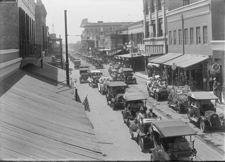
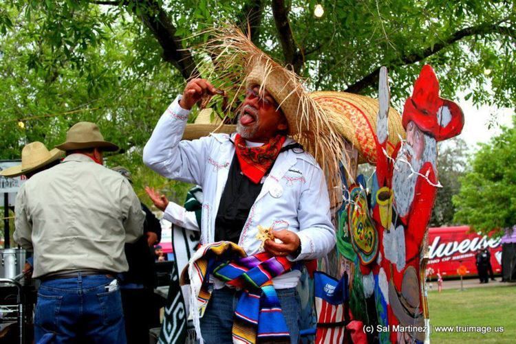
During mid to late February, Charro Days takes place in Brownsville. The holiday is a two-nation fiesta celebrating the friendship between Brownsville and its sister city and border town, Matamoros. The celebration attracts around 50,000 guests per year. It is accompanied with El Grito, a joyous shout originating in Mexican culture as well as a visit from the Mr. Amigo Association. Honorees who have attended previous events include Vicente Fernandez and Mexican actors Arath de la Torre and Eduardo Yanez. Sombrero Festival is another celebration taking place around the same time as Charro Days. The festival is a three-day event consisting of performances from rock, tejano and corrido artists as well as a variety of contests.
Museums
Children's Museum of Brownsville is a museum for young children consisting of educational exhibits and learning centers. Building efforts commenced in 2000 with the museum opening in 2005. It is located next to the Camille Lightner Playhouse in the center of Dean Porter Park in 501 E. Ringgold Street.
Founded in 1935, the Brownsville Museum of Fine Arts is an arts museum featuring exhibitions on Egyptian and Astronomical art. The museum was formerly known as the Brownsville Art League, formed by a group of eight women. The museum underwent a renovation in 1960, featuring a 4,000 sq ft studio and in 2002, it changed its name to its current name also receiving a 17,000 sq foot renovation. It is located in Downtown Brownsville at 660 East Ringgold Street.
The Historic Brownsville Museum is a historic museum opened to the public in 1986. The building was used as a Spanish Colonial Revival passenger depot and was later abandoned. The museum features Spanish architecture and education programs. It also hosts meeting for various organizations including City and State officials. Several renovations were made to give the museum a more "present" look such as the addition of a Spanish-style fountain, a courtyard and an engine building.
Built in 1850 by Henry Miller, owner of the Miller Hotel in downtown Brownsville, the Stillman House Museum was owned by city founder Charles Stillman and Mexican consul Manuel Pérez Treviño. It was the site of meetings with Mexican president Porfirio Diaz. The great grandson of Stillman bought the house after the previous homeowners sold it and was donated to the city after renovations. It opened to the public in 1960. The home experienced damage from Hurricane Dolly in 2008 and reopened to the public the next year after renovations were made.
Costumes of the Americas Museum is an indigenous clothing museum located in 501 Ringgold Street. Inspired by Bessie Kirkland Johnson, the museum was opened in 1997, featuring clothing from indigenous people in several Mexican states and other Latin American countries.
The Commemorative Air Force Museum is an aircraft museum located in 955 Minnesota Ave., next to the Brownsville/South Padre Island International Airport. The museum features World War II aircraft and also holds tours on the early events leading to wars in Asia and Europe. It also features the stories of aviation pilots who were part of the 201st Mexican Fighter Squadron and hosts the annual AirFiesta in February.
Theatre
Jacob Brown Auditorium is an performing arts auditorium located in Downtown Brownsville. The venue has a 1,593 person capacity and has a variety of functions including banquet ceremonies, conference meetings and being a reception hall. It is part of the University of Texas at Brownsville campus, now University of Texas Rio Grande Valley.
The Arts Center is a performing arts and concert venue in conjunction with Texas Southmost College. It is associated with several theater organizations including Chamber Music America and the Association of Performing Arts Presenters. The center is strictly used for theater shows, while only using the lobby for meetings. It is currently the only Arts Center currently operating south of San Antonio.
Camille Lightner Playhouse is a performing arts auditorium founded in 1964 and located on 500 E Ringgold Street. The venue hosts auditions for local and Broadway plays, as well as hosting the Henri Awards, an awards show honoring the best in the venue's staff. It also holds a summer workshop for younger children and holds a reception hall at the DeStefano Room.
Arts
The Brownsville area is full of well-established art galleries and museums that represent not only art of the region and Mexico but feature traveling exhibits from around the world.
Films made or inspired by Brownsville
* The Big Year featured a scene where Brownsville, Texas was written in front of the screen. Film draws inspiration from wildlife in the Rio Grande Valley.
Sports
Each year, Brownsville hosts the Jackie Robinson World Series for nine-year-old baseball players. In 1920 the St. Louis Cardinals held spring training in Brownsville. In 2011 and 2013, University of Texas at Brownsville Ocelots team captured the NAIA Women's Volleyball National Championship in Sioux City, Iowa at the Tyson Events Center.
These are the golf courses operating within the Brownsville city limit:
Newspapers
Television
The Brownsville area is served by numerous local television affiliates:
Radio
Points of interest
Local attractions include the Gladys Porter Zoo, the Brownsville Museum of Fine Art, Camille Lightner Playhouse, a historical downtown with buildings over 150 years old, the Port of Brownsville, and the Children's Museum of Brownsville. There is also easy access to South Padre Island and the Mexican city of Matamoros, Tamaulipas. Sunrise Mall is the largest shopping mall in the city of Brownsville.
Since being remodeled in 2015 the mall has become the primary mall in the Brownsville-Harlingen metroplex. Brownsville previously had another shopping mall, Amigoland Mall by Simon, though the building has since been purchased by the University of Texas at Brownsville (now University of Texas Rio Grande Valley) after many of its tenants moved from Amigoland to Sunrise.