
Founded March 11, 1752 Website www.co.berks.pa.us Area 2,243 km² | Designated May 12, 1982 Population 413,521 (2013) Unemployment rate 4.4% (Apr 2015) | |
 | ||
Colleges and Universities Berks Technical Institute, Penn State Berks, Kutztown University of Pennsy, Albright College, Alvernia University Points of interest Daniel Boone Homestead, Crystal Cave, Hawk Mountain Sanctuary, Conrad Weiser Homestead, Reading Public Museum | ||
Berks County (Pennsylvania German): Barricks Kaundi) is a county located in the U.S. state of Pennsylvania. As of the 2010 census, the population was 411,442. The county seat is Reading.
Contents
- Map of Berks County PA USA
- History
- Geography
- Major highways
- Adjacent counties
- National protected area
- State protected area
- Demographics
- Metropolitan and Combined Statistical Area
- County Commissioners
- Other county offices
- State Senate
- State House of Representatives
- United States House of Representatives
- United States Senate
- Politics
- Colleges and universities
- Private high schools
- Technical and trade schools
- Arts and culture
- Communities
- City
- Census designated places
- Population ranking
- Notable people
- References
Map of Berks County, PA, USA
Berks County comprises the Reading, PA Metropolitan Statistical Area (MSA), which is also included in the Philadelphia-Reading-Camden, PA-NJ-DE-MD Combined Statistical Area. (CSA).
History
Reading developed during the 1740s when the inhabitants of northern Lancaster County sent several petitions requesting that a separate county be established. With the help of German immigrant Conrad Weiser, the county was formed on March 11, 1752 from parts of Chester County, Lancaster County, and Philadelphia County.
It was named after the English county in which William Penn's family home lay - Berkshire, which is often abbreviated to Berks. Berks County began much larger than it is today. The northwestern parts of the county went to the founding of Northumberland County in 1772 and Schuylkill County in 1811, when it reached its current size. In 2005, Berks County was added to the Delaware Valley Planning Area due to a fast-growing population and close proximity to the other communities.
In 2016, former Strausstown borough merged with Upper Tulpehocken township. Strausstown is now considered a village within the county.
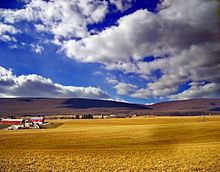
Geography
According to the U.S. Census Bureau, the county has a total area of 866 square miles (2,240 km2), of which 857 square miles (2,220 km2) is land and 9.2 square miles (24 km2) (1.1%) is water. Most of the county is drained by the Schuylkill River, but an area in the northeast is drained by the Lehigh River via the Little Lehigh Creek and areas are drained by the Susquehanna River via the Swatara Creek in the northwest and the Conestoga River (which starts in Berks County between Morgantown and Elverson) in the extreme south.
Major highways
US 222 Bus.
Adjacent counties
National protected area
State protected area
Demographics
As of the 2010 census, the county was 76.9% White non-Hispanic, 4.9% Black or African American, 0.3% Native American, 1.3% Asian, and 2.5% were two or more races. 16.4% of the population was of Hispanic or Latino ancestry.
As of the census of 2010, there were 411,442 people, 154,356 households, and 106,532 families residing in the county. The population density was 479 people per square mile (184.9/km²). There were 164,827 housing units at an average density of 191.9 per square mile (74.1/km²). was 76.9% White non-Hispanic, 4.9% Black or African American, 0.3% Native American, 1.3% Asian, and 2.5% were two or more races. 16.4% of the population was of Hispanic or Latino ancestry. Historically there was a large Pennsylvania Dutch population. It is known as part of Pennsylvania Dutch Country.
According to Muninetguide, the median household income for Berks County, as of 2010, is $54,105. According to patchworknation.org Berks County is classified as a Monied 'Burb.
There were 154,356 households out of which 33.1% had children under the age of 18 living with them, 52.1% were married couples living together, 12.0% had a female householder with no husband present, and 31.0% were non-families. 24.5% of all households were made up of individuals and 10.3% had someone living alone who was 65 years of age or older. The average household size was 2.59 and the average family size was 3.08.
In the county, the population was spread out with 23.9% under the age of 18, 9.9% from 18 to 24, 24.4% from 25 to 44, 27.3% from 45 to 64, and 14.5% who were 65 years of age or older. The median age was 39.1 years. For every 100 females there were 95.90 males. For every 100 females age 18 and over, there were 92.70 males.
Metropolitan and Combined Statistical Area
The United States Office of Management and Budget has designated Berks County as the Reading, PA Metropolitan Statistical Area (MSA). As of the 2010 U.S. Census the metropolitan area ranked 10th most populous in the State of Pennsylvania and the 128th most populous in the United States with a population of 413,491. Berks County is also a part of the larger Philadelphia-Reading-Camden, PA-NJ-DE-MD Combined Statistical Area (CSA), which combines the populations of Berks County as well as several counties around Philadelphia and in the states of Delaware, Maryland and New Jersey. The Combined Statistical Area is the largest in the State of Pennsylvania and 8th most populous in the United States with a population of 7,067,807.
County Commissioners
Other county offices
State Senate
State House of Representatives
United States House of Representatives
United States Senate
Politics
As of October 24, 2016, there are 259,918 registered voters in Berks County.
The first time since 1964 that a Democrat carried Berks in a Presidential election occurred in November 2008, with Barack Obama receiving 53.9% of the vote to John McCain's 44.7%. The other three statewide winners (Rob McCord for Treasurer, Jack Wagner for Auditor General, and Tom Corbett for Attorney General) also carried it. While Republicans have controlled the commissioner majority most of the time and continue to control most county row offices, Democrats have become more competitive in Berks in recent years. In the 2012 Presidential election, Mitt Romney carried the county by approximately a one-percent margin, 49.6% to 48.6%, however, in 2016, Donald Trump carried Berks by a much larger margin of 52.9% to 42.7%.
Colleges and universities
Private high schools
Technical and trade schools
Arts and culture
The Reading Public Museum is an art, science, and history museum.
The Reading Buccaneers Drum and Bugle Corps are an all-age drum corps based in Berks County. The corps, founded in 1957, is a charter member Drum Corps Associates and an 11-time DCA World Champion.
Reading is home to one opera company, Berks Opera Company, founded in 2007 as Berks Opera Workshop. They were named Arts and Entertainment Newsmaker of the Year in 2015.
There are two Pennsylvania state parks and a Natural Area in Berks County.
There are two Pennsylvania Historic Sites in Berks County.
The Old Morlatton Village in Douglassville is maintained by the Historic Preservation Trust of Berks County. The village is composed of four historic structures: White Horse Inn, George Douglass Mansion, Bridge keeper's House, and the Mouns Jones House, constructed in 1716, which is the oldest recorded building in the county. [4]
Communities
Under Pennsylvania law, there are four types of incorporated municipalities: cities, boroughs, townships, and towns. The following cities, boroughs and townships are located in Berks County:
City
Census-designated places
Census-designated places are geographical areas designated by the U.S. Census Bureau for the purposes of compiling demographic data. They are not actual jurisdictions under Pennsylvania law. Other unincorporated communities, such as villages, may be listed here as well.
Population ranking
The population ranking of the following table is based on the 2010 census of Berks County.
† county seat