
Congressional district 15th Website www.lehighcounty.org Founded 6 March 1812 | Area 901.3 km² Population 355,092 (2013) Unemployment rate 4.9% (Apr 2015) | |
 | ||
Destinations Colleges and Universities Muhlenberg College, Lehigh Carbon Communi, DeSales University, Penn State Lehigh Valley, Cedar Crest College | ||
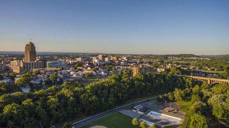
Lehigh County is a county located in the Lehigh Valley region of the U.S. state of Pennsylvania. As of the 2010 census, the population was 349,497. Its county seat is Allentown, the state's third largest city behind Philadelphia and Pittsburgh. The county, which was first settled around 1730, was formed in 1812 with the division of Northampton County into two counties. It is named after the Lehigh River, whose name is derived from the Delaware Indian term Lechauweki or Lechauwekink, meaning "where there are forks".
Contents
- Map of Lehigh County PA USA
- Geography
- Topography
- Adjacent counties
- Climate
- Demographics
- Politics and government
- United States House of Representatives
- 4 year colleges and universities
- 2 year colleges and technical institutes
- Public school districts
- Public charter schools
- Private high schools
- Air
- Bus
- Interstate Highway System
- US Highway System
- Pennsylvania Highway System
- Other major roads
- Media
- Television
- Radio
- Telecommunications
- Recreation
- Communities
- Cities
- Census designated places
- Population ranking
- Notable people
- References
Map of Lehigh County, PA, USA
Lehigh County is included in the Allentown-Bethlehem-Easton, PA-NJ Metropolitan Statistical Area, which is also included in the New York City-Newark, New Jersey, NY-NJ-CT-PA Combined Statistical Area.
It is currently the fastest growing county in Pennsylvania and among the fastest growing nationwide, ranking in the 79th percentile overall for the 2010 to 2012 time period.
Geography
According to the U.S. Census Bureau, the county has a total area of 348 square miles (900 km2), of which 345 square miles (890 km2) is land and 3.1 square miles (8.0 km2) (0.9%) is water.
Topography
The Lehigh Valley, which includes all of Lehigh and Northampton counties, is bounded on the north by Blue Mountain, a ridge of the Appalachian mountain range with an altitude of 1,300 to 1,604 feet (489 m), and on the south by South Mountain, a ridge of 700 to 1,100 feet (340 m) that cuts through the southern portions of the two counties. The highest point in Lehigh County is Bake Oven Knob, a mass of Tuscarora conglomeratic rocks that rise about 100 feet (30 m) above the main ridge of the Blue Mountain in northwestern Heidelberg Township.
Lehigh County is in the Delaware River watershed. While most of the county is drained by the Lehigh River and its tributaries, the Schuylkill River also drains regions in the south of the county via the Perkiomen Creek and the northwest via the Maiden Creek.
Adjacent counties
Climate
Most of the county's climate is considered to fall in the humid continental climate zone. Summers are typically hot and muggy, fall and spring are generally mild, and winter is cold. Precipitation is almost uniformly distributed throughout the year.
For the city of Allentown, January lows average −6 °C (21 °F) and highs average 1.3 °C (34.3 °F). The lowest officially recorded temperature was −26.7 °C (−16.1 °F) in 1912 . July lows average 17.6 °C (63.7 °F) and highs average 29.2 °C (84.6 °F), with an average relative humidity (morning) of 82%. The highest temperature on record was 40.6 °C (105.1 °F) in 1966 . Early fall and mid winter are generally driest, with October being the driest month with only 74.7 mm of average precipitation.
Snowfall is variable, with some winters bringing light snow and others bringing numerous significant snowstorms. Average snowfall is 82.3 centimetres (32.4 in) per year, with the months of January and February receiving the highest at just over 22.86 centimetres (9.00 in) each. Rainfall is generally spread throughout the year, with eight to twelve wet days per month, at an average annual rate of 110.54 centimetres (43.52 in).
Demographics
As of the 2010 census, the county was 71.6% White Non-Hispanic, 6.1% Black or African American, 0.4% Native American or Alaskan Native, 2.9% Asian, 0.0% Native Hawaiian, 2.9% were two or more races, and 8.6% were some other race. 18.8% of the population were of Hispanic or Latino ancestry.
As of the census of 2000, there were 312,090 people, 121,906 households, and 82,164 families residing in the county. The population density was 900 people per square mile (348/km²). There were 128,910 housing units at an average density of 372 per square mile (144/km²). The racial makeup of the county was 87.02% White, 3.56% Black or African American, 0.18% Native American, 2.10% Asian, 0.04% Pacific Islander, 5.28% from other races, and 1.83% from two or more races. 10.22% of the population were Hispanic or Latino of any race. 27.1% were of German, 7.9% Italian, 7.7% Irish, 6.2% Pennsylvania German and 5.6% American ancestry according to Census 2000. 85.0% spoke English, 8.4% Spanish and 1.2% Arabic as their first language.
There were 121,906 households out of which 30.60% had children under the age of 18 living with them, 53.00% were married couples living together, 10.50% had a female householder with no husband present, and 32.60% were non-families. 27.10% of all households were made up of individuals and 11.20% had someone living alone who was 65 years of age or older. The average household size was 2.48 and the average family size was 3.02.
In the county, the population was spread out with 23.90% under the age of 18, 8.10% from 18 to 24, 29.20% from 25 to 44, 23.00% from 45 to 64, and 15.80% who were 65 years of age or older. The median age was 38 years. For every 100 females there were 93.20 males. For every 100 females age 18 and over, there were 89.60 males.
Politics and government
As of January 2010, there are 223,867 registered voters in Lehigh County:
Lehigh County and neighboring Northampton County are part of Pennsylvania's 15th Congressional district. The 15th Congressional district is a contentious swing district with neither Republicans nor Democrats winning the district consistently. Despite the advantage in Democratic registration in the district, the Democrats in the Lehigh Valley are nowhere near as liberal as their counterparts in the Philadelphia area. Voters elected Republican Charlie Dent in 2004, 2006 and 2008 and, previously, Republican Pat Toomey in 1998, 2000, and 2002. In 2004, the county narrowly voted for John Kerry over George W. Bush for President, and in 2008 the county gave all statewide Democratic candidates significant leads and Barack Obama a victory of more than 15 points over John McCain, 57.1% to 41.5%. In 2012, President Obama carried the county again, but by a narrower margin: 53.17% to 45.52%.
All five statewide winners carried it in November 2004. Although the Republican Party has historically been dominant in county-level politics, the Democratic Party has made substantial inroads this decade. In 2005, Bethlehem Mayor Don Cunningham unseated incumbent County Executive Jane Ervin to become the first Democrat to be elected to the office. Four of the nine commissioner seats and all row offices except for the District Attorney have held by Democrats since winning two at-large seats in November 2007. Lehigh County has a home-rule charter with four at-large and five district commissioners. In 2006 Lehigh County voters approved a county-charter amendment to combine the offices of Clerk of Courts, Register of Wills, and Recorder of Deeds into the office of the Clerk of Judicial Records. Clerk of Courts Andrea Naugle won the new office in November 2007.
United States House of Representatives
4-year colleges and universities
2-year colleges and technical institutes
Public school districts
Public charter schools
Private high schools
Air
Lehigh County's primary airport, Lehigh Valley International Airport (IATA: ABE, ICAO: KABE), is located three miles (5 km) northeast of Allentown in Hanover Township.
The county is also served by Allentown Queen City Municipal Airport, a two-runway general aviation facility located off of Allentown's Lehigh Street. Queen City is used predominantly by private aviation that was awarded General Aviation Airport of the year by the Eastern Region of the Federal Aviation Administration in 2006.
Bus
Public bus service in Lehigh County is available through the Lehigh and Northampton Transportation Authority, known as LANTA. Several private bus lines, including Bieber Tourways, Susquehanna Trailways and Trans-Bridge Lines, provide bus service from Allentown to New York City's Port Authority Bus Terminal, Philadelphia's Greyhound Terminal, Atlantic City's Bus Terminal, and other regional locations.
Interstate Highway System
U.S. Highway System
Pennsylvania Highway System
Other major roads
Media
The Lehigh County is part of the Philadelphia broadcast media market, though numerous New York City radio and television stations also are available in Allentown and its suburbs. Lehigh County-based media include The Morning Call, a daily newspaper in Allentown, and two Allentown-based television stations: WLVT Channel 39 (a PBS affiliate) and WFMZ Channel 69 (an unaffiliated, independent television station).
Television
The four major Philadelphia-based network stations serving Lehigh County include KYW-TV (CBS), WCAU (NBC), WPVI (ABC) and WTXF (Fox). The four major Scranton/Wilkes-Barre-based network stations serving Lehigh County are WNEP-TV (ABC), WBRE-TV (NBC), WYOU (CBS), and WOLF-TV (Fox) The four major New York City-based network stations serving Lehigh County include WABC (ABC), WCBS-TV (CBS), WNBC (NBC), and WNYW (Fox). Lehigh Valley-based television outlets include WFMZ-TV Channel 69 (an Allentown-based independent station), WBPH-TV Channel 60, and WLVT-TV (a Bethlehem-based PBS affiliate).
The primary newspaper for the county is The Morning Call, based in Allentown. The Express-Times, based in Easton, also covers the county.
Radio
Lehigh County-area radio stations include WAEB-AM, a news, talk and sports station (in Allentown), WAEB-FM (known as B104), a Top 40 music station (in Allentown), WZZO, a hard rock music station (in Whitehall Township), and others. Some major New York City stations and every major Philadelphia station also can be heard in the county.
Telecommunications
Lehigh County was once served only by the 215 area code from 1947 (when the North American Numbering Plan of the Bell System went into effect) until 1994. With the county's growing population, however, Lehigh County areas were afforded area code 610 in 1994. Today, Lehigh County is covered by 610. An overlay area code, 484, was added to the 610 service area in 1999. A plan to introduce area code 835 as an additional overlay was rescinded in 2001.
Recreation
Most municipalities in the county have set aside at least some land for public recreation, from neighborhood parks and playgrounds to the more expansive parkways developed by the county, city and several townships. Following are the public parks within the county of more than of 25 acres (100,000 m2), including listings of their primary activities:
Communities
.
Under Pennsylvania law, there are four types of incorporated municipalities: cities, boroughs, townships, and, in only one case, towns. The following cities, boroughs and townships are located in Lehigh County:
Cities
Census-designated places
Census-designated places are geographical areas designated by the U.S. Census Bureau for the purposes of compiling demographic data. They are not actual jurisdictions under Pennsylvania law. Other unincorporated communities, such as villages, may be listed here as well.
Population ranking
The population ranking of the following table is based on the 2010 census of Lehigh County.
† county seat
Notable people
Lehigh County is the birthplace of, or home to, several notable Americans, including: