
Founded November 1682 Area 1,966 km² | Website www.chesco.org Population 509,468 (2013) Unemployment rate 3.3% (Apr 2015) | |
 | ||
Points of interest Longwood Gardens, American Helicopter Museum, Brandywine Battlefield, Valley Forge National, Wharton Esherick Studio Colleges and Universities West Chester University, Immaculata University, Lincoln University, Penn State Great Valley Sc, University of Valley Forge | ||
Alex michael the gables wedding film in chadds ford chester county pennsylvania
Chester County (Chesco) is a county in the U.S. state of Pennsylvania. As of the 2010 census, the population was 498,886. The county seat is West Chester. Chester County was one of the three original Pennsylvania counties created by William Penn in 1682. It was named for Chester, England.
Contents
- Alex michael the gables wedding film in chadds ford chester county pennsylvania
- Map of Chester County PA USA
- Driving in chester county pa part 1
- History
- Geography
- Adjacent counties
- National protected area
- State protected areas
- Major highways
- Demographics
- Religion
- Politics
- Government
- Colleges and universities
- Public school districts
- Charter schools
- Independent schools
- Libraries
- Communities
- City
- Census designated places
- Historic community
- Population ranking
- Notable people
- References
Map of Chester County, PA, USA
Chester County is part of the Philadelphia-Camden-Wilmington, PA-NJ-DE-MD Metropolitan Statistical Area. Eastern Chester County is home to many communities that comprise part of the Main Line western suburbs of Philadelphia, while part of its southernmost portion is considered suburban Wilmington, along with southwest Delaware County.
Chester County is the highest-income county in Pennsylvania and 24th highest in the nation as measured by median household income (as of 2010).
Driving in chester county pa part 1
History
Philadelphia, Bucks, and Chester were the three Pennsylvania counties initially created by William Penn on August 24, 1682. At that time, Chester County's borders were Philadelphia County to the north, the ill-defined western edge of the colony (approximately the Susquehanna River) to the west, the Delaware River to the east, and Delaware and Maryland to the south. Chester County replaced the Pennsylvania portion of New Netherland/New York’s "Upland", which was officially eliminated when Pennsylvania was chartered on March 4, 1681, but did not cease to exist until June of that year. Much of the Welsh Tract was in eastern Chester County, and Welsh place names, given by early settlers, continue to predominate there.
The fourth county in the state, Lancaster County, was formed from Chester County on May 10, 1729. On March 11, 1752, Berks County was formed from the northern section of Chester County, as well as parts of Lancaster and Philadelphia counties.
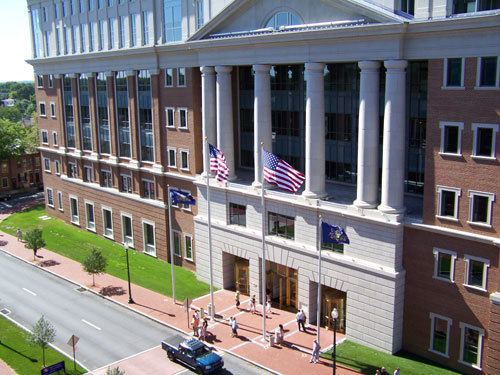
The original Chester County seat was the city of Chester, a center of naval shipbuilding, at the eastern edge of the county. In an effort to accommodate the increased population of the western part of the county, the county seat was moved to a more central location in 1788; in order to mollify the eastern portion of the county, the village, known as Turk's Head, was renamed West Chester. Apparently, this did not work: the eastern portion of the county separated from Chester County on September 26, 1789, becoming Delaware County. West Chester remained the seat of the reduced Chester County, and still is.
Much of the history of Chester County arises from its location between Philadelphia and the Susquehanna River. The first road to "the West" (meaning Lancaster County) passed through the central part of Chester County, following the Great Valley westward; with some re-alignments, it became the Lincoln Highway and later U.S. Route 30. This road is still named Lancaster Avenue in most of the Chester county towns it runs through. The first railroad (which became the Pennsylvania Railroad) followed much the same route, and the Reading Railroad progressed up the Schuylkill River to Reading. Industry tended to concentrate along the rail lines. Easy transportation allowed workers to commute to urban jobs, and the rise of the suburbs followed. To this day, the developed areas form "fingers" extending along major lines of transportation.
During the American Revolutionary War, the Battle of Brandywine was fought at what is now the southeastern fringe of the county. The Valley Forge encampment was at the northeastern edge.
Geography
According to the U.S. Census Bureau, the county has a total area of 759 square miles (1,970 km2), of which 751 square miles (1,950 km2) is land and 8.7 square miles (23 km2) (1.1%) is water. The topography consists of rolling hills and valleys and it is part of the region known as the Piedmont.
Watersheds that serve Chester County include the Octoraro, the Brandywine, and Chester creeks, and the Schuylkill River. Many of the soils are fertile, rich loam as much as twenty-four inches thick; together with the temperate climate, this was long a major agricultural area. Because of its proximity to Philadelphia, Chester County has seen large waves of development over the past half-century due to suburbanization. Although development in Chester County has increased, agriculture is still a major part of the county's economy, and the number of horse farms is increasing in the county. Mushroom growing is a specialty in the southern portion of the county.
Elevations (in feet): High point—1020 Welsh Mt., Honeybrook Twp. Other high points—960 Thomas Hill, Warwick Twp; 960 Barren Hill, West Cain Twp. Low point—66 Schuylkill River, Chester-Montgomery county line. Cities and boroughs: Coatesville 314; Downingtown 255; Kennett Square 300; Oxford 535; Parkesburg 542; Phoenixville 127; Spring City 114; West Chester 459.
Adjacent counties
National protected area
State protected areas
Major highways
US 30 Bus.
US 322 Bus.
Demographics
As of the 2010 census, the county was 82.1% White Non-Hispanic, 6.1% Black or African American, 0.2% Native American or Alaskan Native, 3.9% Asian, 0.0% Native Hawaiian, 1.8% were two or more races, and 2.4% were some other race. 6.5% of the population were Hispanic or Latino.
As of the census of 2000, there were 433,501 people, 157,905 households, and 113,375 families residing in the county. The population density was 573 people per square mile (221/km²). There were 163,773 housing units at an average density of 217 per square mile (84/km²). The racial makeup of the county was 89.21% White, 6.24% Black or African American, 0.15% Native American, 1.95% Asian, 0.03% Pacific Islander, 1.35% from other races, and 1.06% from two or more races. 3.72% of the population were Hispanic or Latino of any race. 18.0% were of Irish, 17.3% German, 13.1% Italian, 10.1% English and 5.6% American ancestry according to their self-reporting on Census 2000. 91.4% spoke English and 3.7% Spanish as their first language.
There were 157,905 households out of which 35.10% had children under the age of 18 living with them, 60.50% were married couples living together, 8.10% had a female householder with no husband present, and 28.20% were non-families. 22.60% of all households were made up of individuals and 7.60% had someone living alone who was 65 years of age or older. The average household size was 2.65 and the average family size was 3.15.
In the county, the population was spread out with 26.20% under the age of 18, 7.90% from 18 to 24, 30.40% from 25 to 44, 23.80% from 45 to 64, and 11.70% who were 65 years of age or older. The median age was 37 years. For every 100 females there were 96.40 males. For every 100 females age 18 and over, there were 93.10 males.
The median income for a household in the county was $65,295, and the median income for a family was $76,916 (these figures had risen to $80,818 and $97,894 respectively as of a 2007 estimate). Males had a median income of $51,223 versus $34,854 for females. The per capita income for the county was $31,627. About 3.10% of families and 5.20% of the population were below the poverty line, including 5.10% of those under age 18 and 5.50% of those age 65 or over.
The region was originally occupied by the Lenni Lenape people, who greeted European settlers in the seventeenth century with amity and kindness. British settlers were mostly English, Scotch-Irish and Welsh in ethnicity. From the late 19th to early 20th century, the industrial areas of the region, such as Coatesville, attracted immigrants and job seekers from Germany and Ireland, Eastern Europe, Italy, and the American rural South, with both black and white migrants coming north. Later Hispanic immigrants have included Puerto Ricans and, most recently, Mexicans.
Long a primarily rural area, Chester County is now the fastest-growing county in the Delaware Valley; it is one of the fastest growing in the entire Northeastern section of the United States.
Religion
In keeping with its colonial history, Chester County is home to a number of historic Quaker buildings, including Birmingham, Birmingham Orthodox, Bradford, Caln, Old Kennett, Parkersville, and Uwchlan meeting houses. Other historic religious buildings include St. Malachi Church, southeastern Pennsylvania's oldest active Catholic mission church, and the Episcopal St. Mary's, St. Paul's, and St. Peter's churches, and Washington Memorial Chapel. Also located in the county are the First Presbyterian Church of West Chester, Coventryville United Methodist Church, which is part of the Coventryville Historic District, and Beth Israel Congregation of Chester County, a Conservative synagogue in Coatesville, a site of Eastern European immigration in the 20th century.
Politics
As of November 2013, there are 337,793 registered voters in Chester County.
Chester County has historically been reliably Republican at the county level; traditionally, it was the most conservative county on the Philadelphia side of Pennsylvania. In recent federal elections, however, it has been trending Democratic, though not as overwhelmingly as the rest of the Philadelphia suburbs. In 2000 Al Gore lost it by almost 10 percent but in 2004 George W. Bush defeated John Kerry by a much smaller margin of only 4.5 percent. Bob Casey, Jr. carried it by 10% when he unseated incumbent Republican US Senator Rick Santorum in 2006. In 2008, Chester County sided with the rest of Pennsylvania and voted for Barack Obama by a much larger margin of 9%, making him the first Democrat to carry it in a Presidential election since 1964. But, in 2009, with a smaller turnout, Republican candidates swept all county-row offices, winning with an average margin of 20%. In 2012 the county voted for Republican candidate Mitt Romney, by a very small margin of about 500 votes.
In 2016, despite Pennsylvania voting for a Republican presidential candidate for the first time since 1988, Chester County voted more Democratic than in 2012, with Hillary Clinton leading Donald Trump by over 25,000 votes or 9.4 percentage points; a 4.8 percentage point swing from 2012. The only two statewide winners in 2016 to carry Chester County were U.S. Senator Pat Toomey (R) and Pennsylvania State Treasurer Joe Torsella (D). Republican candidates John Brown and John Rafferty carried Chester County, though both lost their races for Auditor General and Attorney General, respectively (Rafferty, a State Senator whose district includes northern Chester County, carried the county by a slim margin of 50 votes)
Democrats have made gains in Chester County state legislative seats in recent elections. Democrat Andy Dinniman picked up the 19th Senate District in May 2006 in the special election to replace the late Robert Thompson. Democrat Barbara McIlvaine Smith picked up the open 156th House district in November 2006, winning by 28 votes and tipping the State-House majority to the Democrats. This was the first time that a Democrat had served part of Chester County as State Representative since Jim Gerlach (who represented much of Chester County for 12 years in Congress) unseated Sam Morris in 1990. In 2008, two more open House seats in the county went Democratic—to Tom Houghton in the 13th and Paul Drucker in the 157th. In 2010, however, Chester County swung back to the GOP, with Republicans Dan Truitt (who defeated McIlvaine Smith), Warren Kampf (who defeated Drucker), and John Lawrence (who defeated Houghton) all elected to the State House.
Government
Chester County is administered by a three-person Board of Commissioners, who serve four-year terms. Elections occur in the odd-numbered years that precede U.S. Presidential elections, with the next election falling in 2019. The Commissioners have selective policy-making authority to provide certain local services and facilities on a county-wide basis. Accordingly, the commissioners are responsible for the management of the fiscal and administrative functions of the county.
Colleges and universities
Public school districts
Charter schools
There are 11 public cyber charter schools and 144 bricks and mortar charter schools in Pennsylvania that are available for free statewide, to children K-12. See: Education in Pennsylvania.
Independent schools
Libraries
The Chester County Library System in southeastern Pennsylvania was organized in 1965. It is a federated system composed of a District Center Library in Exton and sixteen member libraries. The system provides materials and information for life, work and pleasure.
Communities
Under Pennsylvania law, there are four types of incorporated municipalities: cities, boroughs, townships, and, in at most two cases, towns. The post office uses community names and boundaries that usually do not correspond to the townships, and usually only have the same names as the municipalities for the cities and boroughs. The names used by the post office are generally used by residents to describe where they live. The following cities, boroughs and townships are located in Chester County:
City
Census-designated places
Census-designated places are geographical areas designated by the U.S. Census Bureau for the purposes of compiling demographic data. They are not actual jurisdictions under Pennsylvania law.
Historic community
Population ranking
The population ranking of the following table is based on the 2010 census of Chester County.
† county seat