
Area 2,515 km² Population 73,912 (2013) | Website www.co.augusta.va.us Founded 1738 | |
 | ||
Points of interest Augusta Military Academy, Blue Ridge Mountains, Folk Art Center, Linville Falls, Grand Caverns Destinations | ||
All schools shut down over islam homework augusta county virginia
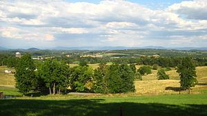
Augusta County is a county located in the Shenandoah Valley on the western edge of the U.S. commonwealth of Virginia. It is the second-largest county in Virginia by total area, and it surrounds the independent cities of Staunton and Waynesboro. The county seat of Augusta is Staunton, although most of the administrative services have offices in neighboring Verona.
Contents
- All schools shut down over islam homework augusta county virginia
- Map of Augusta County VA USA
- History
- Geography
- Adjacent counties and independent cities
- Districts
- School systems
- National protected areas
- Regional park
- Demographics
- Area Populations
- Board of Supervisors
- Constitutional Officers
- Economy
- Communities
- Towns
- References
Map of Augusta County, VA, USA
The county was created in 1738 from part of Orange County, and was named after Princess Augusta of Saxe-Gotha. It was originally a huge area, but many parts of Augusta County were carved out to form other counties and several states, until the current border was finalized in 1790.
As of the 2010 census, the county population was 73,750, which represented an increase of more than 34 percent over the 1990 figure. In addition, Augusta County is part of the Staunton–Waynesboro, VA Metropolitan Statistical Area.
History
Augusta County was formed in 1738 from Orange County, although, because few people lived there, the county government was not organized until 1745. It was named for Augusta of Saxe-Gotha, Princess of Wales and mother of the future King George III of the United Kingdom.
Originally, Augusta County was a vast territory with an indefinite western boundary. Most of what is now West Virginia as well as the whole of Kentucky were formed from it, and it also claimed the territory north and west of those areas, theoretically all the way to the Pacific Ocean.
A series of maps show the formation and division of Augusta County from 1738 through 1791.
Reductions in its extent began in 1770, when its southern part became Botetourt County. In 1776 part of western Augusta County, an area also known as the District of West Augusta, became Monongalia County, Ohio County, and Yohogania County (abolished in 1786). In 1778 the portion of Augusta County west of the Ohio River became Illinois County (abolished in 1784); the northeastern part of what was remained became Rockingham County, and the southwestern part was combined with part of Botetourt County to form Rockbridge County. In 1788 the northern part of the county was combined with part of Hardy County to become Pendleton County. Augusta County assumed its present dimensions in 1790, when its western part was combined with parts of Botetourt County and Greenbrier County to form Bath County.
During the Civil War, Augusta County served as an important agricultural center as part of the "Breadbasket of the Confederacy." The Virginia Central Railroad ran through the county, linking the Shenandoah Valley to the Confederate capital at Richmond. One of the bloodiest engagements fought in the Shenandoah Valley took place on June 5, 1864 at the Battle of Piedmont, a Union victory that allowed the Union Army to occupy Staunton and destroy many of the facilities that supported the Confederate war effort. Augusta County suffered again during General Philip H. Sheridan's "Burning," which destroyed many farms and killed virtually all of the farm animals.
Staunton, the county seat for many years, was incorporated as a city in 1871 and separated from Augusta County in 1902. However, it remained the county seat.
Geography
According to the U.S. Census Bureau, the county has a total area of 971 square miles (2,510 km2), of which 967 square miles (2,500 km2) is land and 3.9 square miles (10 km2) (0.4%) is water. It is the third-largest county in Virginia by land area and second-largest by total area.
Adjacent counties and independent cities
Districts
The county is divided into seven magisterial districts: Beverley Manor, Middle River, North River, Pastures, Riverheads, South River, and Wayne.
School systems
The county is serviced by Augusta County Public Schools.
National protected areas
Regional park
Demographics
As of the Census of 2000, there were 65,615 people, 24,818 households, and 18,911 families residing in the county. The population density was 68 people per square mile (26/km²). There were 26,738 housing units at an average density of 28 per square mile (11/km²). The racial makeup of the county was 95.02% White, 3.60% Black or African American, 0.15% Native American, 0.28% Asian, 0.02% Pacific Islander, 0.32% from other races, and 0.61% from two or more races. 0.94% of the population were Hispanic or Latino of any race.
There were 24,818 households of which 33.00% had children under the age of 18 living with them, 63.70% were married couples living together, 8.60% had a female householder with no husband present, and 23.80% were non-families. 20.10% of all households were made up of individuals and 8.10% had someone living alone who was 65 years of age or older. The average household size was 2.56 and the average family size was 2.94.
In the county, the population was spread out with 23.70% under the age of 18, 6.90% from 18 to 24, 29.80% from 25 to 44, 26.80% from 45 to 64, and 12.80% who were 65 years of age or older. The median age was 39 years. For every 100 females there were 101.10 males. For every 100 females age 18 and over, there were 99.80 males.
The median income for a household in the county was $43,045, and the median income for a family was $48,579. Males had a median income of $31,577 versus $24,233 for females. The per capita income for the county was $19,744. About 4.20% of families and 5.80% of the population were below the poverty line, including 6.40% of those under age 18 and 6.60% of those age 65 or over.
Area Populations
According to the 2010 US Census data, below are the populations of the two towns and select unincorporated communities within Augusta County:
The majority of Grottoes is located in Rockingham County. Only seven of the town's 2,668 residents reside in Augusta County.
Board of Supervisors
Constitutional Officers
Augusta County is represented by Republican Emmett W. Hanger in the Virginia Senate, Republican Richard P. "Dickie" Bell, Republican Ben L. Cline, and Republican R. Steven "Steve" Landes in the Virginia House of Delegates, and Republican Robert W. "Bob" Goodlatte in the U.S. House of Representatives.
Economy
According to the County's 2011 Comprehensive Annual Financial Report, the top employers in the county are:
Communities
The independent cities of Staunton and Waynesboro (incorporated as such in 1902 and 1948 respectively) are located within the boundaries of Augusta County, but are not a part of the county, despite Staunton's status as the county seat. Most county administrative offices, however, are located in Verona, rather than in Staunton.