
Country United States Incorporated 1735 Elevation 79 m Population 21,929 (2010) | State Massachusetts Settled 1639 Time zone Eastern (UTC-5) Zip code 01720 Local time Wednesday 8:42 PM | |
 | ||
Weather 16°C, Wind SW at 21 km/h, 79% Humidity | ||
Video of 3 hillcrest drive acton massachusetts real estate homes
Acton is a suburban town in Middlesex County, Massachusetts, United States, approximately twenty-one miles west-northwest of Boston along Route 2 west of Concord and about ten miles (18 km) southwest of Lowell. The population was 21,929 at the 2010 census and ranked 35th on the list of highest-income places with a population of at least 10,000. It is bordered by Westford and Littleton to the north, Concord and Carlisle to the east, Stow, Maynard, and Sudbury to the south and Boxborough to the west. Acton became an incorporated town in 1735. The town employs the Open Town Meeting form of government with a Town Manager and an elected, five-member Board of Selectmen. Acton was named the 11th Best Place To Live among small towns in the country by Money Magazine in 2015, and the 16th best in 2009 and in 2011. The local high school, Acton-Boxborough Regional High School, was named a Blue Ribbon School by the U.S. Department of Education in 2009. In 2012, U.S. News & World Report ranked Acton-Boxborough #3 among open enrollment high schools and #7 overall for STEM education in the United States.[6]
Contents
- Video of 3 hillcrest drive acton massachusetts real estate homes
- Map of Acton MA USA
- Video of 43 stoneymeade way acton massachusetts real estate homes
- Geography
- The five village centers
- Demographics
- Chinese and foreign born populations
- Income
- History
- Colonization Era through Revolutionary Era
- Industrialization and Civil War
- Government
- Civic infrastructure
- Water district
- Sewers
- Conservation lands
- Playing fields playgrounds
- Education
- Elementary Schools in Acton
- Acton Boxborough Junior High and High School
- Libraries
- Museums
- Theater
- Traditions
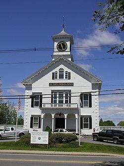
- Points of interest
- Transportation
- In media
- Notable people
- References
Map of Acton, MA, USA
Video of 43 stoneymeade way acton massachusetts real estate homes
Geography
Acton is located at 42°29′N 71°27′W. According to the United States Census Bureau, the town has a total area of 20.3 square miles (53 km2), of which 20.0 square miles (52 km2) is land and 0.3 square miles (0.78 km2), or 1.53 percent, is water. Almost all of Acton is forested, except for where it has been cleared for residential or agricultural use. Some forested areas have been put aside for special use by corporations.
The current geography of Acton was created when the last wave of glaciers retreated approximately ten thousand years ago. Acton has nine drumlins — hills which are composed of glacial till. In addition, Wills Hole and Grassy Pond are kettle ponds which were formed in depressions in the till formed by large blocks of ice.
Acton has two primary stream systems: the Nashoba Brook system including the incoming streams Butter Brook, Will's Hole Brook and Conant Brook and the Fort Pond Brook system including the incoming streams Guggins Brook, Inch Brook, Grassy Pond Brook, Pratt's Brook and Coles Brook. Both stream systems empty into the Assabet River, which passes briefly through the town at its southern corner. Nagog Pond in the north, forms Acton's border with the Town of Littleton and provides drinking water to the Town of Concord. A small artificial pond is at NARA Park in North Acton.
The five village centers
While Acton Center has been the civic center of the town since the revolution, the four other villages centers earned their nomenclature from the names of their corresponding railroad station.
The current Master Plan for the town encourages development in the village centers in an attempt to prevent further sprawl and preserve open space in the rest of the town.
Demographics
According to the 2010 census, there were 21,924 residents, a 7.84% increase from 2000 and 5,958 families residing in the town. The population density was 1,080.5 per square mile (417.0/km²). There were 8,530 total housing units, 96% of which were occupied, at an average density of 384.6 per square mile (148.5/km²). The racial makeup of the town was 77.3% White, 18.6% Asian, 1.1% African American, 0.1% Native American, 1.2% from other races, and 1.7% from two or more races.
Of the 8,187 occupied households, 42.7% had children under the age of eighteen living with them, 63.5% were husband-wife married couples living together. 23.0% of all households were occupied by individuals 65 years of age or older living alone. The age distribution of the population was 29.5% under the age of 18, 4.3% from 18 to 24, 31.5% from 25 to 44, 26.4% from 45 to 64, and 8.4% 65 years of age or older. The median age was 38 years. For every 100 females there were 97.2 males. For every 100 females age eighteen and over, there were 94.2 males. For those age 25 years or older in Acton during the 2000 census, 97.2% had a high school degree or higher, 72.0% had a bachelor's degree or higher, and 40.5% had a graduate degree or higher. Also, 98.0% were employed with a mean commute time of 31.0 minutes.
The median income for a household in the town is $133,532, and the median income for a family is $156,388. Males had a median income of $109,371 versus $48,113 for females. The per capita income for the town was $61,034. About 1.7% of families and 2.9% of the population were below the poverty line, including 2.4% of those under age 18 and 3.3% of those age 65 or over.
Chinese and foreign-born populations
Acton had 2,041 Chinese Americans in 2010, a 151% increase from 2000 and the ninth largest Chinese population in Massachusetts.
In 2014, 25% of the residents of Acton were born outside of the United States. In 2000 this percentage was 14%.
Income
Data is from the 2009-2013 American Community Survey 5-Year Estimates.
History
Acton's history reflects the history of Massachusetts, New England, and the United States.
Acton was first settled by Native Americans who used the Assabet, Sudbury and Concord rivers for transportation and the fields for farming seasonal crops. There is evidence of Native American settlements in Acton which go back 7000 years. When the colonists arrived in this area, the Native American population dropped dramatically due to European diseases for which they had no immunity.
Colonization Era through Revolutionary Era
Concord was the first in-land colonial town established in the MA Bay Colony. The original boundaries of Concord included all of Acton and residents used the Acton land as grazing fields for their animals. In 1639, the first homestead was built within the modern day boundaries of the town..
Acton was established as an independent town on July 3, 1735. Acton has held annual town meetings since 1735, the records of which are held at Acton's Memorial Library.
Acton residents participated in the growing hostility with Great Britain by sending a list of grievances to King George III on Oct. 3rd, 1774. The anniversary of this day is celebrated in Acton as Crown Resistance Day.
At the beginning of the Revolutionary War, on April 19, 1775, a company of minutemen from Acton responded to the call to arms initiated by Paul Revere (who rode with other riders, William Dawes and Samuel Prescott, with Prescott the only one of the three who was able reach Acton itself) and fought at the North Bridge in Concord as part of the Battle of Lexington and Concord. The Acton minutemen were led by Captain Isaac Davis. When a company was needed to lead the advance on the bridge which was defended by the British regulars, Captain Davis was heard to reply, "I haven't a man who is afraid to go." The Acton men led because, unlike other militias there, they were fully equipped with bayonets.
The colonists advanced on the bridge; in the exchange of musket fire that followed, Captain Isaac Davis and Private Abner Hosmer of Acton were killed. Davis was the first officer to die in the American Revolutionary War. In Acton they refer to "the battle of Lexington, fought in Concord, by men of Acton."
Industrialization and Civil War
During the 19th century, Acton participated in the growing Industrial Revolution. By the mid-19th century, Acton was an industrial center for the production of barrels (cooperage). There were also a powder mill, three gristmills and four sawmills in town. The American Powder Mills complex extended downstream along the Assabet River and manufactured gunpowder from 1835 to 1940.
On October 1, 1844 the railroad came to Acton. The Fitchburg Railroad was routed through South and West Acton so that it could serve the mills. South Acton became a busy rail center and was the division point for the Marlborough Branch Railroad. With the railroad came increasing development in those areas. In addition to the Fitchburg Railroad, two others crossed the town: the Nashua and Acton, and the Framingham and Lowell. These two railroads shared a double track right-of-way that ran from West Concord (aka Concord Junction) through East Acton and then splitting in North Acton in the vicinity of Route 27 and Ledgerock Way.
In 1874, the population of the town was almost 1700. The town established its first newspaper, The Acton Patriot, and the residents of West Acton formed the first library, The Citizen's Library. In 1890, the Memorial Library was completed and given to the town by William A. Wilde as a memorial to the Acton soldiers who fought in the Civil War.
Government
Acton uses the Open Town Meeting form of town government. The town charter specifies that the annual town meeting must begin on the first Monday in April. The selectmen may also call a special town meeting at other times of the year to consider other business. Citizens may force a special town meeting by submitting a petition signed by 200 registered voters to the town clerk. Anyone may attend Town Meeting but only registered voters may vote. Acton also has a water district, which is run separately from town government, as a public utility.
Acton's elected officials include the following: the board of selectmen (5 members), the town moderator, the Acton public school committee (6 members), the Acton representatives to the Acton / Boxborough regional school committee (6 members). In addition, the town moderator appoints a finance committee (9 members) which issues an opinion on each of the warrant articles presented to Town Meeting. In addition, a separate and independent branch of government, the Acton Water District, was established in 1912 and consists of three Commissioners, a Moderator, a Secretary, an appointed District Attorney, Finance Committee, Land-Water Use Advisory Committee, and paid professional staff.
The town services are primarily funded through the residential property tax, which is subject to the limitations imposed by State "Proposition 2½." The Water District is funded through water rates, connection fees and property rental. The Water District revenues, however, are not subject to State "Proposition 2½."
Civic infrastructure
The civic infrastructure grew to accommodate the increasing population. A Water District was established in 1912 and a town-wide Fire Department was established in 1913. Acton was the first town in the area to have water-bound macadam highways.
In 2005 a new Public Safety Building was built that expanded space for the Police Department and provided for a Joint Dispatch area with the Fire Department.
Water district
The Acton Water District is a community public water supply that delivers drinking water to the majority (about 90 percent) of the residents of the town of Acton, Massachusetts. All of the water provided from the District comes from seven wells located within the town of Acton. The District's system consists of 106 miles (171 km) of water main, four storage tanks, and water treatment facilities including aeration, activated granulated carbon (GAC), an advanced Zenon(R) filtration facility, plus fluoridation and state mandated chlorination.
Sewers
Most homes and businesses in Acton (approximately 80%) use private on-site sewage systems (i.e. septic tanks). Higher density developments such as condominiums and apartment buildings (approximately 10% of the town) use private sewers which go to small-scale private treatment plants.
In 2001, Acton completed its first public sewer system, which serves approximately 10% of the town, primarily in South Acton. A betterment fee is charged to property owners whose property is sited proximate to the sewage lines, whether or not they connect to the system.
Conservation lands
Acton has a total of over 1,650 acres (7 km2) of town-owned conservation lands. http://www.actontrails.org
These town conservation areas, and some smaller ones, are described and mapped in a website maintained by the town's volunteer Land Stewardship Committee.
Playing fields & playgrounds
Education
At the beginning of the century, each village in Acton had its own grade school, but the town struggled with how to provide a high school education for its students. For most of the early 20th century (until 1925), Acton students were sent to Concord's high school.
In 1953, new schools were constructed to accommodate the growth in the student population. In 1957, Acton and Boxborough created a regional school district for grades 7–12. In 2014, the regional school district was expanded to include the elementary schools of each town. The Merriam School was constructed in 1958. Other schools quickly followed: Douglas (1966), Gates (1968), and Conant (1971). In 1967 a building was constructed for the junior high. In 1973 a huge addition was added to this building and it became the high school; the junior high moved to the old high school building.
Elementary Schools in Acton
The Acton Boxborough Regional School District operates five elementary schools in Acton as well as Acton public School Pre-school. The School District also operates the Blanchard Elementary school in neighboring Boxborough MA.
Acton has an uncommon method of assigning students to elementary schools, called "Open Enrollment." First-time incoming kindergarten parents participate in a lottery-based selection process where the parents "choose" the school by listing their preferences in ranked order. Boxborough students have priority for attendance in the school in their own town, but participate in the lottery if they wish to attend an Acton school. Any remaining spaces at Blanchard become available in the lottery.
This method of school choice has a large impact on the nature of the town. Acton is less oriented around neighborhoods than towns which have neighborhood based schools. This carries over into the recreational youth sport organizations whose teams are not organized around specific elementary schools. As a result, students and families are likely to have broad social connections in all parts of the town rather than being limited to neighborhoods. School Choice also benefits the towns real estate market since home valuations are not impacted by the perceived desirability of given neighborhood's school.
While the curriculum in the district is fairly standardized, each of the elementary schools has a different teaching philosophy. The schools and their philosophy of education are:
Acton-Boxborough Junior High and High School
The Acton-Boxborough Regional School has a single Junior High School (Raymond J. Grey Junior High School) for grades 7 & 8 and a single High School (Acton-Boxborough Regional High School) for grades 9 through 12. The regional district accepts some students from other neighboring towns as 'choice' students if the school committee decides this is in the best interest of the district. Both the junior high and high school were enlarged and renovated in 2000–2005. They have multiple on-campus shops: the Junior High School Store, the High School Store, and the cafeterias. Both building are located on the school district campus in Acton.
Current enrollment is the Junior High is appropriately 1,000 students while the High School has roughly 2000 students. The High School was ranked as the 3rd best public school in 2014 by Boston Magazine.
Libraries
Acton has two public libraries: the Acton Memorial Library and the West Acton Citizens' Library.
The Acton Memorial Library was given to the town of Acton by William Allan Wilde as a memorial to its Civil War veterans in 1890. The building was expanded in 1967, and a second major expansion was completed in 1999.
There are also libraries in each of the elementary schools, the Junior High, and the High School.
The Acton Historical Society owns the Jenks Library which contains historical maps, documents, photographs and drawings.
Museums
Theater
Though there are several theater groups in Acton, the two eldest are Theatre III and Open Door Theater. The multi award-winning Theatre III was founded in 1956 when three organizations (a local chorus, dance group, and dramatic troupe) combined to present a show. It produces several plays and musicals each season in the historical old church building on Central Street.
Open Door Theater is a community theater group which was founded to provide an inclusive theater experience. Open Door produces one large musical each year which features a large number of performers ranging in age from 9 to adult including people with special needs. They perform and rehearse in the Dragonfly Theatre, located inside the R. J. Grey Junior High School.
Traditions
Points of interest
Transportation
Acton is five miles (8 km) from I-495 and ten miles (16 km) from I-95/Route 128. Routes 2, 2A, 27, 62, 111, and 119 run through town.
The MBTA Commuter Rail Fitchburg Line train stops at the South Acton station. South Acton is a major station on the line at which many trains terminate. Besides the urban stops at Cambridge (Porter Square) and Boston (North Station Terminal), it is the only station on the line at which all trains stop. The MBTA Fitchburg Line provides service to Fitchburg, Leominster, Shirley, Ayer, Littleton, Concord, Lincoln, Weston, Waltham, Belmont, Cambridge, and Boston.
Yankee Lines provides a commuter bus service to Copley Square in Boston from the intersection of Route 2A and 119 in Acton.