
- elevation 49 ft (15 m) Length 64 km | - elevation 1,129 ft (344 m) Discharge 68.87 m³/s Basin 1,339 sq mi (3,468 km2) Bridges Bridgeport Covered Bridge | |
 | ||
Sources North Yuba River, Middle Yuba River | ||
Yuba river gold mining california 2014
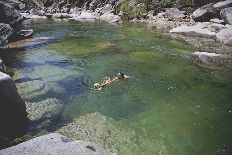
The Yuba River is a tributary of the Feather River in the Sierra Nevada and eastern Sacramento Valley, in the U.S. state of California.
Contents
- Yuba river gold mining california 2014
- Map of Yuba River California USA
- Yuba river aerial view nevada county california
- Course
- North fork
- Middle fork
- South fork
- Main stem
- History
- Dams and diversions
- Tributaries
- References
Map of Yuba River, California, USA
The main stem of the river is about 40 miles (64 km) long, and its headwaters are split into North, Middle and South Forks. The confluence of the former two is considered the beginning of the Yuba River. The river drains about 1,339 square miles (3,470 km2) of the western slopes of the Sierra Nevada mountain range as well as a small portion of the Sacramento Valley. It contributes about a third of the flow of the Feather River, and almost 10 percent of the flow of the Sacramento River, which it ultimately drains into.
The river's name comes from a Maidu village, spelled in early records as Yubu and applied to the river by 1844. Some claim the name is a variant of Spanish uba or uva, referring to grapes found growing along the banks of the river.
Yuba river aerial view nevada county california
Course
Most of the Yuba River's flow is incorporated from its three main tributaries, the North Yuba, Middle Yuba and South Yuba. All three rivers run westwards from the crest of the Sierra Nevada to form the main stream of the Yuba. The beginning of the main stem is defined as the confluence of the North and Middle Yuba Rivers; the North Fork is longer.
North fork
The North Yuba River, 61.0 miles (98.2 km) long, rises near the eastern border of the Tahoe National Forest, on a mountainside along California State Route 49. It flows southwest then west through a 3,000-foot-deep (910 m) canyon past the small villages of Downieville, where it receives the Downie River, and Goodyears Bar. It then incorporates the flow of Canyon Creek and Slate Creek, two of its main tributaries, and very soon after widens into New Bullards Bar Reservoir, which is impounded by the 645-foot (197 m) New Bullards Bar Dam. Very soon after leaving the dam it joins with the Middle Yuba to form the Yuba River.
Middle fork
Originating in a bowl-shaped valley in Moscove Meadow, the 55.4-mile-long (89.2 km) Middle Yuba River flows north into Jackson Meadows Reservoir, then turns west, descending steeply into a gorge, defining over almost its entire length the boundary of Sierra County in the north and Nevada County in the south. The river bends to the southwest, then west again, receiving Kanaka Creek from the right and Grizzly Creek from the left. It intersects California State Route 49 about 2 miles (3.2 km) northwest of North San Juan, then a few miles after joins with the North Yuba River.
South fork
The 65.0-mile-long (104.6 km) South Yuba River is a left-entering tributary of the Yuba River originating in the northern Sierra Nevada at Lake Angela in Nevada County about three quarters of a mile north of Donner Pass, about three miles east of the town of Soda Springs. After passing through Lake Van Norden with Upper Castle Creek (longer than the Lake Angela stem) entering from the right, it gathers numerous snow-fed tributaries running west through a marshy, lake-filled valley, criss-crossing Interstate 80. The river briefly enters Placer County, then flows into Lake Spaulding, then plunges westward into a steep-sided valley. Canyon Creek enters from the right, then Poorman Creek also from the right near the town of Washington. The river continues west into the foothills, crossing under State Route 49. Its mouth is on the east shore of upper Englebright Lake, formed by a dam across the Yuba River. |
Main stem
From the joining of the North and Middle forks, the Yuba flows southwards, then southwest, through the Sierra Nevada foothills, forming the Yuba-Nevada County border. The river widens into the main arm of Englebright Lake near French Bar, and is joined by the South Yuba within the reservoir. The Yuba leaves the Englebright Dam near Lake Wildwood, California and is then joined by Deer Creek, the stream flowing from that lake, on the left. The Yuba slows down as it flows from the mountains out into the Sacramento Valley near the Yuba Goldfields, a section of the Yuba River valley consisting of dredged sediments washed down by hydraulic mining in the 19th century. The river then turns southwest, flowing through irrigated farmland. It then skirts the south side of Marysville and reaches its destination at the Feather River between the cities of Marysville, Yuba City and Linda.
History
The Yuba River valley was originally situated in one of California's largest Native American population centers. Historians divide the natives living in the Yuba area into several groups – the Konkow, Maidu, Nisenan and Miwok. These groups did not function as large tribes; rather, they were divided into hundreds of small villages, with distinct names but similar customs. Like other indigenous people of the Sierra Nevada region, their staple food were acorns, but they also hunted and gathered for other foods including abundant salmon runs in the Yuba River.
In the 1850s, the California Gold Rush brought some of the first European-American settlers into the area, followed by many Mexican, African and Chinese immigrants. Within a few years diseases which the Native Americans had no immunity over, brought by the incoming people, wiped out most of the native population. The Yuba River and its forks were one of the richest gold-bearing regions, and miners poured to the region in great numbers. Although gold was first extracted by simple methods such as panning and sluicing, mining operations quickly turned into large-scale industrial hydraulic mining. About 25 million cubic yards (19,400,000 m3) of hydraulic mining debris was carried down the Yuba River. This raised stream beds up to 50 ft (15 m) in places, buried riverside land under sediment, and increased flooding risks. The practice was banned in 1884 following lawsuits by farmers who had been affected by the debris flows. Much of the debris left by the destruction of hydraulic mining remains as the Yuba Goldfields.
The large scale mining with the extensive use of mercury lead to a contamination of a relative large area. By 2013 the contamination is still detectable and will be so for an estimated time of more than 10000 years.
In 1877, the world's first long-distance telephone line was strung along the South Fork of the Yuba River from French Corral to Bowman Lake, a distance of 60 miles (97 km).
Dams and diversions
Like the majority of California rivers, the Yuba was dammed at many points during the 20th century and large amounts of water are drawn for irrigation and municipal water supply. Daguerre Point Dam was built in 1906 by the U.S. Army Corps of Engineers in order to trap hydraulic mining debris. After concerns about its impact on fish populations, the dam was fitted with fish ladders in 1937. The concrete arch Englebright Dam was built in 1941 to trap mining debris following the re-legalization of hydraulic mining during the 1930s. Mining never resumed on a Gold Rush scale in the Yuba River watershed; today Englebright serves primarily for hydroelectricity generation.
New Bullards Bar Dam was built on the North Fork of the Yuba River in response to severe flooding in 1955. Completed in 1969, the concrete-arch dam, 645 ft (197 m) high, is one of the tallest in the United States and provides the primary dry-season water storage for the Yuba River basin, serving both irrigation and hydropower interests. The dam is part of the Yuba River Development Project, which also includes a diversion dam (Our House Dam) on the Middle Fork, which sends most of that river's flow into New Bullards Bar Reservoir for long term storage purposes. The New Bullards Bar dam replaced a smaller concrete arch dam built in 1922-1924 for debris control and power generation. Water from New Bullards Bar feeds the New Colgate Powerhouse about 4 miles (6.4 km) below the dam. The powerhouse has a capacity of 340 megawatts and generates over 1.3 billion kilowatt hours per year. These diversions have resulted in the seasonal dewatering of the lower North and Middle Forks and about four miles of the main Yuba River.
The Middle and South Forks are linked by the Yuba-Bear and Drum-Spaulding hydroelectric projects, which are owned by the Nevada Irrigation District and Pacific Gas and Electric, respectively. These two interconnected projects generate a combined 1.2 billion kilowatt hours per year and with over 40 dams and reservoirs and 16 powerhouses, are considered the most complex hydroelectric scheme in the United States. Major dams include Jackson Meadows Dam and Bowman Dam (part of Yuba-Bear) and Lake Spaulding Dam and Fordyce Lake Dam (part of Drum-Spaulding). These projects divert a portion of the Yuba River's flow to the Bear River, a tributary of the Feather River further south.
Other dams include Scotts Flat and Wildwood on Deer Creek; and Mildred and Virginia Ranch on Dry Creek, a lower tributary of the Yuba.
Tributaries
In hierarchical order, going upstream:
Clear Creek