
Area 41,963 km² | Barwon South West Population 54,645 (2011 census) | |
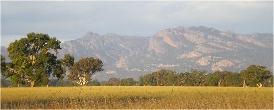 | ||
Wimmera harvest 2016
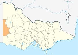
The Wimmera is an ill–defined district, sometimes incorrectly referred to as an economic region, of the Australian state of Victoria. The district is located within parts of the Loddon Mallee and the Grampians regions; and covers the dryland farming area south of the range of Mallee scrub, east of the South Australia border and north of the Great Dividing Range. It can also be defined as the land within the social catchment of Horsham, its main settlement.
Contents
- Wimmera harvest 2016
- Seeding wheat in the west wimmera may 2015
- History
- Regional development and population
- Climate
- Geography
- Natural heritage
- References
Most of the Wimmera is very flat, with only the Grampians and Mount Arapiles rising above vast plains and the low plateaux that form the Great Divide in this part of Victoria. The Grampians are very rugged and tilted, with many sheer sandstone cliffs on their eastern sides, but gentle slopes on the west.
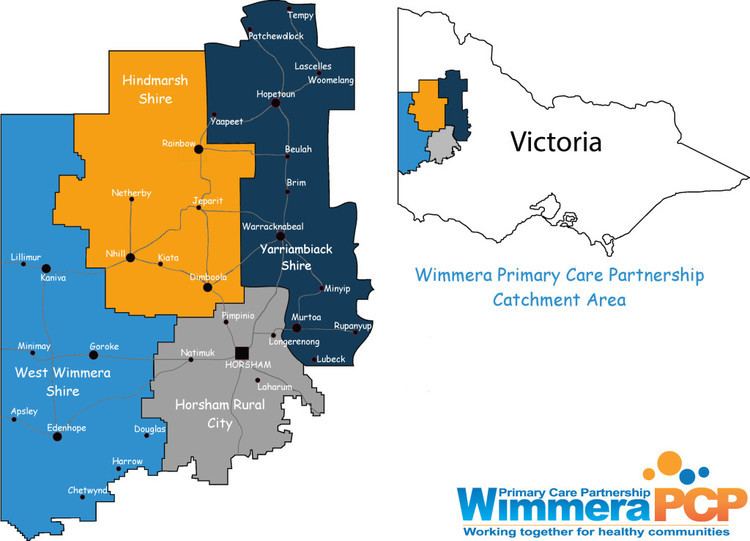
In the context of the Interim Biogeographic Regionalisation for Australia, the Wimmera is a sub–region of 2,145,380 hectares (5,301,300 acres) located within the Murray Darling Depression bioregion. The Wimmera is one of the nine districts in Victoria used for weather forecasting by the Australian Bureau of Meteorology. The Victorian Department of Environment and Primary Industries defines the district as a 30,000-square-kilometre (12,000 sq mi) region for agricultural production purposes encompassing the Buloke, Hindmarsh, Horsham City, Northern Grampians, West Wimmera and Yarriambiack local government areas.
At the 2011 census, the six local government areas (LGAs) that are thought to comprise the ill–defined district had a combined population of 54,645. The area of these same four LGAs is 41,963 square kilometres (16,202 sq mi).
Seeding wheat in the west wimmera may 2015
History
The area was first surveyed by Thomas Mitchell in the mid 1830s, and he is credited with naming the Grampians after a mountain range in his native Scotland, and naming the region as Wimmera, adapting a word from the local indigenous language meaning 'throwing stick'.
Regional development and population
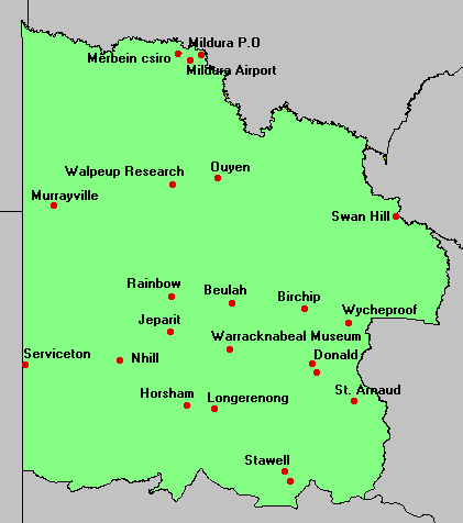
The area contains a number of important towns, such as Horsham, Warracknabeal, Dimboola, Stawell and Nhill. Almost all of these are largely dependent on the grain and sheep industries, and are usually dominated by flour mills and grain storage silos. The smaller towns in the area are dying due to the constantly declining value of the primary products that dominate the region's economy: modern farm technology allows individual farmers to stay viable by farming more land, but the lower population and better transport make smaller service centres less and less viable.
Climate
The climate is semi-arid to sub-humid, with annual rainfall ranging generally from 380 millimetres (15 in) in the north to 580 millimetres (23 in) in the south. In the Grampians, annual precipitation can be as high as 1,150 millimetres (45 in) and snowfalls are not uncommon. Most rain falls in winter, though heavy summer falls can occur, the most famous of which was the thunderstorm that dumped 133.2 millimetres (5.24 in) on Nhill in mid-January 1974.
Temperatures are hot in summer, ranging typically from a maximum of 30 °C (86 °F) to a minimum of 14 °C (57 °F), whilst extremes can be as high as 46 °C (115 °F). In the winter, maximums are 15 °C (59 °F), but mornings can be cool, averaging at Horsham 4 °C (39 °F).
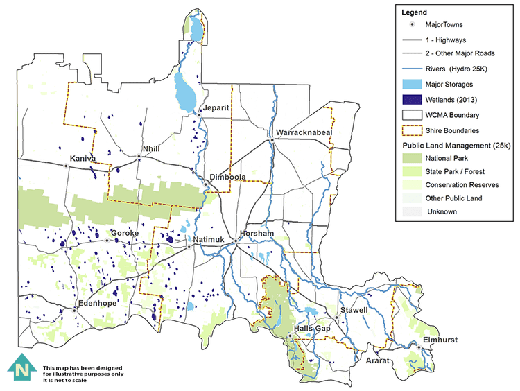
Geography
Most of the soils are very infertile and many are sandy; however in a narrow belt between Nhill and Warracknabeal there are heavy grey Vertisols, that, although still deficient in phosphorus, are otherwise free of major nutrient deficiencies and are able to hold water very well. These grey soils are the principal wheat soils of Victoria. Red-brown earths are also used for wheat but do not give as high yields and require more fertilisation.
The Wimmera River flows from the Grampians towards Lake Hindmarsh. Many streams in the region flow only after sustained heavy rainfall and are often dry for long spells. In fact, in recent years Rocklands Reservoir, the main water storage of the district, has become almost unviable due to a succession of dry years.
Natural heritage
The Wimmera is renowned for its natural heritage.
One of the key preservation areas is contained within the Grampians National Park, which possesses many unusual wildflowers and the greatest diversity of flora and fauna in Victoria west of the Snowy River. The Grampians also possess many important Aboriginal artifacts. A local Aboriginal name Gariwerd was adopted by the National Park in 1991 in recognition of this fact; however, this change was soon reversed after a change of state government in 1992.
The Little Desert National Park, south of Nhill and west of Dimboola, is a large wilderness area of sand dunes that were too infertile for productive farming even with superphosphate and trace elements.