
Population 81,544 (2011 census) Area 40,183 km² | State electorate(s) Mildura
Murray Plains Federal division Division of Mallee | |
 | ||
Lgas Shire of Buloke, Shire of Gannawarra, Rural City of Mildura, Rural City of Swan Hill | ||
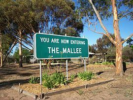
The Mallee is an ill–defined district, sometimes incorrectly referred to as an economic region, of the Australian state of Victoria. The district is located entirely within the Loddon Mallee region; and covers the most northwesterly district in the state bounded by the South Australian and New South Wales borders, inclusive of the Murray River.
Contents
- Map of Mallee NSW 2738 Australia
- Definitions
- Geography and climate
- Population
- Economic development
- References
Map of Mallee NSW 2738, Australia
Definitions of the district vary, however all are based on the Victorian distribution of mallee eucalypts. These trees dominate the surviving vegetation through most of Mallee, except for swamps and areas along waterways, and the very rare stands of intact Casuarina.
At the 2011 census, the four local government areas (LGAs) that are thought to comprise the ill–defined district had a combined population of 81,544. The area of these same four LGAs is 40,183 square kilometres (15,515 sq mi).
Definitions
In the context of the Interim Biogeographic Regionalisation for Australia, the Mallee is spread over parts of both the Murray Darling Depression and Riverina bioregions. Some definitions of the Mallee extend the district into South Australia, which is called Murray Mallee.
The Mallee is one of the nine districts in Victoria used for weather forecasting by the Australian Bureau of Meteorology.
The Victorian Department of Environment and Primary Industries defines the district as a 39,300-square-kilometre (15,200 sq mi) region for agricultural production purposes encompassing the Buloke, Gannawarra, Mildura City and Swan Hill City local government areas.
Another common definition is that the Mallee is the part of Victoria dependent on Mildura and Swan Hill.
The Victorian Government has historically had many departmental regions combining the Mallee with the greater Bendigo area, the current one being named the "Loddon Mallee" region. This region includes the Loddon River catchment and adjacent areas as well as the Mallee. This region is used by all state government departments, and often there is a central body for the region located in Bendigo. In 2005, there were attempts to push for a separate region in north-west Victoria in the belief that this would deliver more services to the district.
For tourism purposes, the term Wimmera Mallee is used to describe the Wimmera district and very small parts of the Mallee that are distant from the Murray River. A separate tourism district known as Mildura Swan Hill covers the rural cities of Mildura and Swan Hill.
Geography and climate
The Mallee is, for all practical purposes, completely flat and very low-lying: in fact for long geological periods the whole region has been inundated by the ocean. Most of the Mallee consists of sand dunes that have been deposited as a result of movement of sand from the interior of Australia during arid glacial periods of the Quaternary. The soils are generally very infertile and sandy: the better ones on more stabilised sand dunes in the east are slightly loamy and pink to light brown and have been able to support wheat and barley growing as a result of the development of superphosphate and other fertilisers. In the west the soils are unconsolidated sands, much less alkaline than in the east, and not generally able to support any grain cropping.
The Mallee has no surface drainage: the native vegetation has so high a rooting density that the rainfall of most years is easily absorbed and the porous sandy soils mean that any excess in an exceptionally wet year will recharge groundwater supplies which tend to be highly saline. Flow from the Wimmera River to the south supplies Lake Hindmarsh and, very occasionally (in 1918, 1956 and 1975), overflows to the north. The Murray River is, thus, the only source of fresh water for the region and is consequently overburdened by intensive irrigation.
The climate of the Mallee is the hottest and driest in Victoria owing to its inland location. Rainfall is usually only produced by the most vigorous frontal systems or by occasional penetration of tropical air in the summer. Average annual rainfall shows a well-defined north-south gradient: Mildura averages only 267.9 millimetres (10.55 in) per year but Hopetoun in the south receives around 370 mm (15 in). Variability, however, is quite high : in 1973 the Mallee averaged as much as 650 mm (26 in) but in 1982 only 115 mm (4.5 in). Temperatures in summer are generally very hot: during the Early 2009 southeastern Australia heat wave, Hopetoun reached 48.8 °C (119.8 °F) and the average maxima in January and February are 32.7 °C (90.9 °F). In July, maximum temperatures average 15.4 °C (59.7 °F), but minima average 4.4 °C (39.9 °F) and frosts are very common.
Population
At the 2011 census the Mallee had a population of 81,544, most of which live close to the Murray River in the district's two cities, Mildura and Swan Hill. These and other settlements within the municipalities based on these centres contain over two-thirds of the region's population. Hopetoun, Ouyen and Birchip are the major towns in the south.
^1 The Shire of Buloke is included in both the Mallee and the Wimmera districts; hence the imprecise definition.Economic development
The Mallee is a primarily agricultural region: apart from possible mineral sands in the west and salt from certain ephemeral lakes there are no mineral deposits of value and industry is generally on a small scale and confined to food processing. Wheat and barley are widely grown on the less infertile soils in the southeast of the region, but fertilizers, especially superphosphate are essential for success and yields only a quarter of those in most of Europe or North America - in drought years, they can be as little as one twentieth of European wheat yields.
Fruit growing along the Murray River has in modern times overshadowed grain crops as the Mallee's major source of revenue. Oranges and grapes are particularly important and the region produces a large part of Victoria's wine though most of it is inexpensive cask wines. Dairying on irrigated pastures is important in the south of the region, but is threatened by its high water demand and the extreme scarcity of water in the Murray-Darling Basin.
Tourism is also significant industry. Mildura and Swan Hill contain a number of tourism focused businesses, including a number of specially built attractions and festivals. The Murray itself is also a major attraction, many people coming to the district for fishing and to stay on houseboats. The many Mallee national parks - Wyperfeld, Hattah-Kulkyne and Murray Sunset National Parks, wilderness parks, state forests, and other parks over the river are also major drawcards.