
Length 81.3 km Existed 1964 – present | Constructed 1964 | |
 | ||
Washington state route 530 landslide anniversary 2015
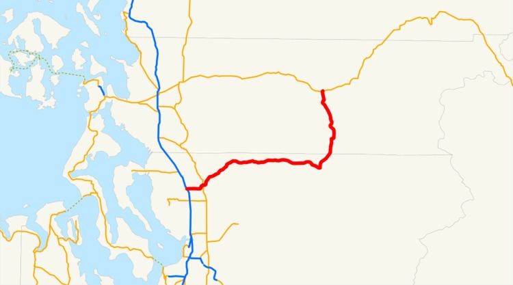
State Route 530 (SR 530) is a Washington state highway in Snohomish and Skagit counties. The 50.52-mile (81.30 km) long route runs northeast from an interchange with Interstate 5 (I-5) southwest of Arlington past SR 9 in Arlington and Darrington to end at SR 20 in Rockport. Serving the communities of Arlington, Arlington Heights, Oso, Darrington and Rockport, the roadway travels parallel to a fork of the Stillaguamish River from Arlington to Darrington, the Sauk River from Darrington to Rockport and a BNSF Railway route that extends from Arlington to Cicero, located west of Oso.
Contents
- Washington state route 530 landslide anniversary 2015
- Map of WA 530 Washington USA
- Route description
- Former route 19641991
- History
- References
Map of WA-530, Washington, USA
The first segment of SR 530 to appear on a map was a road extending from Arlington to Oso in 1899. The first segment to be state-maintained was Secondary State Highway 1E (SSH 1E), which ran from Conway to Arlington. SSH 1E was extended to Darrington in 1957 and later renumbered to SR 530 in 1964; the road was extended to Rockport in 1983 and later the route from Conway to I-5 was removed from the system in 1991. Since 1991, minor construction projects arranged by the Washington State Department of Transportation (WSDOT) have improved the roadway and WSDOT plans to realign the highway near the Sauk River.
Route description
State Route 530 (SR 530) begins at a diamond interchange with Interstate 5 (I-5) southwest of Arlington, 0.78 miles (1.26 km) south of where I-5 crosses the Stillaguamish River. After the interchange, the highway had a daily average of 22,000 motorists in 2007, which is significantly higher than in 1970 when 5,400 motorists used the stretch of road. From the interchange, the highway is named Jackson Road and travels east to intersect Smokey Point Boulevard, which travels south to Smokey Point and was once U.S. Route 99, a major north–south road. After passing the intersection, the roadway continues east through a primarily rural area until it curves north and later east to enter Arlington city limits. Within Arlington, SR 530 intersects SR 9, another north–south highway that the road has a brief concurrency with. After the concurrency, the highway is named Burke Avenue and intersects West Avenue, which was SR 9 before it was realigned to the current western alignment. The roadway becomes the Arlington–Darrington Road after bridging the Stillaguamish River and passing the Twin Rivers County Park, the road turns northeast into Arlington Heights.
In Trafton, which is located in Arlington Heights, SR 530 passes a residential area and a road that leads to the Jim Creek Naval Radio Station, a United States Navy facility. After leaving Trafton, the road crosses a railroad track used by the BNSF Railway before crossing the North Fork of the Stillaguamish River in Cicero. The highway crosses the tracks and the Stillaguamish River fork near Oso to continue east past several communities. The roadway turns southeast and passes the Darrington Municipal Airport to enter Darrington town limits. Once in Darrington, SR 530 becomes Seeman Street and goes east to an intersection with Seeman Street and Emmens Street. Emmens Street is also named the Mountain Loop Highway, which travels southwest to connect National Forest Route 20 and SR 92 in Granite Falls. At the intersection, the road turns north and leaves Darrington to follow the Sauk River. Outside of Darrington, the roadway travels north, briefly entering the boundaries of the Mount Baker National Forest and leaves Snohomish County. After entering Skagit County, SR 530 crosses the Sauk River and heads north to cross the Skagit River and end at an intersection with SR 20 in Rockport.
Former route (1964–1991)
From 1964 until 1991, SR 530 began at an interchange with I-5 in Conway and traveled southeast to I-5 again at the current western terminus and then followed the current route. The former routing, now called the Pioneer Highway, followed the Seattle–Vancouver, BC route of the Great Northern Railway served by the International from Conway to Silvana. The former route began at a diamond interchange with I-5 in Conway, which was also the western terminus of SR 534. From the interchange, the roadway traveled west to Fir Island Road, which travels west across the South Fork of the Skagit River to Fir Island. The road then turned south to parallel railroad tracks owned by the Great Northern Railway and also parallel the South Fork of the Skagit River. At Milltown, SR 530 intersected Milltown Road, which would later interchange with I-5 to the east. South of Milltown and west of Lake Ketchum, the route crossed into Snohomish County. After crossing into Snohomish County and passing Lake Ketchum, SR 530 traveled south to a junction with the Old Pacific Highway and turned southeast into North Stanwood. The highway exited North Stanwood to enter Stanwood, where it intersected SR 532. The roadway curved southeast and passed Sunday Lake, some residential areas and Norman before entering Silvana. After Silvana, the road continued southeast and later eastward to interchange with I-5.
History
The current route of SR 530 first appeared on a map around 1899, when a road following the North Fork of the Stillaguamish River ended east of Oso. A map published in 1911 showed a road traveling from Conway southeast past Stanwood and Arlington towards Oso and Darrington. The first state-maintained highway that used a section of the current roadway was Secondary State Highway 1E (SSH 1E), which was established in 1937 during the creation of the Primary and secondary highways; SSH 1E ran from an intersection with Primary State Highway 1 (PSH 1) in Conway south to what would become SSH 1Y in 1945 in Stanwood (then called East Stanwood) and east past PSH 1 again to SSH 1A in Arlington. SSH 1E was later extended in 1957 past SSH 1A in Arlington to the Mountain Loop Highway in Darrington, which had been finished by late 1941.
During the 1964 highway renumbering, SSH 1E became SR 530, SSH 1A became SR 9 and SSH 1Y became SR 532; from 1964 until 1983, SR 530 was 49.07 miles (78.97 km) long. On December 26, 1980, SR 530 was closed between Stanwood and Silvana due to a flood that caused the Stillaguamish River to overflow from its banks, which the highway parallels. The roadway was extended 18.64 miles (30.00 km) north from Darrington to SR 20 in Rockport, making the highway a total of 68.34 miles (109.98 km) and both termini being in Skagit County. SR 530 was later shortened 16.98 miles (27.33 km), moving the western terminus to an interchange with I-5 southwest of Arlington.
Since being shortened, five minor construction projects, arranged by the Washington State Department of Transportation (WSDOT), have occurred. The confluence of the Sauk and Suiattle rivers have eroded the riverbank that supports the road north of Darrington. Wilder Construction Inc. of Bellingham was hired by WSDOT to stabilize the riverbank to prevent the highway collapsing into the river. The project was completed in December 2007 and took place between Darrington and Rockport. A temporary rock wall was also constructed to protect SR 530 and will be removed once WSDOT realigns the highway north of Darrington, which is expected to be completed after 2011.
On March 22, 2014, a three-mile section of SR 530 in northern Snohomish County, roughly midway between Darrington and Arlington, was completely blocked by the Oso landslide. The highway was cleared enough by May 31 to open one lane of escorted traffic. Because the highway was badly damaged, and because the topography of the area had been altered by the landslide, WSDOT decided to elevate that section of the highway when it was rebuilt. As of July 27, 2014, the first of four stages in rebuilding the highway had been completed. The new roadway was opened September 22, and the project is expected to be finished in early October 2014.