
Country United States County Snohomish Area code 360 Exchange: 436 Elevation 169 m Population 1,362 (2013) | Time zone Pacific (PST) (UTC-8) FIPS code 53-16690 Zip code 98241 Local time Friday 2:02 PM | |
 | ||
Weather 6°C, Wind S at 13 km/h, 84% Humidity | ||
Darrington is a town in Snohomish County, Washington, United States. The population was 1,347 at the 2010 census.
Contents
- Map of Darrington WA 98241 USA
- History
- Geography
- 2010 census
- 2000 census
- Education
- Notable person
- Recreation
- References
Map of Darrington, WA 98241, USA
History
The upper Stillaguamish valley where Darrington is located was once settled by the local Sauk-Suiattle Tribes in the drainage of the Sauk, Suiattle and Whitechuck rivers abundant in salmon and other fish. In 1870 a group of surveyors working for the Northern Pacific railroad came to the area to chart a pass over the Cascade Mountains to the Wenatchee Valley. Although a suitable route was found, the railroad chose a route further south. Gold was discovered at Monte Cristo in the summer of 1889 and prospectors began to flood into the Cascade Mountains. A road was punched in to Monte Cristo from Sauk City on the Skagit River. The location of where Darrington is now became a half-way point on the road, then a boomtown called "Starve Out".
At one point called "The Portage", the town was renamed Barrington in 1895 following a community meeting. The U.S. Postal Department mistakenly changed the first letter to a "D", resulting in the current name.
The Northern Pacific railroad branch from Arlington reached Darrington on June 1, 1901. This opened up the possibilities for timber harvesting. Several sawmills started up in the area and with them small towns and communities. Over the years most of the small mills have closed or merged with the mill in town, Hampton Lumber Mill which is the largest employer in Darrington. The Northern Pacific railroad was abandoned in 1991 and the tracks were pulled in 1994 to begin construction for the Whitehorse Rails to Trails.
Darrington was officially incorporated on October 15, 1945 and this was the same year that the first Town Hall was built. The new Town Hall housed the City clerk and Mayor, Fire department, library and community center with a dance floor. The following year the community came together to raise money for a new fire truck. This fundraiser was named the Timberbowl and the tradition lasted for several decades. Timber harvesting is still a very important part of the Darrington economy. Many people come out to enjoy the camping and trails of Darrington's surrounding wilderness areas, Boulder River Wilderness, Henry M. Jackson Wilderness and the Glacier Peak Wilderness.
The site of the 2014 Oso mudslide, one of the worst disasters of its kind in the history of the United States, is 12 miles (19 km) west of Darrington. Partly in reaction to the mudslide, the United States House and Senate both passed the Green Mountain Lookout Heritage Protection Act, a bill that would protect a lookout building in that area, an important draw for local tourism.
Geography
Darrington is located at 48°15′8″N 121°36′14″W (48.252260, -121.603876).
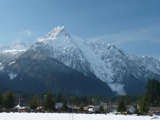
According to the United States Census Bureau, the town has a total area of 1.67 square miles (4.33 km2), of which, 1.65 square miles (4.27 km2) is land and 0.02 square miles (0.05 km2) is water. The town is surrounded by mountains, the highest of these mountains is Whitehorse with an elevation of 6,852 feet to the southwest. The elevation of the town is only at 554 feet and there are three roads that give you access through the North Cascades from Darrington. To the south is the Mountain Loop Highway, a Forest Service Scenic By way which connects to Granite Falls at 56 miles. SR 530 takes you north from Darrington along the Sauk River to Rockport. The closest town to Darrington is Arlington which is a 27-mile drive west on SR 530 paralleling the Stillaguamish River and Whitehorse Rails to Trails. Back before the "new" SR 530 connected Darrington to the valley below, it was an all day trip to drive to Everett. The term "Going Down Below" is still widely used among the community meaning going out of town.
2010 census
As of the census of 2010, there were 1,347 people, 567 households, and 349 families residing in the town. The population density was 816.4 inhabitants per square mile (315.2/km2). There were 644 housing units at an average density of 390.3 per square mile (150.7/km2). The racial makeup of the town was 92.4% White, 2.4% Native American, 0.4% Asian, 0.5% from other races, and 4.2% from two or more races. Hispanic or Latino of any race were 3.2% of the population.
There were 567 households of which 30.9% had children under the age of 18 living with them, 44.8% were married couples living together, 9.5% had a female householder with no husband present, 7.2% had a male householder with no wife present, and 38.4% were non-families. 32.6% of all households were made up of individuals and 13.1% had someone living alone who was 65 years of age or older. The average household size was 2.37 and the average family size was 2.96.
The median age in the town was 41.4 years. 22.7% of residents were under the age of 18; 7.7% were between the ages of 18 and 24; 24.9% were from 25 to 44; 28.1% were from 45 to 64; and 16.6% were 65 years of age or older. The gender makeup of the town was 50.9% male and 49.1% female.
2000 census
As of the 2000 census, there were 1,136 people, 473 households, and 292 families residing in the town. The population density was 1,171.9 people per square mile (452.2/km²). There were 505 housing units at an average density of 520.9 per square mile (201.0/km²). The racial makeup of the town was 94.98% White, 1.67% Native American, 0.35% Asian, 0.26% from other races, and 2.73% from two or more races. Hispanic or Latino of any race were 1.23% of the population.
There were 473 households out of which 30.9% had children under the age of 18 living with them, 49.0% were married couples living together, 8.7% had a female householder with no husband present, and 38.1% were non-families. 31.7% of all households were made up of individuals and 14.6% had someone living alone who was 65 years of age or older. The average household size was 2.40 and the average family size was 3.08.
In the town, the age distribution of the population shows 27.1% under the age of 18, 6.9% from 18 to 24, 27.5% from 25 to 44, 21.9% from 45 to 64, and 16.6% who were 65 years of age or older. The median age was 38 years. For every 100 females there were 96.9 males. For every 100 females age 18 and over, there were 97.6 males.
The median income for a household in the town was $32,813, and the median income for a family was $44,063. Males had a median income of $36,429 versus $25,625 for females. The per capita income for the town was $17,384. About 4.7% of families and 8.9% of the population were below the poverty line, including 10.9% of those under age 18 and 6.6% of those age 65 or over.
Education
The Darrington School District educates approximately 570 children each year on a single K-12 campus. The Parent Teacher Student Association is very involved in the local schools. School assemblies are held several times a year where students are awarded for academic achievements as well as constructive behavior. There is also a drama club for the high school and middle school. They do two performances a year.
The mascot for the school is the Darrington Loggers, named after the industry on which the town was built. Darrington has consistently fielded highly competitive teams for both boys' and girls' sports. The sports available to Darrington students include football, basketball, baseball, volleyball, tennis, and wrestling. The sports in Darrington are coached by both teachers who are on staff at the school and by local townspeople. When hiring coaches, employees of the school district are given priority over non-employees. In 1981, the Darrington Loggers won the State B Championship for baseball. The Loggers are also very successful in other sports as well.
Darrington Elementary School has approximately 264 students. 49.6% of the students receive free or reduced-price meals. Special education students make up 18.3%. There are 20 classroom teachers, and the average years of teacher experience is 20. In addition, 80% of the teachers at Darrington Elementary hold a master's degree. Dan Rankin is currently the mayor.
Because of this financial hardship of an already poverty stricken district, all Middle School sports are planning to be cut, as the district cannot afford the costs associated with them anymore. There will also be educational cuts, what those are have not been released yet.
Notable person
Recreation
The area surrounding Darrington houses tremendous recreational opportunities. Hiking, fishing, rafting and rock climbing are some of the activities that take place nearby. In early 2014 a craft brewery "Whiskey Ridge Brewing Company" became the first craft brewery in Darrington. It was located in the historic Old City Town Hall building but moved to Arlington in 2015 and is located at 116 E 5th Street, Arlington.