
Country United States Area code 360 Elevation 35 m Population 18,664 (2013) | Time zone PST (UTC-8) FIPS code 53-02585 Zip code 98223 Local time Wednesday 5:51 AM | |
 | ||
Weather 6°C, Wind S at 18 km/h, 70% Humidity | ||
Arlington is a city in northern Snohomish County, Washington, United States, bordered by the city of Marysville to the south. The population was 17,926 at the 2010 census.
Contents
- Map of Arlington WA USA
- History
- Geography
- 2010 census
- 2000 census
- Climate
- Timber
- Railroad
- Farming
- Aviation
- Notable aviation accidents
- Medical
- Smokey Point
- Gleneagle
- High Clover Park
- Arlington Heights
- References
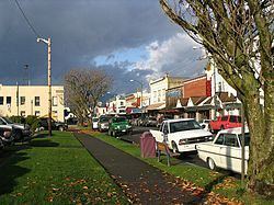
Map of Arlington, WA, USA
History
Prior to European settlement, the area was long inhabited by indigenous peoples. Their historic descendants have identified as the Stillaquamish Tribe.
Arlington was platted by European Americans in 1900, and was named after Lord Henry Arlington, a member of the cabinet of King Charles II of England. Haller City was a nearby town founded April 24, 1890, by Theodore Haller and his parents Henrietta and Granville O. Haller. When Arlington was incorporated as a city in May 5, 1903, it included Haller City. Arlington is home to the Stillaguamish Valley Pioneer Museum.
Geography
According to the United States Census Bureau, the city has a total area of 9.26 square miles (23.98 km2), of which, 9.25 square miles (23.96 km2) is land and 0.01 square miles (0.03 km2) is water.
2010 census
As of the census of 2010, there were 17,926 people, 6,563 households, and 4,520 families residing in the city. The population density was 1,937.9 inhabitants per square mile (748.2/km2). There were 6,929 housing units at an average density of 749.1 per square mile (289.2/km2). The racial makeup of the city was 85.6% White, 1.2% African American, 1.4% Native American, 3.3% Asian, 0.3% Pacific Islander, 3.9% from other races, and 4.2% from two or more races. Hispanic or Latino of any race were 9.5% of the population.
There were 6,563 households of which 40.3% had children under the age of 18 living with them, 50.7% were married couples living together, 12.6% had a female householder with no husband present, 5.6% had a male householder with no wife present, and 31.1% were non-families. 24.0% of all households were made up of individuals and 10.2% had someone living alone who was 65 years of age or older. The average household size was 2.70 and the average family size was 3.21.
The median age in the city was 34.3 years. 28.3% of residents were under the age of 18; 8.7% were between the ages of 18 and 24; 29.2% were from 25 to 44; 22.4% were from 45 to 64; and 11.3% were 65 years of age or older. The gender makeup of the city was 48.6% male and 51.4% female.
2000 census
As of the census of 2000, there were 12,750 people, 4,281 households, and 3,095 families residing in the city. The population density was 1,548.4 people per square mile (598.2/km²). There were 4,516 housing units at an average density of 597.0 per square mile (230.6/km²). The racial makeup of the city was 90.01% White, 1.13% African American, 1.04% Native American, 2.20% Asian, 0.32% Pacific Islander, 2.47% from other races, and 2.83% from two or more races. Hispanic or Latino of any race were 5.83% of the population.
There were 4,281 households out of which 42.6% had children under the age of 18 living with them, 56.7% were married couples living together, 11.5% had a female householder with no husband present, and 27.7% were non-families. 22.7% of all households were made up of individuals and 9.3% had someone living alone who was 65 years of age or older. The average household size was 2.72 and the average family size was 3.19.
In the city, the age distribution of the population shows 31.5% under the age of 18, 8.0% from 18 to 24, 32.6% from 25 to 44, 18.4% from 45 to 64, and 9.6% who were 65 years of age or older. The median age was 32 years. For every 100 females there were 93.3 males. For every 100 females age 18 and over, there were 91.2 males.
The median income for a household in the city was $40,000, and the median income for a family was $51,941. Males had a median income of $41,517 versus $26,912 for females. The per capita income for the city was $19,146. About 5.8% of families and 7.2% of the population were below the poverty line, including 9.2% of those under the age of 18 and 10.4% of those age 65 and older.
Climate
According to the Köppen climate classification system, Arlington has a warm-summer Mediterranean climate (Csb).
Timber
From its founding, Arlington had an economy based on timber harvesting and processing, and timber products. It was once dubbed the "Shingle Capital of the World," with numerous logging camps, sawmills, and shingle mills in the vicinity.
Railroad
Historically, Arlington developed as a railroad town with several different rail connections. It was located on the Northern Pacific(NP) mainline that stretched from the Canada–US border through Sedro-Woolley to Snohomish, Washington. Arlington also had a branch line running east to Darrington, which primarily carried timber products.
Both of these lines were abandoned in the 1980s by NP's successor Burlington Northern, due to declining traffic and national restructuring of the industry. While the railroad is not as important to the city's economy as formerly, Arlington still maintains a rail connection with BNSF Railways via a spur line. Various trestles and railroad signal equipment are still in place.
Snohomish County is in the process of converting the abandoned rail right-of-way into bike/hike trails under the federal Rails to Trails program.
Farming
Aviation
The city owns the Arlington Municipal Airport, located three miles (5 km) southwest of Arlington. It stages the annual Arlington Fly-In, which draws aircraft from all across the US and Canada.
Notable aviation accidents
On October 19, 1959 a Boeing 707-227 (registration N7071) crashed on a Stillaguamish River bed northeast of the city. It was the first of five Boeing 707s intended for delivery to Braniff International Airways. A Boeing test pilot and a Braniff captain were killed in an emergency landing after three of the aircraft's four engines were torn off during a training maneuver.
Medical
Smokey Point
Smokey Point is a busy residential, commercial, and industrial community. The northeast portion of this community was annexed by Arlington in 1999.
Gleneagle
The largest planned development in Arlington, Gleneagle is a 1,037-unit neighborhood and HOA built in and around the Gleneagle Golf Course. Consisting of single-family homes and townhouses, Gleneagle was developed primarily from 1987 through 2002; it houses approximately 30% of Arlington's population.
High Clover Park
High Clover Park is a planned neighborhood and development, consisting of 162 single family homes. It is situated northwest of the Arlington Municipal Airport.
Arlington Heights
Arlington Heights is a residential area situated east of Arlington on the triangular raised plateau bordered on the east by the Cascade Mountains, on the northwest by the North Fork of the Stillaguamish River, and on the southwest by the South Fork of the Stillaguamish River. In the Cascade foothills east of Arlington Heights is the Jim Creek Naval Radio Station, a very low frequency radio array for communication with submarines. It is largely decommissioned but still in use as a recreation facility by Navy personnel and families. Arlington Heights is outside the municipal boundaries of Arlington, but its residents have Arlington postal addresses and their children attend Arlington schools. Some areas in Arlington Heights have excellent views of Whitehorse and Three Fingers mountains.