
- elevation 6,077 ft (1,852 m) - min 430 cu ft/s (12.2 m/s) Mouth Sauk River | - elevation 377 ft (115 m) Source Suiattle Glacier Country United States of America | |
 | ||
- average 1,750 cu ft/s (49.6 m/s) - max 30,700 cu ft/s (869.3 m/s) | ||
The Suiattle River is a river in the U.S. state of Washington.
Contents
- Map of Suiattle River Washington USA
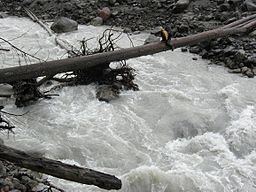
- Dupont crosses suiattle river on the pct in wa
- CourseEdit
- TributariesEdit
- References
Map of Suiattle River, Washington, USA
Dupont crosses suiattle river on the pct in wa
CourseEdit
The Suiattle River originates from the Suiattle Glacier on the east slopes of Glacier Peak in the Cascade Range. It flows generally northwest to join the Sauk River north of Darrington. The Sauk River in turn joins the Skagit River, which empties into Skagit Bay, part of Puget Sound. It is a National Wild and Scenic River.
TributariesEdit
The Suiattle's largest tributaries include Chocolate Creek, entering the river's upper reaches, Dusty Creek, Sulpher Creek and Downey Creek. Image Lake is in the river's drainage basin.
References
Suiattle River Wikipedia(Text) CC BY-SA