
Basin area 1,813 km² Length 108 km | - elevation 0 m (0 ft) Basin area 1,813 km² Bridges Mark Clark Bridge | |
 | ||
Cities | ||
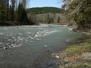
Oso tree house over the north fork of the stillaguamish river washington
The Stillaguamish River is a river in northwest Washington in the United States. It is mainly composed of two forks, the longer North Fork Stillaguamish (45 miles (72 km)) and the South Fork Stillaguamish. The two forks join near Arlington. From there the Stillaguamish River proper flows for 22 miles (35 km) to Puget Sound. The river's watershed drains part of the Cascade Range north of Seattle.
Contents
- Oso tree house over the north fork of the stillaguamish river washington
- Map of Stillaguamish River Washington USA
- Swimming at the stillaguamish river
- CourseEdit
- Natural historyEdit
- HydrologyEdit
- HistoryEdit
- References
Map of Stillaguamish River, Washington, USA
Swimming at the stillaguamish river
CourseEdit
The Stillaguamish River is formed from the confluence of the North and South Forks, both of which rise in the Cascades. The North Fork rises as several branches in a remote area of Skagit County near Finney Peak, approximately 10 miles (16 km) north of Darrington. Collecting many tributary creeks, the river flows south, then west through the foothills along the Skagit-Snohomish county line. Tributaries of the North Fork Stillaguamish River include Boulder River and Deer Creek.
The South Fork (30 miles (48 km)) rises near in central Snohomish County, 20 miles (32 km) south of Darrington, and flows west and northwest by Silverton, Verlot, and Granite Falls.
The two forks unite at Arlington in northwestern Snohomish County. The combined stream flows west, entering the north end of Port Susan, an arm of Puget Sound, approximately 10 miles (16 km) west of Arlington. Between the North and South Forks there is a portion of the Mount Baker-Snoqualmie National Forest called the Boulder River Wilderness.
Natural historyEdit
The Stillaguamish River and its tributaries are known for their salmon runs. Eight salmonid species use the streams for spawning, including chinook, coho, chum, pink, and sockeye salmon, steelhead trout, sea-run cutthroat, and bull trout.
HydrologyEdit
The north fork of the Stillaguamish river level is monitored by gauges operated by the USGS, and river levels can vary by as much as 13 vertical feet. The river level rises and falls very quickly, with the average north fork flood duration of 8 hours. Of the 5 highest north fork flood levels on record, 3 of them have occurred since 2009.
HistoryEdit
Variant names for the Stillaguamish River, according to the USGS, include Tuxpam River, Stoh-luk-whahmpsh River, Stillaquamish River, Steilaguamish River, Stalukahamish River, and other similar spellings.
The Oso landslide occurred on the North Fork of the Stillaguamish.