
Country State | Languages spoken Hindi, English District | |
 | ||
Map of Warisaliganj
Warisaliganj is a Town and a Nagar Panchayat in Nawada district, in the Indian state of Bihar.
Contents
- Map of Warisaliganj
- Flood in india 2014 rajapur warisaliganj nawada
- Warisaliganj
- History
- Geography
- Demographics
- Administration
- Economy
- Banks
- Education
- Places
- Transport
- Rail Network
- Road Network
- Air
- References
Flood in india 2014 rajapur warisaliganj nawada
Warisaliganj
History
Warisaliganj, to the north of Nawada, was founded by Waris Ali Khan, a member of the Kamgar Khan's Mayi Family during Zamindar system. Waris-ali-ganj, the name is some time spelt Warsaliganj from an erroneous belief that it was named after Mr. Worseley, a former Deputy Magistrate of Nawada. Earlier it was a village called Chakdharampur.
Geography
Warisaliganj is located at 25.01°N 85.63°E / 25.01; 85.63. It has an average elevation of 68 metres (223 feet).The area comes under one of the most fertile zones of the state with well-irrigated landscapes by sakri river and its canals system.
Demographics
As of 2011 India census, Warisaliganj Nagar Panchayat has population of 34,056 of which 17,874 are males while 16,182 are females as per report released by Census India 2011. Population of Children with age of 0-6 is 5536 which is 16.26% of total population of Warisaliganj (NP). In Warisaliganj Nagar Panchayat, Female Sex Ratio is of 905 against state average of 918. Moreover, Child Sex Ratio in Warisaliganj is around 953 compared to Bihar state average of 935. Literacy rate of Warisaliganj town is 69.72% higher than state average of 61.80%. In Warisaliganj, Male literacy is around 77.43% while female literacy rate is 61.12%.Schedule Caste (SC) constitutes 11.95% while Schedule Tribe (ST) were 0.20% of total population in Warisaliganj (NP) Hindi, Magahi and Urdu are the main languages spoken in the area. Angika and Maithili are also used by some people.
Administration
The Warisaliganj town is divided into 20 wards for which elections are held every 5 years. The Nagar Panchayat has total administration over the houses to which it supplies basic amenities like water and sewerage. It is also authorized to build roads within Nagar Panchayat limits and impose taxes on properties coming under its jurisdiction. Warisaliganj is also part of the Warisaliganj legislative constituency of state of Bihar. The area consists of Pakri Barawan and Kashichak blocks included. It also comes under the Nawada Lok Sabha constituency. Aruna Devi is the incumbent MLA from the area to represent the legislative constituency of Warisaliganj.
Economy
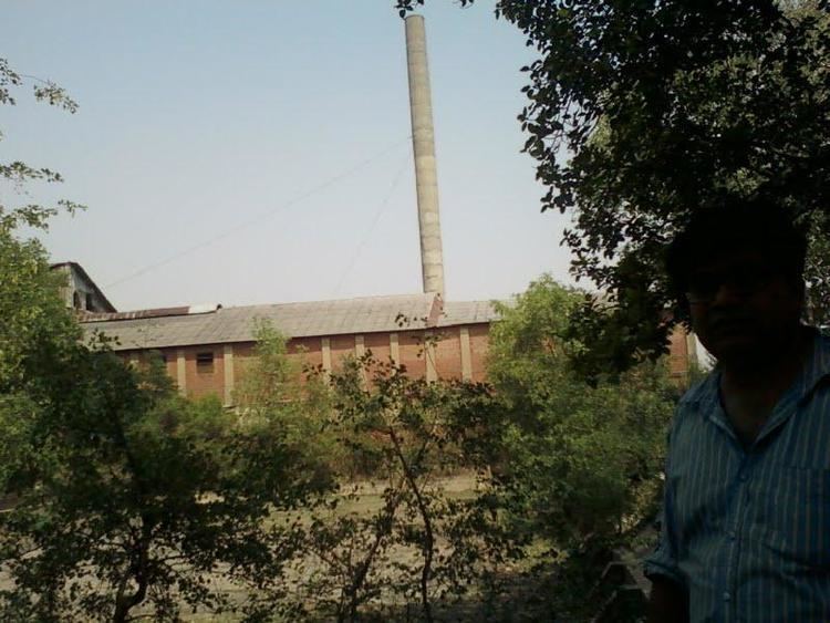
The market consists of several big and small merchants. Due to the Indian Railway's only Rack Point for Freight Wagons in the whole district, the town has many Wholesale spots. Warisaliganj was among one of the famous industry places in Bihar having sugar and cotton mills till few years ago. Nowadays the very famous Mohini sugar mill situated in the outskirts of town is closed due to unconsciousness of the leaders of the area whereas some active people are still working to restart the closed Mill.Some small scale industries are still present in different villages nearby.Warisaliganj is also famous for sweets like Tilkut, Khaja and Raskadam in the district.
Banks
Education
Warisaliganj town is very famous for education in the whole Nawada district as many renowned schools and colleges are situated here.
Schools and Colleges (Government and Private)
Places
The Town itself has got very less or no important places to visit.The famous Sun temple (Surya Mandir) is located on the outskirts of the town near administrative offices of the block. The place is used for celebrating all kinds of religious and spiritual events of the locality. The place also has the recently opened Sanskrit college opened in the campus.There is also a picnic spot called "Maafi Garh" in the outskirts of the town near referral hospital used by the locals on occasions like new year and Makar Sankranti. Apart from these the major tourist places nearby are Kakolat Falls, Rajgir, Bodhgaya, Pawapuri are located within 1-2 hours of journey.
Warisaliganj block area has got many old renowned places like Apsarh,Naromurar,Sarkatti etc. of historical background. The village Dariyapur Parvati six miles north of Warisaliganj has ruins and relic of Kapotika Bodh Bihar. In the centre stands a famous temple of Avalokiteshwer.King Aditaysen founded the historical monuments in the village Apsarh that is visible today.
The Village sarkatti is located 8 km from the Warisaliganj town and once the one of the highly decorated Estate during the Zamindari system.It is also known for the huge traditional houses owned by the members of the erstwhile Zamindar family.
Naromurar village 8 km far from the town. It is one of the ancient villages of India having a four hundred year older Thakur Wadi dedicated to Maryada Purushottam Ram and Lord Shiva. A giant 32 feet Hanumanta statue also exists in the Thakur Wadi premises which was built by saint Hanuman Das. There are three statues of lord Vishnu in the Makanpur village of Gupta period privately owned by Ram Ratan Prasad Singh Ratnakar an eminent scholar and writer.
Transport
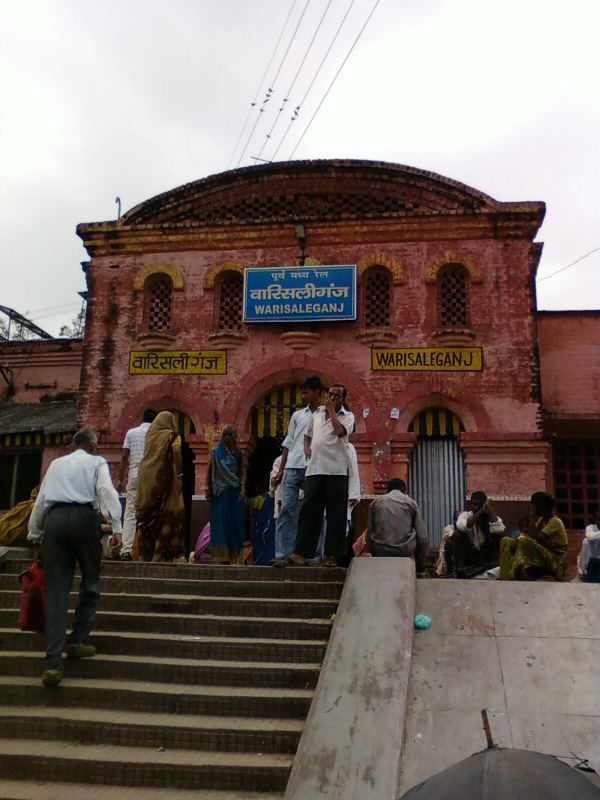
The town is well connected by all other parts of the state by roadways and railways.SH 83 passes through Warisaliganj Connecting Nawada and Sheikhpura districts. The very famous National Highway NH 20 which is part of the Asian Highway Network and AH42 is just 11 km by road connecting Patna and Ranchi. The other areas connected by roads are Nawada, Biharsharif, Patna, Rajgir, Pakri Barawan, Barbigha etc.Direct Buses for Ranchi, Dhanbad, Tata, Begusarai are also available through various famous transport providers. The town is also connected by the Indian Railway B.G. line through the Gaya–Kiul line of East Central Railway.Warisaliganj Railway Station is also one of the important rack point for Freight Wagons.For local transport, frequent Taxi facilities are provided by private vendors in and around the town.Rickshaws and Autos are major means of local transport within the town.
Rail Network
- Patna Railway Station → Gaya Railway Station → Warisaliganj Railway Station or Patna Railway Station → Kiul railway station → Warisaliganj Railway Station
Road Network
- From Meethapur Bus Stand or Gandhi Maidan Bus Stand, Patna to Warisaliganj
- From Meethapur Bus Stand or Gandhi Maidan Bus Stand, Patna to Nawada, from Nawada to Warisaliganj either by train or by bus
- From Meethapur Bus Stand or Gandhi Maidan Bus Stand, Patna to Bihar Sharif, from Bihar Sharif to Warisaliganj via NH 20
Air
By air,Warisaliganj is well connected to some of the popular airports of Bihar, Jharkhand and West Bengal and they are :
- Gaya Airport 89 kilometres (55 mi)
- Lok Nayak Jayaprakash Airport, Patna 113 kilometres (70 mi)
- Birsa Munda Airport, Ranchi 244 kilometres (152 mi)
- Netaji Subhas Chandra Bose International Airport, Kolkata 465 kilometres (289 mi)