
Established 1995 Lowest point 640 feet (200 m) Designation North Country Trail | Highest point 879 feet (268 m) Length 101,389 m | |
 | ||
Location Northwest Ohio United States Trailheads Parking available in all counties. Use Hiking, Bicycling, Cross Country Skiing, Equestrian Sights Oak Openings Preserve Metropark, Fraker Mill Covered Bridge | ||
Wabash cannonball trail
The Wabash Cannonball Trail is a rail to trail conversion in northwestern Ohio, U.S. It is 63 miles (101 km) long. The North Fork of the Wabash Cannonball Trail is part of the North Coast Inland Trail, which plans to fully connect Indiana to Pennsylvania, and portions of the trail are included in the North Country National Scenic Trail.
Contents
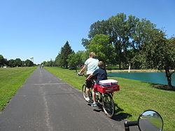
Wabash cannonball trail ride south fork
History
The Wabash Railroad line used by the trail was first built in 1855, and service continued until 1969. The Norfolk Southern Railway then purchased it. The rails were finally abandoned in 1990. Local enthusiasts developed the idea of creating a public recreational trail and utility corridor. On March 24, 1994, the corridor was purchased from Norfolk Southern.
The name Wabash Cannonball stems from an 1882 American folk song about an imaginary train. No train actually had the name until 1949, when the Wabash Railroad actually named its Detroit-St. Louis day train as the Cannon Ball.
Other rail-to-trail conversions of the Wabash Railroad in the Midwestern region include the Kiwanis Trail in Adrian, Michigan, the Wabash Heritage Trail in West Lafayette, Indiana, and the Wabash Trail in Sangamon County, Illinois.
North Fork
The northern section of the trail roughly parallels both the Ohio Turnpike I-80/90 and US Route 20A for about 43 miles (69 km) starting in Maumee, and extending through Monclova, Wauseon, and West Unity, ending at its western trailhead near Montpelier, Ohio.
South Fork
An additional 18-mile (29 km) spur runs from Maumee southwest to near Liberty Center, Ohio. That trailhead has a parking area near Whitehouse, Ohio.
Condition
All portions of the trail in Lucas County are paved. A 2-mile (3.2 km) section of the trail in Fulton County, owned by the city of Wauseon, also is paved. The remainder of the North Fork in Fulton and Williams counties are unpaved, as is the South Fork in Henry County.
Note that distance information about the trail differs slightly from one source to another based on whether missing sections of the trail are counted or not. Some sources say the north fork is 43 miles (69 km) (not counting missing sections), others say 45 miles (72 km) (counting the missing sections), and still others 47 miles (76 km) (counting detour mileage).