
Country USA Time zone Eastern (EST) (UTC-5) Zip code 43567 Population 7,303 (2013) | State Ohio Elevation 771 ft (235 m) | |
 | ||
Weather 12°C, Wind S at 23 km/h, 53% Humidity | ||
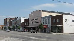
Wauseon is a city in and the county seat of Fulton County, Ohio, United States. The population was 7,332 at the 2010 census. It was named after Wauseon, a Potawatomi Native American chief who lived in the area before the founding of the state.
Contents
- Map of Wauseon OH 43567 USA
- History
- Geography
- 2010 census
- 2000 census
- Schools
- Library
- Medical Care
- Parks Attractions
- Notable people
- Radio
- Television
- References
Map of Wauseon, OH 43567, USA
History
The first seat of justice in the county was Ottokee, because of its central location in the county; a wooden courthouse was built in 1851. Wauseon was platted 1854 when the railroad was extended to that point. The village was incorporated in 1859. With the commercial success that the railroad brought to Wauseon, it was designated county seat in 1871. The Fulton County Courthouse was built in 1872.
Geography
Wauseon is located at 41°33′8″N 84°8′21″W (41.552230, -84.139126).
According to the United States Census Bureau, the city has a total area of 5.19 square miles (13.44 km2), of which 5.17 square miles (13.39 km2) is land and 0.02 square miles (0.05 km2) is water.
2010 census
As of the census of 2010, there were 7,332 people, 2,798 households, and 1,939 families residing in the city. The population density was 1,418.2 inhabitants per square mile (547.6/km2). There were 3,061 housing units at an average density of 592.1 per square mile (228.6/km2). The racial makeup of the city was 90.3% White, 0.9% African American, 0.3% Native American, 1.0% Asian, 5.2% from other races, and 2.3% from two or more races. Hispanic or Latino of any race were 14.2% of the population.
There were 2,798 households of which 38.0% had children under the age of 18 living with them, 51.4% were married couples living together, 13.1% had a female householder with no husband present, 4.8% had a male householder with no wife present, and 30.7% were non-families. 26.6% of all households were made up of individuals and 10.7% had someone living alone who was 65 years of age or older. The average household size was 2.58 and the average family size was 3.10.
The median age in the city was 35.4 years. 28.6% of residents were under the age of 18; 8.2% were between the ages of 18 and 24; 25.6% were from 25 to 44; 24.5% were from 45 to 64; and 13.1% were 65 years of age or older. The gender makeup of the city was 47.9% male and 52.1% female.
2000 census
As of the census of 2000, there were 7,091 people, 2,706 households, and 1,875 families residing in the city. The population density was 1,437.6 people per square mile (555.3/km²). There were 2,851 housing units at an average density of 578.0 per square mile (223.3/km²). The racial makeup of the city was 92.77% White, 0.55% African American, 0.37% Native American, 0.82% Asian, 0.01% Pacific Islander, 4.02% from other races, and 1.47% from two or more races. Hispanic or Latino of any race were 9.79% of the population.
There were 2,706 households out of which 37.9% had children under the age of 18 living with them, 63.0% were married couples living together, 12.2% had a female householder with no husband present, and 30.7% were non-families. 26.0% of all households were made up of individuals and 10.6% had someone living alone who was 65 years of age or older. The average household size was 2.58 and the average family size was 3.13.
In the city the population was spread out with 29.1% under the age of 18, 9.1% from 18 to 24, 28.8% from 25 to 44, 20.5% from 45 to 64, and 12.5% who were 65 years of age or older. The median age was 34 years. For every 100 females there were 88.7 males. For every 100 females age 18 and over, there were 85.1 males.
The median income for a household in the city was $39,591, and the median income for a family was $48,981. Males had a median income of $32,645 versus $24,042 for females. The per capita income for the city was $17,491. About 3.9% of families and 5.2% of the population were below the poverty line, including 6.5% of those under age 18 and 1.7% of those age 65 or over.
Schools
The school district is the Wauseon Exempted Village School District. This comprises:
Library
The library was originally funded by tycoon and entrepreneur Andrew Carnegie in 1906. In 2005, the library loaned more than 238,000 items to its 20,000 cardholders. Total holdings in 2005 were over 91,000 volumes with over 210 periodical subscriptions. From 2016-2017 the library underwent a major renovation, fixing the crumbling foundation of the library building. The library temporarily moved out to the former location of Bill's Lockeroom on Shoop Avenue until mid April of 2017 before moving back in to the original library building on Elm Street.
Medical Care
Fulton County Health Center is a rural critical access hospital that includes an emergency department with a heliport for medical evacuation.
Parks & Attractions
Notable people
Fulton County Expositor, a paper of Ohio Community Media
The Village Reporter
Radio
96.1 WMTR-FM
Television
INTV-Channel 5