
Elevation 4,215 m Prominence 128 m | First ascent 5 August 1819 | |
 | ||
Isolation 0.7 kilometres (0.43 mi) Similar Ludwigshöhe, Schwarzhorn, Parrotspitze, Signalkuppe, Balmenhorn | ||
Vincent pyramid
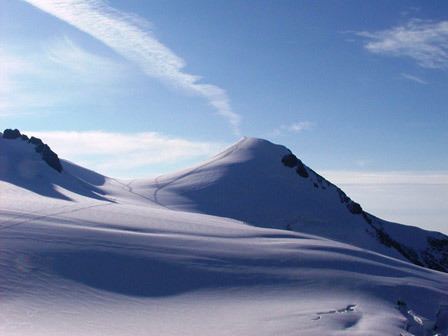
The Vincent Pyramid (Italian: Piramide Vincent, French: Pyramide Vincent) (4,215 m (13,829 ft)) is a mountain of the Pennine Alps, located on the border between the Italian regions of Aosta Valley and Piedmont. The Vincent Pyramid is one of the secondary summits of Monte Rosa. It lies south of the Ludwigshöhe, between the Lysgletscher and the Piode Glacier.
Contents
- Vincent pyramid
- Map of Vincent Pyramid 11020 Gressoney La TrinitC3A9 Aosta Valley Italy
- Monte rosa 2016 signalkuppe balmenhorn vincent pyramid
- References
Map of Vincent Pyramid, 11020 Gressoney-La-Trinit%C3%A9, Aosta Valley, Italy
The Vincent Pyramid summit was successfully climbed on 15 August 1819 by the brothers Nicolas (Johann Nikolaus) and Joseph Vincent from Gressoney-Saint-Jean, after whom the peak has been named.
Monte rosa 2016 signalkuppe balmenhorn vincent pyramid
References
Vincent Pyramid Wikipedia(Text) CC BY-SA