
Elevation 4,554 m Prominence 102 m | First ascent 9 August 1842 | |
 | ||
Easiest route Glacier tour via west flank, south-west ridge (F) Similar Zumsteinspitze, Parrotspitze, Ludwigshöhe, Vincent Pyramid, Monte Rosa (Dufourspitze) | ||
Signalkuppe punta gnifetti 4554m 04 08 2014
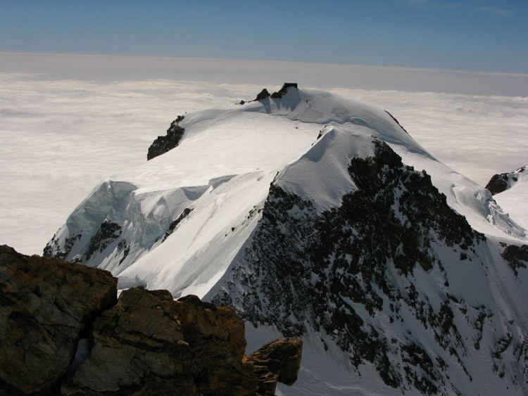
The Signalkuppe (in German, pronounced seen-yall-koo-pay) also known as Punta Gnifetti (in Italian) (4,554 m) is a peak in the Pennine Alps on the border between Italy and Switzerland. It is a subpeak of Monte Rosa. The mountain is named after 'the Signal', a prominent gendarme atop the east ridge, named Cresta Signal.
Contents
- Signalkuppe punta gnifetti 4554m 04 08 2014
- Map of Signalkuppe 28876 Macugnaga Province of Verbano Cusio Ossola Italy
- Signalkuppe capanna regina margherita 4554m
- References
Map of Signalkuppe, 28876 Macugnaga, Province of Verbano-Cusio-Ossola, Italy
The first ascent was made by Giovanni Gnifetti, a parish priest from Alagna Valsesia, together with J. Farinetti, C. Ferraris, C. Grober, J. and G. Giordiano and their porters on 9 August 1842.
The highest hut in Europe, the Margherita Hut (named after Italy's Queen consort Margherita of Savoy) lies on the summit of the mountain. Work started in 1890, supported by the Italian crown, and Queen Margherita opened it in 1893. The new hut, a high-altitude Faraday Cage, is clad in sheet copper to shield against unwanted electrical fields.