
Congressional district At-large Website unioncountysd.org Founded 1862 Unemployment rate 3.8% (Apr 2015) | Area 1,210 km² Population 14,829 (2013) | |
 | ||
Points of interest Sugar Daddy's Casino, Triple Crown Casino, Bulow Park | ||
Union County is a county located in the U.S. state of South Dakota. As of the 2010 census, the population was 14,399. Its county seat is Elk Point. Originally named Cole County, the named was changed to Union because of Civil War sentiment.
Contents
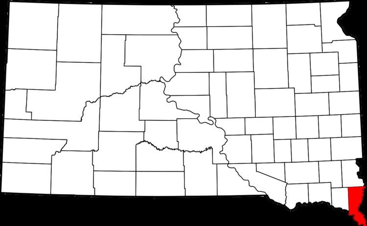
- Map of Union County SD USA
- Geography
- Major highways
- Adjacent counties
- Protected areas
- 2000 census
- 2010 census
- Cities
- Census designated places
- Unincorporated communities
- Ghost towns
- Townships
- Unorganized territory
- References
Map of Union County, SD, USA
Union County is part of the Sioux City, IA–NE–SD Metropolitan Statistical Area. Progressive Farmer rated Union County second in the 2006 "Best Place to Live" in the U.S., because "its schools are good, its towns neat and its people friendly."
Geography
According to the U.S. Census Bureau, the county has a total area of 467 square miles (1,210 km2), of which 461 square miles (1,190 km2) is land and 6.6 square miles (17 km2) (1.4%) is water. It is the fifth-smallest county in South Dakota by area.
Major highways
Adjacent counties
Protected areas
2000 census
As of the census of 2000, there were 12,584 people, 4,927 households, and 3,517 families residing in the county. The population density was 27 people per square mile (11/km²). There were 5,345 housing units at an average density of 12 per square mile (4/km²). The racial makeup of the county was 96.85% White, 1.34% Asian, 0.37% Native American, 0.01% Pacific Islander, 0.33% Black or African American, 0.24% from other races, and 0.87% from two or more races. 1.26% of the population were Hispanic or Latino of any race.
There were 4,927 households out of which 34.80% had children under the age of 18 living with them, 62.00% were married couples living together, 6.30% had a female householder with no husband present, and 28.60% were non-families. 24.20% of all households were made up of individuals and 10.30% had someone living alone who was 65 years of age or older. The average household size was 2.53 and the average family size was 3.02.
In the county, the population was spread out with 27.00% under the age of 18, 7.30% from 18 to 24, 28.40% from 25 to 44, 23.70% from 45 to 64, and 13.50% who were 65 years of age or older. The median age was 37 years. For every 100 females there were 99.20 males. For every 100 females age 18 and over, there were 98.30 males.
The median income for a household in the county was $44,790, and the median income for a family was $51,227. Males had a median income of $35,406 versus $23,440 for females. The per capita income for the county was $24,355. About 3.70% of families and 5.50% of the population were below the poverty line, including 4.90% of those under age 18 and 10.70% of those age 65 or over.
2010 census
As of the 2010 United States Census, there were 14,399 people, 5,756 households, and 4,043 families residing in the county. The population density was 31.3 inhabitants per square mile (12.1/km2). There were 6,280 housing units at an average density of 13.6 per square mile (5.3/km2). The racial makeup of the county was 95.5% white, 0.9% Asian, 0.7% black or African American, 0.6% American Indian, 0.1% Pacific islander, 0.7% from other races, and 1.6% from two or more races. Those of Hispanic or Latino origin made up 2.1% of the population. In terms of ancestry, 42.0% were German, 18.2% were Norwegian, 17.7% were Irish, 7.9% were English, 6.8% were Swedish, and 3.7% were American.
Of the 5,756 households, 32.8% had children under the age of 18 living with them, 58.9% were married couples living together, 7.5% had a female householder with no husband present, 29.8% were non-families, and 25.1% of all households were made up of individuals. The average household size was 2.49 and the average family size was 2.98. The median age was 40.2 years.
The median income for a household in the county was $59,889 and the median income for a family was $71,308. Males had a median income of $42,702 versus $31,993 for females. The per capita income for the county was $33,783. About 3.9% of families and 4.9% of the population were below the poverty line, including 4.3% of those under age 18 and 10.5% of those age 65 or over.
Cities
Census-designated places
Unincorporated communities
Ghost towns
Townships
The county is divided into thirteen townships:
Unorganized territory
The county contains one area of unorganized territory: Richland.