
Existed: 1926 – present Constructed 1926 | Length 158.9 km | |
 | ||
Major cities | ||
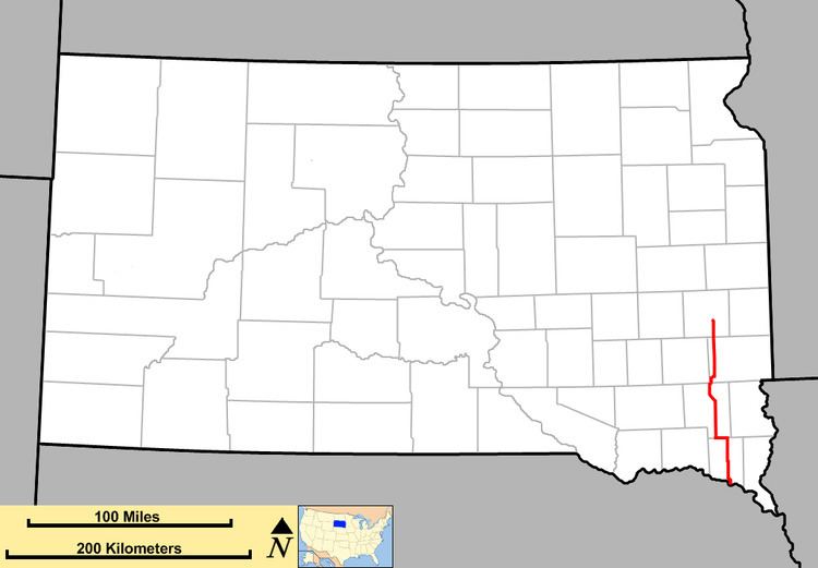
South Dakota Highway 19 is a state route located in east central and southeast South Dakota. It begins at the Nebraska border, as a continuation of Nebraska Highway 15. It runs northerly to South Dakota Highway 34 southeast of Madison. It is 100 miles (161 kilometers) in length.
Contents
Map of SD-19, South Dakota, USA
History
South Dakota 19 was implemented in 1926. Its alignment has remained the same during this period, with two exceptions.
The original routing in Turner County had SD 19 go northward into Centerville, then westward to meet its present routing. Around 1950, SD 19 was rerouted to follow South Dakota Highway 46 for 6 miles (9.7 km) before heading north again, resulting in a bypass of Centerville. The original route was designated as South Dakota Highway 19A.
In Clay County, SD 19 originally ended in Vermillion, at South Dakota Highway 50. The road was extended when the Vermillion-Newcastle Bridge over the Missouri River opened up in 2001. Previously, the nearest places to cross the river were at Yankton and Sioux City, Iowa.
Related routes
South Dakota Highway 19A is a short spur route in Turner County. It extends from South Dakota Highway 19 to South Dakota Highway 46 via Centerville. It is 8 miles (13 km) in length. The alignment of South Dakota 19A was originally a portion of South Dakota 19. Around 1950, the routing was changed so that SD 19 followed SD 46 for a 6-mile (9.7 km) stretch, bypassing Centerville. At that time, the original route was given the SD 19A designation. SD 19A is legally defined in South Dakota Codified Laws § 31-4-144.