
Congressional district At-large Website lincolncountysd.org Founded 1867 | Area 1,497 km² Population 49,858 (2013) | |
 | ||
Colleges and Universities Colorado Technical University, Globe University‑Sioux Falls, National American University, Minnesota School of Business Points of interest Blood Run Site, Lake Alvin, Great Plains Zoo, Washington Pavilion of Arts and, Great Bear Recreation Park | ||
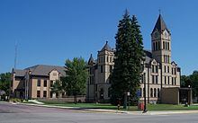
Lincoln County is a county located in the U.S. state of South Dakota. As of the 2010 census, the population was 44,828, making it the third-most populated county in the state. Its county seat is Canton. The county was named after Abraham Lincoln, 16th President of the United States.
Contents
- Map of Lincoln County SD USA
- Geography
- Lakes
- Protected areas
- Adjacent counties
- 2000 census
- 2010 census
- Cities
- Towns
- Census designated place
- Townships
- References
Map of Lincoln County, SD, USA
Lincoln County is included in the Sioux Falls, SD, Metropolitan Statistical Area.
It is one of the top 10 fastest-growing counties in the United States in terms of rate of population increase, rate of housing unit increase, and many other factors. This is due to the southward growth of Sioux Falls, and the expansion of its suburbs.
Geography
According to the U.S. Census Bureau, the county has a total area of 578 square miles (1,500 km2), of which 577 square miles (1,490 km2) is land and 0.5 square miles (1.3 km2) (0.08%) is water.
Lakes
Protected areas
Adjacent counties
2000 census
As of the census of 2000, there were 24,131 people, 8,782 households, and 6,665 families residing in the county. The population density was 42 people per square mile (16/km²). There were 9,131 housing units at an average density of 16 per square mile (6/km²). The racial makeup of the county was 97.55% White, 0.34% Black or African American, 0.53% Native American, 0.46% Asian, 0.02% Pacific Islander, 0.29% from other races, and 0.81% from two or more races. 0.70% of the population were Hispanic or Latino of any race.
There were 8,782 households out of which 41.00% had children under the age of 18 living with them, 66.50% were married couples living together, 6.70% had a female householder with no husband present, and 24.10% were non-families. 19.50% of all households were made up of individuals and 8.00% had someone living alone who was 65 years of age or older. The average household size was 2.72 and the average family size was 3.14.
In the county, the population was spread out with 29.70% under the age of 18, 7.60% from 18 to 24, 31.90% from 25 to 44, 20.40% from 45 to 64, and 10.40% who were 65 years of age or older. The median age was 34 years. For every 100 females there were 99.80 males. For every 100 females age 18 and over, there were 97.50 males.
The median income for a household in the county was $48,338, and the median income for a family was $55,401. Males had a median income of $34,486 versus $24,133 for females. The per capita income for the county was $22,304. About 3.20% of families and 4.40% of the population were below the poverty line, including 4.70% of those under age 18 and 7.80% of those age 65 or over.
2010 census
As of the 2010 United States Census, there were 44,828 people, 16,649 households, and 12,287 families residing in the county. The population density was 77.7 inhabitants per square mile (30.0/km2). There were 17,875 housing units at an average density of 31.0 per square mile (12.0/km2). The racial makeup of the county was 96.1% white, 1.0% Asian, 0.7% black or African American, 0.5% American Indian, 0.3% from other races, and 1.4% from two or more races. Those of Hispanic or Latino origin made up 1.2% of the population. In terms of ancestry, 47.1% were German, 20.9% were Norwegian, 11.7% were Irish, 7.2% were Dutch, 5.2% were English, and 3.9% were American.
Of the 16,649 households, 41.0% had children under the age of 18 living with them, 63.3% were married couples living together, 7.3% had a female householder with no husband present, 26.2% were non-families, and 20.2% of all households were made up of individuals. The average household size was 2.68 and the average family size was 3.11. The median age was 32.8 years.
The median income for a household in the county was $67,365 and the median income for a family was $75,231. Males had a median income of $43,537 versus $34,715 for females. The per capita income for the county was $33,261. About 2.7% of families and 4.3% of the population were below the poverty line, including 4.9% of those under age 18 and 7.5% of those age 65 or over.
Cities
Towns
Census-designated place
Townships
The county is divided into sixteen townships: