
Founded 1851 Largest city Sioux City Website www.woodbury-ia.com Population 102,130 (2013) Congressional district 4th | Named for Levi Woodbury Time zone Central: UTC-6/-5 Area 2,274 km² County seat Sioux City | |
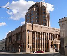 | ||
Cities Sioux City, Sergeant Bluff, Moville, Salix, Correctionville Colleges and Universities Western Iowa Tech Communi, Morningside College, Briar Cliff University, St Luke's College, Iowa School of Beauty Points of interest Sioux City Art Center, Sioux City Public Museum, Woodbury County Courthouse, Stone State Park, Lewis & Clark Interpretiv | ||
National register of historic places listings in woodbury county iowa top 5 facts
Woodbury County is a county located in the U.S. state of Iowa. As of the 2010 census, the population was 102,172. The county seat is Sioux City.
Contents
- National register of historic places listings in woodbury county iowa top 5 facts
- Map of Woodbury County IA USA
- History
- Geography
- Adjacent counties
- 2010 census
- 2000 census
- Politics
- Unincorporated communities
- Population ranking
- References
Map of Woodbury County, IA, USA
Woodbury County is included in the Sioux City, IA-NE-SD Metropolitan Statistical Area.
History
Originally established in 1851 as Wahkaw County, the Iowa Legislature in 1853 changed the name to Woodbury County in honor of Levi Woodbury (1789–1851), a senator and Governor of New Hampshire who served as a Supreme Court justice from 1844 until his death.
The first county seat of Wahkaw County was the now-extinct village of Thompsonville; when the Legislature changed the county name to Woodbury, the new county seat became Sergeant's Bluff (now Sergeant Bluff). The county seat was moved to Sioux City in 1856.
The Winnebago Tribe of Nebraska (Ho-Chunk) also owns reservation land in Woodbury County.
Geography
According to the U.S. Census Bureau, the county has a total area of 878 square miles (2,270 km2), of which 873 square miles (2,260 km2) is land and 4.9 square miles (13 km2) (0.6%) is water. It is the third-largest county by area in Iowa.
Adjacent counties
2010 census
The 2010 census recorded a population of 102,172 in the county, with a population density of 117.062/sq mi (45.1980/km2). There were 41,454 housing units, of which 39,052 were occupied.
2000 census
As of the census of 2000, there were 103,877 people, 39,151 households, and 26,426 families residing in the county. The population density was 119 people per square mile (46/km²). There were 41,394 housing units at an average density of 47 per square mile (18/km²). The racial makeup of the county was 87.48% White, 2.02% Black or African American, 1.69% Native American, 2.41% Asian, 0.04% Pacific Islander, 4.37% from other races, and 1.99% from two or more races. 9.11% of the population were Hispanic or Latino of any race.
There were 39,151 households out of which 34.00% had children under the age of 18 living with them, 51.90% were married couples living together, 11.30% had a female householder with no husband present, and 32.50% were non-families. 26.60% of all households were made up of individuals and 11.20% had someone living alone who was 65 years of age or older. The average household size was 2.58 and the average family size was 3.13.
In the county, the population was spread out with 27.30% under the age of 18, 10.20% from 18 to 24, 28.30% from 25 to 44, 20.80% from 45 to 64, and 13.40% who were 65 years of age or older. The median age was 34 years. For every 100 females there were 96.10 males. For every 100 females age 18 and over, there were 92.80 males.
The median income for a household in the county was $38,509, and the median income for a family was $46,499. Males had a median income of $31,664 versus $22,599 for females. The per capita income for the county was $18,771. About 7.20% of families and 10.30% of the population were below the poverty line, including 13.60% of those under age 18 and 7.40% of those age 65 or over.
Politics
Between 1988-2012 Woodbury County was the quintessential swing county in Iowa with no candidate winning by more than 3.5% over that quarter century. However, in 2016 Donald Trump dominated the county by a 20% margin, the largest margin of victory since Lyndon Johnson's landslide election in 1964.
Unincorporated communities
Population ranking
The population ranking of the following table is based on the 2010 census of Woodbury County.
† county seat