
Existed: 1926 – present Constructed 1926 | Length 260.4 km | |
 | ||
U s route 212 in minnesota leaving the twin cities
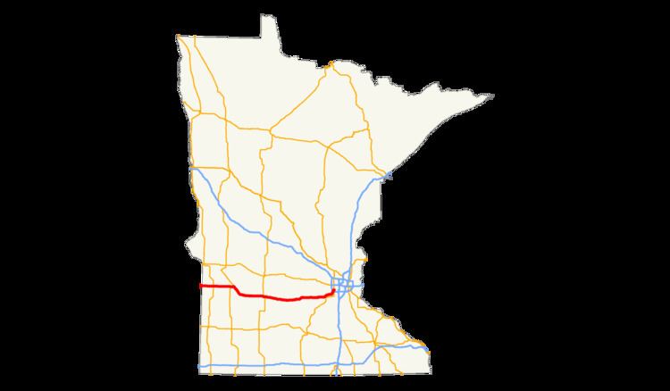
Within the U.S. state of Minnesota, U.S. Highway 212 (U.S. 212) travels from the South Dakota state line in the west, crossing the southwestern part of the state, to the Minneapolis – Saint Paul metropolitan area in the east, ending at its interchange with U.S. 169 and State Highway 62 in the Minneapolis suburb of Edina. U.S. 212 in Minnesota has an official length of 161.8 miles (260.4 km). It is an urban freeway within the Minneapolis – Saint Paul area, and is mostly a two-lane rural road elsewhere in the state.
Contents
- U s route 212 in minnesota leaving the twin cities
- U s route 212 in minnesota
- Route description
- South Dakota to Granite Falls
- Granite Falls to Glencoe
- Glencoe to the Twin Cities area
- Auto trails
- Designation as a US Highway
- Construction
- Highway 312
- Major intersections
- References
Prior to the establishment of the U.S. Highway system, most of the U.S. 212 corridor in Minnesota was part the transcontinental auto trail known as the Yellowstone Trail, which was established in 1917. U.S. 212 was established in 1926 but originally terminated at U.S. Highway 12 in the city of Willmar from 1926 to 1934. U.S. 212 was shifted to its current alignment around 1934, continuing slightly east of its current terminus to end at then U.S. 12 in Saint Paul until 1982, when U.S. 212 was truncated to Edina. In 2008, the Twin Cities portion of U.S. 212 was relocated to a new freeway (formerly designated as State Highway 312 from 2003 to 2008).
U s route 212 in minnesota
Route description
U.S. Highway 212 in Minnesota passes through seven counties in the southern part of the state, from the South Dakota state line to the Twin Cities area. It runs in straight east–west course from the South Dakota line across prairie land to the city of Montevideo. From there the route follows the valley of the Minnesota River to Granite Falls. It then leaves the Minnesota River valley to pass through farming areas until Glencoe, where the terrain gradually becomes more hilly as the road continues east. As the route approaches the Twin Cities, the road becomes a freeway running parallel to, but not within, the Minnesota River valley. U.S. 212 ends at the junction of U.S. 169 and State Highway 62 in the Minneapolis suburb of Edina.
The entire length of U.S. Highway 212 in Minnesota is officially designated the Minnesota Veterans Memorial Highway.
Legally, the Minnesota section of U.S. 212 is defined as Legislative Routes 155, 12, 187, and 260 in the Minnesota Statutes. The route is not marked with those numbers.
South Dakota to Granite Falls
U.S. 212 crosses into Minnesota from South Dakota, traveling through flat, open terrain. About 12 miles (19 km) from the state line, it intersects with U.S. Highway 75, then enters the small city of Dawson several miles later. U.S. 212 continues past Dawson through more fertile prairie land, eventually being joined by U.S. Highway 59. The overlapped routes pass by the entrance to Camp Release State Park, a 14-acre (57,000 m2) park where the former Sioux village of Chief Red Iron was located, and which also contains a 51-foot (16 m) granite monument commemorating the release of 269 prisoners from Sioux captivity. U.S. 212 and 59 split in the western edge of the city of Montevideo in the valley of the Minnesota River, with U.S. 59 heading northwest and U.S. 212 heading southeast. U.S. 212 follows the Minnesota valley for about thirteen miles (19 km) to the city of Granite Falls. In the center of the city, State Highway 23 joins U.S. 212 briefly as they cross the Minnesota River, with the two routes splitting soon after leaving the eastern city limits. The city of Granite Falls is known as being the hometown of Andrew Volstead, who authored the National Prohibition Act.
Granite Falls to Glencoe
East of Granite Falls, U.S. 212 leaves the Minnesota River valley, heading due east across a variety of farming areas in the south central portion of the state. For the next 28 miles (45 km), U.S. 212 passes through a series of small cities in this area: Sacred Heart, Renville, Danube, and Olivia. In Olivia, the county seat of Renville County, U.S. 212 meets with U.S. Highway 71. U.S. 212 continues due east through more farmland, again passing through a series of small cities that developed along the route. Through the next 30 miles (48 km) of the road, U.S. 212 goes through Bird Island, Hector (intersecting with State Highway 4), Buffalo Lake, Stewart and Brownton (intersecting with State Highway 15). Brownton, which is located on Buffalo Creek, is the site of the Sioux Uprising, one of the earliest massacres of white settlers in the region. Several miles later, U.S. 212 is joined by State Highway 22, U.S. 212 becomes a four-lane divided highway heading east into the city of Glencoe closely following Buffalo Creek. Highway 22 splits off to the north in downtown Glencoe, while U.S. 212 heads east out of the city.
Glencoe to the Twin Cities area
East of Glencoe, the terrain becomes progressively more hilly as U.S. 212 continues eastward. U.S. 212 is joined by State Highway 5 and State Highway 25 about eight miles (13 km) after leaving Glencoe. The three overlapped routes continue east into the city of Norwood Young America for about two miles (3 km), after which Highways 5 and 25 split off to the north in the center of the city. After leaving Norwood Young America, U.S. 212 becomes a two-lane road, passing by several lakes, then continues east for several miles to the city of Cologne, then into the community of Dahlgren. East of Dahlgren, U.S. 212 becomes a freeway as it heads into the Twin Cities area. The freeway runs along the northwest upland of the Minnesota River valley.
After the first interchange on the freeway with Jonathan Carver Parkway, U.S. 212 enters the city limits of Chaska. The road then curves to the north, crossing over Chaska Creek and interchanging with Engler Boulevard, before turning northeastward. The freeway meets with State Highway 41. Less than two miles (3 km) later, the freeway enters the city of Chanhassen, where it has two interchanges and passes by several lakes. U.S. 212 then crosses into Hennepin County and into the city of Eden Prairie. U.S. 212 is joined by State Highway 5 in Eden Prairie for about 1.5 miles (2.4 km) as they travel eastward. The overlap with Highway 5 ends at the cloverleaf interchange with Interstate 494. At the boundary between Eden Prairie and Edina, U.S. 212 is paralleled by State Highway 62 and the two routes have a junction with U.S. Highway 169. U.S. Highway 212 officially ends at the eastern limit of this interchange in Edina, where eastbound U.S. 212 merges into eastbound Highway 62. Highway 62 continues the roadway into the city of Minneapolis.
Auto trails
Most of the route of present-day U.S. Highway 212 between Montevideo and Norwood Young America was originally designated as part of the transcontinental auto trail known as the Yellowstone Trail, which was conceived in 1912. The Yellowstone Trail stretched from Seattle, Washington, via Yellowstone National Park, to Plymouth, Massachusetts. The auto trail route in Minnesota was officially recognized by the Minnesota Highway Department in 1917. East of Norwood Young America, the Yellowstone Trail utilized State Highway 5, shifting to Excelsior Boulevard via the Minnewashta Parkway to reach Minneapolis. West of Montevideo, the Yellowstone Trail used present day State Highway 7 to U.S. Highway 12.
The westernmost section of present-day U.S. 212, from the South Dakota line to Montevideo, was also part of another auto trail known as the Short Cut West Highway. This auto trail went on a direct route between Minneapolis and Yellowstone National Park. The Yellowstone Trail also connects Minneapolis with Yellowstone National Park but travels a longer, more circuitous route through many populated centers. Between Montevideo and the Twin Cities area, the Short Cut West Highway ran along State Highway 7 until Lake Minnewashta, where it ended at the Yellowstone Trail.
Designation as a U.S. Highway
In 1926, the U.S. Highway system was implemented in the country. U.S. 212 was originally designated as a route that connected U.S. 85 in Belle Fourche, South Dakota, with U.S. 12 in Willmar, Minnesota. In 1934, U.S. 212 was extended east to Saint Paul along mostly its modern alignment. In the Twin Cities area, U.S. 212 utilized Flying Cloud Drive and Vernon Avenue to reach Excelsior Boulevard. It then followed Lake Street through Minneapolis, crossing the Mississippi River into Saint Paul and becoming Marshall Avenue, finally ending at then U.S. 12 in downtown Saint Paul. In 1983, U.S. 212 was truncated to end at U.S. Highway 169 in Edina, resulting in U.S. 212 no longer connecting to U.S. 12, its parent route.
Construction
The paving of U.S. 212 in Minnesota began in 1928 and the route was completely paved by 1940. The earliest sections to be paved were the roads east of State Highway 15, which was paved by 1929. The portion of the route in Renville County was paved by 1931, while the portion between U.S. Highway 75 and Granite Falls was paved between 1932 and 1934. The portion west of U.S. Highway 75 had originally been a county road and was only added to the state highway system in 1934. Paving of this section was finished in 1938. The portion that overlapped with State Highway 5 was paved by 1940.
Over the next few decades, several sections of the road were reconstructed as four-lanes divided highways. The four-lane road between Glencoe and Norwood Young America was completed in 1959. The expressway approach in the vicinity of I-494 was completed by 1971. Several other segments were reconstructed in 1990, namely the old Flying Cloud Drive alignment, which became a four-lane divided surface arterial, and the State Highway 5 overlap, which became an expressway.
The section of the route between Glencoe and Chaska currently alternates between a 65 mph four-lane expressway and a 55 mph two-lane roadway. A four-way stop sign in Glencoe is located within the 65 mph expressway segment of the route. Counties and cities along Highway 212 are lobbying to extend the four-lane divided highway west of Glencoe. Mn/DOT is considering the proposal.
From Hector to State Highway 22 near Glencoe, the route is planned to be reconstructed with passing lanes beginning in 2009.
Highway 312
Between Eden Prairie and Chaska, U.S. Highway 212 was relocated in July 2008 to a new, more northerly, 12-mile (19 km) freeway alignment. During planning and construction, the new freeway was given the temporary designation of Highway 312.
On April 29, 2002, former U.S. Transportation Secretary Norman Mineta was in the Twin Cities for an announcement regarding transportation in Minnesota. Mineta presented a $2.9 million check (Federal Highway Administration grant) to state transportation officials. The $2.9 million is part of the $238 million funding for the new 12-mile (19 km) freeway alignment of U.S. Highway 212 in Eden Prairie, Chanhassen, and Chaska. The groundbreaking celebration on August 20, 2005, was held in Chaska. Elected officials at the ceremony included former U.S. Senator Norm Coleman, former U.S. Rep. Mark Kennedy, U.S. Rep. John Kline, former U.S. Rep. Jim Ramstad and Lieutenant Governor Carol Molnau. Lieutenant Governor and Transportation Commissioner Molnau said that "When the Legislature approved the $900 million Transportation Finance Bill secured by the Pawlenty Administration during 2003, we were able to advance Highway 212 as a 'design-build' project by eight years from its originally scheduled start between 2010 and 2015."
On December 7, 2007, a six-mile (10 km) portion of the project from Dell Road in Eden Prairie to State Highway 41 in Chaska opened to traffic, giving drivers use of about half of the new freeway alignment. It was signed using its temporary designation of State Highway 312. On July 14, 2008, the remaining portion of the project from Highway 41 to just west of Carver opened to traffic. The new freeway has a designated shoulder on both sides for a planned Bus Rapid Transit route extending from Carver, MN to points eastward along the freeway.
Soon after the completion of Highway 312, the 312 route number was retired and Highway 212 was relocated onto the new freeway. The former surface alignment of Highway 212 along Flying Cloud Drive was turned back to the maintenance of Carver and Hennepin counties as County Road 61.
Major intersections
All exits are unnumbered.