
Website www.co.renville.mn.us Population 15,166 (2013) Unemployment rate 4.8% (Apr 2015) | Area 2,556 km² | |
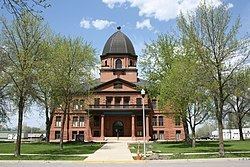 | ||
Founded February 20, 1855 (created)1866 (organized) Points of interest Giant Corn Gazebo, Joseph Brown House R, Renville County Parks De, Skalbekken County Park, Birch Coulee | ||
Renville County is a county located in the U.S. state of Minnesota. As of the 2010 census, the population was 15,730. Its county seat is Olivia. The county was formed in 1855 and organized in 1866.
Contents
- Map of Renville County MN USA
- History
- Geography
- Lakes
- Major highways
- Adjacent counties
- Demographics
- Cities
- Unincorporated communities
- Ghost towns
- References
Map of Renville County, MN, USA
History
Renville County is named in honor of Joseph Renville, a fur trader. The county was the site of several engagements in the Dakota War of 1862.
Geography
According to the U.S. Census Bureau, the county has a total area of 987 square miles (2,560 km2), of which 983 square miles (2,550 km2) is land and 4.2 square miles (11 km2) (0.4%) is water.
Lakes
Major highways
Adjacent counties
Renville County borders a total of nine counties, more than any other county in Minnesota except for Beltrami County, which also borders nine counties.
Demographics
As of the census of 2000, there were 17,154 people, 6,779 households, and 4,623 families residing in the county. The population density was 18 people per square mile (7/km²). There were 7,413 housing units at an average density of 8 per square mile (3/km²). The racial makeup of the county was 95.72% White, 0.06% Black or African American, 0.51% Native American, 0.20% Asian, 0.02% Pacific Islander, 2.77% from other races, and 0.73% from two or more races. 5.11% of the population were Hispanic or Latino of any race. 50.9% were of German, 16.3% Norwegian and 5.1% Swedish ancestry.
There were 6,779 households out of which 31.50% had children under the age of 18 living with them, 59.10% were married couples living together, 5.60% had a female householder with no husband present, and 31.80% were non-families. 28.50% of all households were made up of individuals and 15.10% had someone living alone who was 65 years of age or older. The average household size was 2.48 and the average family size was 3.05.
In the county, the population was spread out with 26.50% under the age of 18, 6.60% from 18 to 24, 25.30% from 25 to 44, 21.70% from 45 to 64, and 19.80% who were 65 years of age or older. The median age was 40 years. For every 100 females there were 99.30 males. For every 100 females age 18 and over, there were 98.50 males.
The median income for a household in the county was $37,652, and the median income for a family was $45,065. Males had a median income of $30,473 versus $22,179 for females. The per capita income for the county was $17,770. About 6.30% of families and 8.80% of the population were below the poverty line, including 10.80% of those under age 18 and 8.10% of those age 65 or over.