
Basin area 4,000 km² | - elevation 1,430 m (4,692 ft) - elevation 220 m (722 ft) | |
 | ||
- right Bogong Creek, Doubtful Creek, Happy Jacks Creek, Jounama Creek, McGregors Creek, Blowering Creek, Goobarragandra River, Brungle Creek | ||
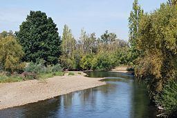
Tumut river 2014
The Tumut River (/ˈtjuːmət/), a perennial stream that is part of the Murrumbidgee catchment within the Murray–Darling basin, is located in the Snowy Mountains and South West Slopes districts of New South Wales, Australia.
Contents
- Tumut river 2014
- Map of Tumut River New South Wales Australia
- Location and features
- Etymology
- Environmental concerns
- Sporting and leisure activities
- References
Map of Tumut River, New South Wales, Australia
Location and features
The Tumut River rises on the northern face of Mount Jagungal in the Snowy Mountains at 1,430 metres (4,690 ft) and flows generally north by west, joined by twelve tributaries including the Doubtful Creek, Happy Jacks Creek and Goobarragandra River before meeting its confluence with the Murrumbidgee River, at Darbalara near the town of Gundagai; descending 1,210 metres (3,970 ft) over its 182-kilometre (113 mi) course.
Between Cabramurra and Tumut, the natural course of the Tumut River has been altered as a result of the construction of the Snowy Mountains Scheme. A series of sixteen major dams and seven hydro-electric power stations were constructed between 1949 and 1974 to harness the flow of the Tumut and Snowy rivers. The Tumut River is impounded by six dams, located at Happy Jacks Dam, Tumut Pond Dam, Tumut Two Dam, Talbingo Dam, Jounama Dam, and Blowering Dam. Four hydro-power stations are located adjacent to the river flow. Although a relatively short river, the natural flow of the Tumut River is quite high, as it drains the snowmelt and other runoff from a large proportion of the northern Snowy Mountains. The natural flow of the river is amplified by water transferred from the Tooma River and Lake Eucumbene by the Snowy Mountains Scheme.
Etymology
The word Tumut is derived from the Aboriginal word of doomut or doomat, meaning camping by the river.
Environmental concerns
The Tumut River has been subject to considerable debate and lobbying on environmental grounds. The Tumut River has been widely documented as suffering from the effects of the un-natural flow regime resulting from the creation of the Snowy Mountain Scheme and the irrigation demand downstream of the Tumut River. Environmental damage attributed to the management of the Tumut River by the Government of New South Wales includes;
Sporting and leisure activities
The Tumut River has been a popular destination for a variety of sport and leisure activities including;