
- elevation 1,590 m (5,217 ft) | - elevation 236 m (774 ft) | |
 | ||
- left Bulls Head Creek, Broadway Creek, Little River (Snowy Mountains), Yellow Bog Creek, Taylors Creek - location near Tintaldra, Victoria | ||
Tooma River, a perennial stream that has had its flow diverted as a result of the Snowy Mountains Scheme, is part of the Murray catchment within the Murray–Darling basin and is located in the Australian Alpine region of New South Wales and Victoria, Australia.
Contents
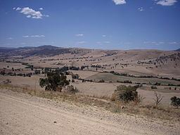
Map of Tooma River, New South Wales, Australia
Course and features
The river rises near Mount Jagungal on the western slopes of the Snowy Mountains and its natural flow drains generally north, then west before turning south, joined by eight tributaries including the Tumbarumba Creek, and reaching its confluence with the Murray River between the villages of Tooma and Tintaldra; descending 1,350 metres (4,430 ft) over its 74 kilometres (46 mi) course.
The Tooma Reservoir, part of the Snowy Mountains Scheme, captures water in the headwaters of the Tooma River, and diverts the water to the Tumut Pondage on the Tumut River, where the water is used to generate electricity in the sequence of hydro-electric power stations along the length of the Tumut River. This diversion results in a transfer of water from the Murray River catchment (which includes the Tooma River), to the Murrumbidgee River catchment (which includes the Tumut River). However, a compensating opposite transfer from the Murrumbidgee to the Murray basins is made using a different part of the Snowy Mountains Scheme.