
- elevation 1,330 m (4,364 ft) - elevation 272 m (892 ft) | ||
 | ||
- right Sandy (Waterfall) Creek, Emu Flat Creek, Broken Cart Creek - location north of Peppercorn Hill Sources Fiery Range Trail, Snowy Mountains | ||
Goobarragandra River, a perennial stream that is part of the Murrumbidgee catchment within the Murray–Darling basin, is located in the Snowy Mountains region of New South Wales, Australia.
Contents
Map of Goobarragandra River, New South Wales, Australia
Course and features
The river rises on the north western side of the Fiery Range in the Snowy Mountains at 1,330 metres (4,360 ft) and flows generally north west, joined by five minor tributaries towards its mouth at the confluence with the Tumut River at Tumut; dropping 1,060 metres (3,480 ft) over the course of the river's length of 56 kilometres (35 mi).
The river flows through the town of Goobarragandra; and the Hume and Hovell Walking Track follows the river for a short duration, about 10 kilometres (6.2 mi) south of Tumut.
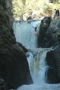
There are large waterfalls and rapids along this river. There are "camping" spots along the Goobarragandra River as well.