Country Australia Construction began 1968 Length 701 m Catchment area 1,093 km² | Status Operational Opening date 1971 Height 162 m Opened 1971 | |
 | ||
Similar Jounama Dam, Blowering Dam, Tooma Dam, Tumut Pond Dam, Snowy Mountains Scheme | ||
Talbingo dam
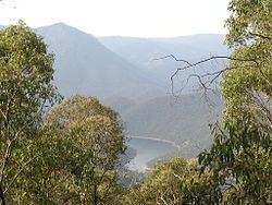
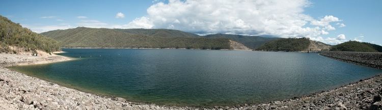
Talbingo Dam is a major ungated rock fill with clay core embankment dam with concrete chute spillway across the Tumut River upstream of Talbingo in the Snowy Mountains region of New South Wales, Australia. The dam's main purpose is for the generation of hydro-power and is the largest of sixteen major dams that comprise the Snowy Mountains Scheme, a vast hydroelectricity and irrigation complex constructed in south-east Australia between 1949 and 1974 and now run by Snowy Hydro. The impounded reservoir is called Talbingo Reservoir.
Contents
Talbingo dam
Location and features

Commenced in 1968 and completed in 1971, Talbingo Dam is a major dam on the Tumut River, within the Snowy Mountains, approximately 5 kilometres (3.1 mi) south of the village of Talbingo. The dam was constructed by Thiess Bros Pty Limited and, at the time, the project was the largest dam ever built in Australia. The dam is the largest and last of the sixteen dams completed as part of the Snowy Mountains Scheme.
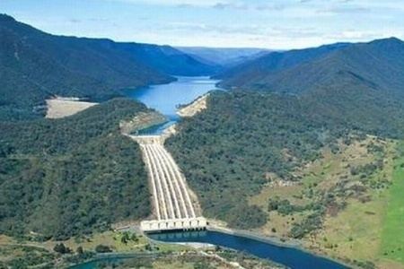
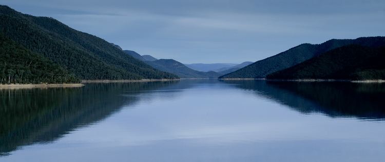
The dam wall comprising 14,488,000 cubic metres (511,600,000 cu ft) of rockfill with an upstream sloping silty clay core is 162 metres (531 ft) high and is 701 metres (2,300 ft) long. At 100% capacity the dam wall holds back 920,000 megalitres (32,000×10^6 cu ft) of water at an average depth of 70 metres (230 ft). The surface area of Talbingo Reservoir is 1,935.5 hectares (4,783 acres) and the catchment area is 1,093 square kilometres (422 sq mi). The spillway is capable of discharging 4,290 cubic metres per second (151,000 cu ft/s).
Power generation

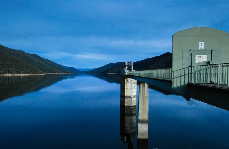
Directly downstream of the dam wall is Tumut 3, a pumped-storage hydroelectric power station, that has six turbine generators (3 of which double as the station's water pumps) with a total generating capacity of 1,500 megawatts (2,000,000 hp) of electricity; with a net generation of 812 gigawatt-hours (2,920 TJ) per annum. The power station has 150.9 metres (495 ft) rated hydraulic head, which flows into the station from 6 large pressure pipes (one for each turbine) from a concrete inlet structure at the edge of the reservoir, built about midway between the proper Talbingo dam and its spillway. The inlet structure can be mistaken by tourists for being the main dam, due to being a far more conspicuous sight from the road that leads in to the Talbingo Dam/Tumut 3 complex. The pumps draw water from Jounama Pondage at the rate of 297 cubic metres per second (10,500 cu ft/s), returning water to Talbingo Reservoir for later generation use in periods of peak-demand. The power generated at Tumut 3 serves both New South Wales and Victoria.
Recreation
The reservoir is a popular area for fishing; inclusive of Brown Trout, Rainbow Trout, Golden Perch, Macquarie Perch, Redfin, and Trout Cod. Power boating is permitted.
Camping is permitted in Kosciuszko National Park.