
Founded 1879 Area 3,911 km² | Named for S.L. Spink Congressional district At-large Website www.spinkcounty-sd.org Population 6,610 (2013) Unemployment rate 3.8% (Apr 2015) | |
 | ||
Rivers James River, Turtle Creek, Foster Creek | ||
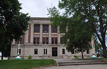
Spink County is a county located in the U.S. state of South Dakota. As of the 2010 census, the population was 6,415. Its county seat is Redfield. The county was created in 1873 and organized in 1879 within Dakota Territory.
Contents
- Map of Spink County SD USA
- Geography
- Major highways
- Adjacent counties
- 2000 census
- 2010 census
- Cities
- Towns
- Census designated place
- Unincorporated community
- Townships
- References
Map of Spink County, SD, USA
Geography
According to the U.S. Census Bureau, the county has a total area of 1,510 square miles (3,900 km2), of which 1,504 square miles (3,900 km2) is land and 5.8 square miles (15 km2) (0.4%) is water.
Major highways
Adjacent counties
2000 census
As of the census of 2000, there were 7,454 people, 2,847 households, and 1,933 families residing in the county. The population density was 5 people per square mile (2/km²). There were 3,352 housing units at an average density of 2 per square mile (1/km²). The racial makeup of the county was 97.56% White, 0.21% Black or African American, 1.48% Native American, 0.09% Asian, 0.01% Pacific Islander, 0.12% from other races, and 0.52% from two or more races. 0.39% of the population were Hispanic or Latino of any race.
There were 2,847 households out of which 30.60% had children under the age of 18 living with them, 58.60% were married couples living together, 6.10% had a female householder with no husband present, and 32.10% were non-families. 29.30% of all households were made up of individuals and 15.80% had someone living alone who was 65 years of age or older. The average household size was 2.45 and the average family size was 3.05.
In the county, the population was spread out with 25.60% under the age of 18, 6.70% from 18 to 24, 26.10% from 25 to 44, 22.60% from 45 to 64, and 18.90% who were 65 years of age or older. The median age was 40 years. For every 100 females there were 107.20 males. For every 100 females age 18 and over, there were 106.20 males.
The median income for a household in the county was $31,717, and the median income for a family was $37,114. Males had a median income of $25,065 versus $20,386 for females. The per capita income for the county was $15,728. About 10.20% of families and 12.80% of the population were below the poverty line, including 17.20% of those under age 18 and 9.80% of those age 65 or over.
Several Hutterite communities are in Spink County, including near Ashton and Stratford.
2010 census
As of the 2010 United States Census, there were 6,415 people, 2,608 households, and 1,677 families residing in the county. The population density was 4.3 inhabitants per square mile (1.7/km2). There were 3,139 housing units at an average density of 2.1 per square mile (0.81/km2). The racial makeup of the county was 97.1% white, 1.2% American Indian, 0.3% black or African American, 0.1% Asian, 0.4% from other races, and 0.9% from two or more races. Those of Hispanic or Latino origin made up 1.1% of the population. In terms of ancestry, 52.6% were German, 11.6% were Norwegian, 10.0% were Irish, 9.2% were English, and 5.5% were American.
Of the 2,608 households, 26.5% had children under the age of 18 living with them, 53.4% were married couples living together, 6.4% had a female householder with no husband present, 35.7% were non-families, and 31.8% of all households were made up of individuals. The average household size was 2.30 and the average family size was 2.89. The median age was 44.4 years.
The median income for a household in the county was $45,000 and the median income for a family was $60,639. Males had a median income of $40,273 versus $26,139 for females. The per capita income for the county was $25,295. About 8.2% of families and 17.0% of the population were below the poverty line, including 19.0% of those under age 18 and 12.0% of those age 65 or over.
Cities
Towns
Census-designated place
Unincorporated community
Townships
The county is divided into thirty-seven townships: