
 | ||
Islands | ||
Upper spencer gulf promotional video
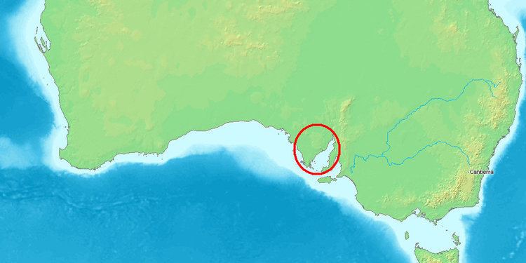
The Spencer Gulf is the westernmost of two large inlets on the southern coast of Australia, in the state of South Australia, facing the Great Australian Bight. The Gulf is 322 km (200 mi) long and 129 km (80 mi) wide at its mouth. The western shore of the Gulf is the Eyre Peninsula, while the eastern side is the Yorke Peninsula, which separates it from the smaller Gulf St Vincent. Its entrance was defined by Matthew Flinders as a line from Cape Catastrophe on Eyre Peninsula to Cape Spencer on Yorke Peninsula.
Contents
- Upper spencer gulf promotional video
- Map of Spencer Gulf South Australia Australia
- Cruising spencer gulf in south australia
- History
- Wildlife
- Marine species
- Marine mammals
- Seabirds
- Islands
- Port Development Proposals
- Seawater desalination plants
- Spencer Gulf in Film Video
- Aquatic Reserves
- Marine Parks
- Terrestrial reserves
- Important Bird Areas
- References
Map of Spencer Gulf, South Australia, Australia
The largest towns on the gulf are Port Lincoln, Whyalla, Port Pirie, and Port Augusta. Smaller towns on the gulf include Tumby Bay, Port Neill, Arno Bay, Cowell, Port Germein, Port Broughton, Wallaroo, Port Hughes and Port Victoria.
Cruising spencer gulf in south australia
History
The gulf was named Spencer's Gulph by Flinders on 20 March 1802, after George John Spencer, the 2nd Earl Spencer (an ancestor of Diana, Princess of Wales). Visiting at roughly the same time as Flinders, Nicholas Baudin named the area Golfe Bonaparte. While other names bestowed by Baudin persisted (like Fleurieu Peninsula), Spencer Gulf became the official name.
By the 1830s, the natural harbour of Port Lincoln had become the site of an unofficial settlement, due in part to its convenience as a base for whaling vessels – which had long operated in the Great Australian Bight. Prior to the selection of Adelaide, some consideration was given to Port Lincoln as the potential site of a capital city.
The interior was not officially explored or settled by Europeans until after Edward John Eyre's 1839 expeditions, and the gazetting of Port Lincoln the same year.
Wildlife
The land surrounding the gulf, consisting of the Eyre and Yorke Peninsulas, is the Eyre Yorke Block bioregion. This was originally wooded shrubland but has now mainly been cleared for agriculture. Many of South Australia's iconic marine species can be found on the shores and in the waters of Spencer Gulf.
Marine species
The rocky inshore reef along the coast near Port Bonython and Point Lowly is a breeding ground for the Northern Spencer Gulf population of giant Australian cuttlefish. They are a favorite food of local bottlenose dolphins, who have developed sophisticated techniques for safely eating these creatures. The Upper Spencer Gulf is also known for its snapper and Yellowtail kingfish fishing. Great white sharks are sometimes seen in Spencer Gulf by fishermen, and shark cage diving and surface tours operate out of Port Lincoln.
A relic population of tiger pipefish (Filicampus tigris), a subtropical species is range limited to Northern Spencer Gulf.
Marine mammals
Visiting southern right whales and humpback whales enter Spencer Gulf from June through to October, and can be seen as far north as Point Lowly and Port Augusta. New Zealand fur seals and Australian sea lions can be found in Southern Spencer Gulf, with occasional sightings occurring in Northern Spencer Gulf. Bottlenose dolphins can be seen in the gulf's waters year-round.
Seabirds
Breeding colonies of little penguins exist on islands in Spencer Gulf. The northernmost colonies are located at Lipson Island and Wardang Island. In 2004, the Wardang Island colony's population was approximately 8,000 penguins. Cape Barren geese and several species of cormorants also breed on islands in Spencer Gulf.
Islands
Spencer Gulf contains a number of inshore and offshore islands. These include (from north to south):
Port Development Proposals
Due to its proximity to many identified mineral deposits in South Australia's Far North, Eyre Peninsula and Braemar regions, there are multiple new port and harbor developments proposed for the region.
These include new or expanded facilities at (from north to south):
Seawater desalination plants
As of 2016, there are one reverse osmosis and one thermal seawater desalination plant drawing water from Spencer Gulf. Several others are planned. All currently or will produce water primarily or exclusively for industrial use. They are:
Spencer Gulf in Film & Video
The Spencer Gulf region, its wildlife and its development are the subjects of a forthcoming documentary film entitled Cuttlefish Country.
Aquatic Reserves
Spencer Gulf contains four aquatic reserves.
Blanche Harbour-Douglas Bank Aquatic Reserve which is located in west side of Spencer Gulf, north of Whyalla, was declared in 1980 ‘for fisheries management, protection of its mangrove-seagrass communities and associated fish nursery areas.’
Goose Island Aquatic Reserve which is located at Goose Island on the east side of Spencer Gulf near Port Victoria was declared in 1971 to provide ‘a conservation area where teaching institutions may conduct classes and scientific research on marine biology and ecology and to protect the habitat of the seal colony situated on White Rocks.’
Whyalla - Cowleds Landing Aquatic Reserve which is located in on the west side of Spencer Gulf, just south of Whyalla, was declared in 1980 to ‘protect the mangrove-seagrass communities and associated fish nursery areas.’
Yatala Harbour Upper Spencer Gulf Aquatic Reserve which is located in Yatala Harbour on the east side of Spencer Gulf, north of Port Pirie, was declared in 1980 for ‘the protection of its mangrove-seagrass communities and associated fish nursery areas.’
Marine Parks
Spencer Gulf contains five marine parks, each with its own outer boundary and internal zoning. Fishing is prohibited with Sanctuary Zones, and detailed maps and GPS coordinates for the parks are available from the Government of South Australia's Department of Environment, Water & Natural Resources.
The marine parks within Spencer Gulf are (from north to south):
Terrestrial reserves
A number of terrestrial reserves either adjoin Spencer Gulf at low water or are located on islands within the gulf. On the west coast of the gulf, from north to south, they are Munyaroo Conservation Park, Franklin Harbor Conservation Park, Lipson Island Conservation Park, Tumby Island Conservation Park, Sir Joseph Banks Group Conservation Park, Lincoln National Park and Memory Cove Wilderness Protection Area. On the east coast of the gulf, from north to south, they are Winninowie Conservation Park, Bird Islands Conservation Park, Goose Island Conservation Park, Leven Beach Conservation Park and Innes National Park. At the mouth of the gulf, the Gambier Islands Conservation Park is located within the Gambier Islands group.
Important Bird Areas
Three Important Bird Areas (IBAs) have been nominated by BirdLife International at locations in Spencer Gulf. The Spencer Gulf Important Bird Area lies along the north-eastern coast of the Gulf; it comprises a 460 square kilometres (180 sq mi) strip of coastal land consisting mainly of intertidal mudflats, mangroves and salt marshes. It was identified as an IBA by BirdLife International because of its importance for the conservation of waders, or shorebirds. The other two IBAs within Spencer Gulf are located in the Sir Joseph Banks Group and at Goose Island. Both sites contain breeding colonies of various island seabird species.