
Type Highway Length 605 km | Route number(s) National Route 1 | |
 | ||
Major cities Major settlements | ||
South Coast Highway is a Western Australian highway. It is a part of the Highway 1 network.
Contents
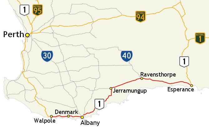
Map of S Coast Hwy, Western Australia, Australia
With a length of 592 kilometres (368 mi), it runs from Esperance to Walpole roughly in parallel to Western Australia's south coast. Even then the journey is pretty much inland.
Approximately 40 kilometres from Ravensthorpe lies the Fitzgerald River National Park with beaches, coastal and mountain walking trails and wildflowers. There are three more national parks with abundant wildlife along the journey to Walpole. Albany is a former whaling town and is rich in history.
Beyond Walpole, Highway 1 continues as South Western Highway to Perth. Beyond Esperance, Highway 1 continues as Coolgardie–Esperance Highway to Norseman.
References
South Coast Highway Wikipedia(Text) CC BY-SA