
Population 14,953 (2016 est.) Area 8,960 km² Region South West Slopes | Administrator Paul Sullivan Founded 12 May 2016 | |
 | ||
Established 12 May 2016 (2016-05-12) Federal divisions Division of Farrer, Division of Riverina | ||
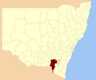
The Snowy Valleys Council is a local government area located in the South West Slopes region of New South Wales, Australia. This area was formed in 2016 from the merger of the Tumut Shire with the neighbouring Tumbarumba Shire.
Contents
The council area copmrises 8,960 square kilometres (3,460 sq mi) and covers the western side of the southern-most portion of the Great Dividing Range and foothills in New South Wales. Large sections of the local government area are contained within national parks. At the time of its establishment, the population in the council area was estimated to be 14,953.
The Administrator of Snowy Valley Council is Paul Sullivan, until the elections for councillors to take place on 9 September 2017.
Main towns and villages
In addition to the towns of Adelong, Batlow, Tumbarumba and Tumut, localities in the area include Brungle, Cabramurra, Gilmore, Grahamstown, Gocup, Jingellic, Khancoban, Killimicat, Rosewood, Talbingo, Tooma and Wondalga.
Council
Once elected, Snowy Valleys Council will comprise nine Councillors elected proportionally as a single ward. All Councillors are expected to be elected for a fixed four-year term of office with effect from 9 September 2017.