
Population 1,487 (2006 census) Postcode(s) 2653 Postal code 2653 | Established 1850s Elevation 645 m Local time Sunday 9:47 PM | |
 | ||
Location 480 km (298 mi) SW of Sydney477 km (296 mi) NE of Melbourne114 km (71 mi) SE of Wagga Wagga137 km (85 mi) NE of Albury65 km (40 mi) S of Tumut Weather 20°C, Wind N at 8 km/h, 62% Humidity | ||
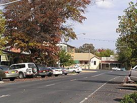
Tumbarumba
Tumbarumba (/tʌmbəˈrʌmbə/ tum-bə-RUM-bə) is a small town in New South Wales, Australia, about 480 kilometres (300 mi) southwest of the state capital, Sydney. Tumbarumba is located on the periphery of the Riverina and South West Slopes regions at the western edge of the Snowy Mountains. The 2011 census showed the population of the town to 1455 people, a decline from 1,487 people living there in 2006. Locals refer to the town as 'Tumba'.
Contents
- Tumbarumba
- Map of Tumbarumba NSW 2653 Australia
- Tumbarumba country change riverina
- History
- Industry
- Tourism
- Education
- Events
- Climate
- Sport
- References
Map of Tumbarumba NSW 2653, Australia
To the south and east, the highest peak of the Snowy Mountains and mainland Australia—Mount Kosciuszko—can be seen.
Tumbarumba country change riverina
History
The community was established in the late 1850s after gold was discovered in the district. The Post Office opened on 1 August 1860 but was spelt Tumberumba until 1915.
A railway branch line was opened to Tumbarumba in 1921. The Tumbarumba railway line ran from Wagga Wagga through Tarcutta. The service has been suspended since 1987.
Gold mining petered out in the 1930s, and the region's economy now depends on agriculture and tourism. The timber industry dominates the Shire’s economy.
The name Tumbarumba may be derived from Wiradjuri dhamba dhamba, meaning "very soft" or alternatively from the Aboriginal words for "hollow sounding ground", "thunder", "sound" or "place of big trees".
Industry
The major industry in the town is softwood timber processing, with the Hyne and Sons Timber Mill to the west of the town being the biggest employer. Other industries include tourism, viticulture (Tumbarumba is in the Tumbarumba wine region), and blueberry growing. Tourism is a source of income due to its proximity to the snow fields.
Tourism
Tumbarumba provides a convenient base for visiting the Western Snowy Mountains area.
The town lies on the Snowy Valleys Way which Destination NSW advertises as a more leisurely and picturesque driving route to take between Sydney and Melbourne. The Snowy Valleys way links Gundagai and Beechworth passing through Tumut, Tumbarumba and Corryong.
Tumbarumba is also close to the 440 km Hume and Hovell Track. Access to the track is at the Henry Angel Trackhead, 9 km from Tumbarumba toward Khancoban. A half day walk from the Henry Angel Trackhead to 'Big Hill' provides spectacular views of the western face of the Snowy Mountains Main Range. This walk passes old gold workings at the Burra Falls.
Tumbarumba is also the centre for the Tumbarumba wine region, a developing cool climate wine growing region with the first plantings in 1982. Several local wineries have 'cellar doors' with wines for sale.
The Museum and Visitor Information Centre on Bridge Street is open 363 days of the year, and the Tumbarumba Library and Archive on Prince Street is open Monday to Saturday, but check for opening hours.
Education
There are three schools in Tumbarumba. Tumbarumba Public School and All Saints Primary School (Catholic) providing primary education. Tumbarumba High School provides secondary education to the district.
Events
Climate
Tumbarumba has an oceanic climate (Cfb). Frosts are frequent and snowfall is by no means unknown in the winter: the lowest recorded maximum temperature was 1.1 °C (34.0 °F) on 15 July 1966 and the coldest recorded minimum temperature was −10.4 °C (13.3 °F) on 22 June 1989. The hottest recorded maximum is 40.2 °C (104.4 °F) on 7 February 2009.
Sport
Tumbarumba Greens fields a rugby league team in the Group 9 competition and the Tumbarumba Kangaroos compete in the Victorian-based Upper Murray Football League.