
Population 878 (2013) State electorate(s) Wagin Founded 1902 Mayor Mark Conley | Established 1902 Area 1,195 km² | |
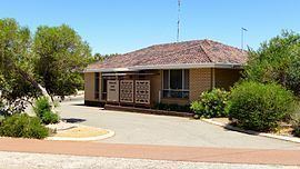 | ||
The Shire of Cuballing is a local government area located in the Wheatbelt region of Western Australia. Cuballing is located 15.1 kilometres (9 mi) north of the town of Narrogin and 192 kilometres (119 mi) southeast of the capital, Perth. The Shire covers an area of 1,195 square kilometres (461 sq mi) and its seat of government is the small town of Cuballing.
Contents
Over 10% of its area contains native dryandra forests. The economy, worth approximately $20 million per year to the state economy, is based on agriculture, with cereal grains, sheep and pig farming being the main activities
History
On 31 October 1902, the Cuballing Road District was created. On 1 July 1961, it became a shire following the enactment of the Local Government Act 1960.
Wards
On 3 May 2003, the shire was divided into two wards.
Between 1912 and 2003, the ward names were as follows: